


more stats
3.5 miles
Distance
68 ft
Climb
-1,001 ft
Descent
00:21:40
Avg time
-935 ft
Altitude change
6,033 ft
Altitude min
7,006 ft
Altitude max
6,968 ft
Altitude start
6,033 ft
Altitude end
-5.1%
Grade
-21.4%
Grade max
16%
Grade min
1,378 ft
Distance climb
2 miles
Distance down
4,442 ft
Distance flat
00:21:40
Avg time

Breaks Details

  • Activities
    • Mountain Bike
    • E-Bike
    • Hike
    • Trail Running
  • Riding Area
    Iron Hills Trail System
    Cedar City, Utah
  • Difficulty Rating
  • Local Popularity
    90 in Mountain Biking heatmap [+]
    • 100 in E-Biking
    • 90 in Trail Running
    • 85 in Hiking
  • Global Ranking
    #2405 in Mountain Biking [+]
    • #6949 in E-Biking
    • #103740 in Trail Running
    • #109910 in Hiking
  • State Ranking
    #87 in Mountain Biking · Utah [+]
    • #135 in E-Biking
    • #2,225 in Trail Running
    • #2,447 in Hiking
  • Hiking SAC Scale
    T1 Hiking
  • Trail Type
    Singletrack
  • Direction
    Both Directions[+]
    • Both Directions for E-Biking
    • Both Directions for Trail Running
    • Both Directions for Hiking
  • Climb Difficulty
    Blue
  • Trail Visibility
    Always easy to follow
  • Season
    Closed 12/1 - 4/30 to protect Mule Deer winter range.
  • Dogs Allowed
    Yes
  • eBike Allowed
  • Year Opened
    2025
  • Land Owner

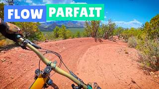
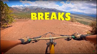
Purpose-built trail that caps the southern end of the Iron Hills Trail System. It's a fast descent with massive bermed turns and optional features that will keep intermediate and advanced riders entertained.

It's a bi-directional trail so please yield to uphill MTB and all foot traffic.

All trails in the Iron Hills System are closed December 1st - April 30th annually to protect critical winter Mule Deer habitat.

Tags
Berms

Local Trail Association

Traditionally Indigenous Territory

Recent Activity on Trail

Past Week
  • 7 rides
  • 15 miles average
6 Months
  • 59 rides
  • 12 miles avg distance
All
  • 191 rides
  • Last: Nov 13, 2026
c1c2c3c4
January
February
March
April
May
June
July
August
September
October
November
December
update trails status or condition

Breaks Trail Reports

statusdatedescription
Oct 17, 2026 @ 12:02am (America/Denver)
Oct 16, 2026
hero dirt. down tree across the trail near the top, can ride around.
Aug 27, 2026 @ 8:34am (America/Denver)
Aug 27, 2026
reporter Final washout. May need some armoring
Aug 27, 2026 @ 8:31am (America/Denver)
Aug 27, 2026
reporter Washout
Aug 27, 2026 @ 8:24am (America/Denver)
Aug 27, 2026
reporter Washout
Aug 27, 2026 @ 8:21am (America/Denver)
Aug 27, 2026
reporter Trail damage washout
more »
Status:
on Oct 17, 2026
Ideal
Avg: 4.21 (4 votes)
Your vote: 0

view (692)
close
      Directions to breaks trailhead (37.620320, -113.081450)

      Photos

      11 more »
      mtb
      108 |
      Oct 30, 2025 @ 12:24pm
      Oct 30, 2025
      mtb
      118 |
      Oct 30, 2025 @ 12:24pm
      Oct 30, 2025
      mtb
      142 |
      Oct 30, 2025 @ 12:23pm
      Oct 30, 2025
      mtb
      123 |
      May 9, 2025 @ 5:09pm
      May 9, 2025

      Videos

      5 more »
      youtuber  Breaks – Une descente douce comme du bonbon...
      mtb
      12:24 | 283 | May 19, 2025 , Cedar City
      youtuber A Relaxed, Musical MTB Descent | Breaks Trail...
      mtb
      12:11 | 364 | May 22, 2025 , Cedar City
      Iron Hills MTB
      mtb
      6:03 | 126 | Jul 28, 2026 , Cedar City
      'Breaks' Trail. Cedar City, Utah.
      mtb
      15:24 | 223 | Dec 24, 2025 , Cedar City
      4.8 ★★★★★
      4 Ratings
      5 ★ 75%
      4 ★ 25%
      3 ★
      2 ★
      1 ★

      4 Reviews & Comments

      bluedog15 bluedog15
      “Effort equals reward” great trail to climb with some stiff sections but all rideable. The views are magnificent and all that effort is rewarded with the fast flowing downhill back to the campground. Awesome trail building!
      Kknuth
      Great trail……. We rode this mid April and I look forward to seeing it get packed in and hope this years monsoons are gentle on the new trail. Also……. Brake gently on this and let it get packed in. You will be amazed to see a trail like this outside of a Lift Served bike park
      bensgig bensgig
      Not sure where my comment went. I just added a whole thing. Maybe it takes a bit for it to show up. But a great beginner or intermediate. Definitely rideable uphill easy. Super flowy. Burns. You can take it slow or fast whichever you want. Great addition to this trail system. I would way rather ride up this than tombstone. But that's just me.

      We hope you've been enjoying Trailforks!

      Create a FREE account to view all trail reviews and much more.

      • By cryptobioticTF Pro IronTC BLM CC & contributors
      • #841804 - 2,177 views

      Frequently Asked Questions

      ▼ Where is Breaks located?
      Breaks is located in Iron Hills Trail System, Cedar City, Utah, United States. It is part of the Iron Hills Trail System trail network. The trailhead is located at coordinates 37.62032, -113.08145.
      ▼ How hard is Breaks?
      Breaks is rated as Blue difficulty. The average grade is 5.1%. The climb difficulty is rated Blue.
      ▼ What is the elevation gain for Breaks?
      Breaks has 68 ft of elevation gain. The trail has 1,001 ft of elevation descent. The elevation ranges from 6,033 ft to 7,006 ft.
      ▼ Is Breaks a point to point trail?
      Breaks is not a point to point trail. The direction is Both Directions. The trail type is singletrack.
      ▼ How long is Breaks?
      Breaks is 3.5 miles long. The trail type is singletrack.
      ▼ Are dogs allowed on Breaks?
      Yes, dogs are allowed on Breaks. Please keep dogs on a leash where required and clean up after them.
      ▼ When is the best time of year to ride Breaks?
      Breaks is best visited during: Closed 12/1 - 4/30 to protect Mule Deer winter range..
      ▼ How do I access Breaks? Where is the closest parking trailhead?
      The closest parking and trailhead locations to Breaks are: View all parking locations in the area.
      ▼ How long does it take to ride Breaks?
      Based on recorded activities, it takes an average of 22 minutes to ride Breaks. The trail is 3.5 miles long. Actual times will vary based on fitness level, conditions, and pace. View recent activity logs for more details.
      ▼ How busy is Breaks?
      Breaks is a very popular trail. There have been 600 recorded activities on this trail. The trail has received 692 check-ins. View recent activity on this trail.

      Hit the Trail

      Open in App

      Get this trail on your phone instantly.

      open trail in app

      Download Trail

      Save to wishlist, Garmin & download.
      save the trail

      Find Related Routes

      Find routes and users activities that include this trail.
      find routes for this trail

      You must enter a description before submitting.

