This trail is archived
This trail is permanently closed/decommissioned
more stats
2,113 ft
Distance
-225 ft
Descent
00:03:00
Avg time
-225 ft
Altitude change
1,267 ft
Altitude min
1,493 ft
Altitude max
1,493 ft
Altitude start
1,266 ft
Altitude end
-10.7%
Grade
-34.8%
Grade max
1,998 ft
Distance down
115 ft
Distance flat
00:03:00
Avg time

Brexit Details

  • Activities
    • Mountain Bike
    • E-Bike
  • Riding Area
  • Difficulty Rating
  • Local Popularity
    5 in Mountain Biking [+]
    • 5 in E-Biking
  • Trail Type
    Singletrack
  • Bike Type
    AM, XC
  • Climb Difficulty
    Green
  • Physical Rating
    Moderate
  • Trail Visibility
    Always easy to follow
  • eBike Allowed
    Yes up to Class 1
  • TTFs on Trail
    Berm, Drop, Jump, Gap Jump
  • Year Opened
    2023
  • Land Owner
    Hancock Victorian Plantations

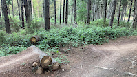
Brexit waves goodbye to The EU early on with a hard left and gets straight into some tight corners. Followed with berms, small wedges, a hip jump and gap jumps. Its a fast trail with real mix of tech, flow and airtime, guaranteed to put a smile on ya dial.
This completely free build was designed and spearheaded by Notty and Dan. With Marc Mconnachie on the digger down low and a huge 170+hrs of volunteer effort of the Alpine Cycling Club on the hand tools.

Bike Park

Local Trail Association
Traditionally Indigenous Territory

Recent Activity on Trail

Past Week
  • 0 rides
  •  
6 Months
  • 0 rides
  •  
All
  • 31 rides
  • Last: Apr 28, 2024
c1c2c3c4
January
February
March
April
May
June
July
August
September
October
November
December
update trails status or condition

Brexit Trail Reports

statusdatedescription
Apr 29, 2024 @ 4:43pm
Apr 29, 2024
reporter Retired Mystic Bowl trail due to HVP May 2024 harvesting
Apr 10, 2024 @ 8:50pm
Apr 10, 2024
reporter spraying has been completed. trail is open again
Apr 8, 2024 @ 8:04pm
Apr 8, 2024
reporter HVP are performing weed hand spraying in Mystic Bowl from 7am Tuesday 9th April through to evening Wednesday 10th April. The following trails will...
Jan 26, 2024 @ 2:42pm
Jan 26, 2024
Dec 4, 2023 @ 4:05pm
Dec 4, 2023
more »
Status:
on Apr 29, 2024
Avg: 4.11 (2 votes)
Your vote: 0

view (279)
close
3D
Trail Conditions
  • Unknown
  • Snow Groomed
  • Snow Packed
  • Snow Covered
  • Snow Cover Partial
  • Freeze/thaw Cycle
  • Icy
  • Prevalent Mud
  • Wet
  • Variable
  • Ideal
  • Dry
  • Very Dry
Trail Flow (Ridden Direction)
Trailforks scans users ridelogs to determine the most popular direction each trail is ridden. A good flowing trail network will have most trails flowing in a single direction according to their intension.
The colour categories are based on what percentage of riders are riding a trail in its intended direction.
  • > 96%
  • > 90%
  • > 80%
  • > 70%
  • > 50%
  • < 50%
  • bi-directional trail
  • no data
Trail Last Ridden
Trailforks scans ridelogs to determine the last time a trail was ridden.
  • < 2 days
  • < 1 week
  • < 2 weeks
  • < 1 month
  • < 6 months
  • > 6 months
Trail Ridden Direction
The intended direction a trail should be ridden.
  • Downhill Only
  • Downhill Primary
  • Both Directions
  • Uphill Primary
  • Uphill Only
  • One Direction
Contribute Details
Colors indicate trail is missing specified detail.
  • Description
  • Photos
  • Description & Photos
  • Videos
Trail Popularity ?
Trailforks scans ridelogs to determine which trails are ridden the most in the last 9 months. Trails are compared with nearby trails in the same city region with a possible 25 colour shades. Think of this as a heatmap, more rides = more kinetic energy = warmer colors.
  • most popular
  • popular
  • less popular
  • not popular
ATV/ORV/OHV Filter
Max Vehicle Width
inches
US Cell Coverage
Legend
cell carrier legend

Radar Time
Activity Recordings
Trailforks uses anonymized public activity data. ?
Activity Recordings
Trailforks uses anonymized public activity data. ?
Personal Heatmap
Activity Types
all / none
Options
2
Date range month
Winter Trails
Warning A routing network for winter maps does not exist. Selecting trails using the winter trails layer has been disabled.
Missing Trails
Most Popular
Least Popular
Trails are colored based on popularity. The more popular a trail is, the more red. Less popular trails trend towards green.
Jump Magnitude Heatmap
Heatmap of where riders jump on trails. Zoom in to see individual jumps, click circles to view jump details.
BC Backroad Status

Service Road Atlas is a free to use, community-driven service for viewing and creating reports on the numerous back-country service roads around B.C. and Alberta.

map legend
Slope Aspect
Direction the slope faces
Flat N NE E SE S SW W NW
Trails Deemphasized
Trails are shown in grey.
disable
Only show trails with no bike usage.
Enable
Suggested Layers
Based on selected activity type

    Save the current map location and zoom level as your default home location whenever this page is loaded.

    Save
        Directions to brexit trailhead (-36.745880, 146.963360)

        Photos

        37 more »
        54 |
        Oct 9, 2023 @ 2:24am
        Oct 9, 2023
        19 |
        Dec 4, 2023 @ 4:05pm
        Dec 4, 2023
        42 |
        Dec 3, 2023 @ 7:45pm
        Dec 3, 2023
        16 |
        Oct 26, 2023 @ 11:41pm
        Oct 26, 2023

        Videos

        1 more »
        0:05 | 97 | Oct 9, 2023 , Bright

        1 Review & Comments


        We hope you've been enjoying Trailforks!

        Create a FREE account to view trail comments and much more.

        • By Notty22TF Pro & contributors
        • #96052 - 950 views

        Hit the Trail

        Open in App

        Get this trail on your phone instantly.
        open trail in app

        Download Trail

        Save to wishlist, Garmin & download.
        save the trail

        Find Related Routes

        Find routes and users activities that include this trail.
        find routes for this trail

        You must enter a description before submitting.