more stats
3,402 ft
Distance
55 ft
Climb
-92 ft
Descent
00:03:25
Avg time
-36 ft
Altitude change
305 ft
Altitude min
391 ft
Altitude max
378 ft
Altitude start
341 ft
Altitude end
-1.1%
Grade
-16%
Grade max
11.6%
Grade min
1,188 ft
Distance climb
1,529 ft
Distance down
607 ft
Distance flat
00:03:25
Avg time

Bronzewing Details

  • Activities
    • Mountain Bike
    • E-Bike
    • Adaptive Bike
  • Riding Area
    Daisy Hill
    Brisbane
  • Ref Number
    #18
  • Difficulty Rating
  • Voted Difficulty
    Green (1 vote)
  • Local Popularity
    100 in Mountain Biking [+]
    • 100 in E-Biking
  • Global Ranking
    #212 in Mountain Biking [+]
    • #2185 in E-Biking
  • Trail Type
    Singletrack
  • Bike Type
    AM, XC, Adaptive MTB
  • Direction
    One Direction
    Popular Direction Shown
  • Climb Difficulty
    Green
  • Physical Rating
    Moderate
  • Trail Visibility
    Always easy to follow
  • eBike Allowed
    Yes up to Class 1
  • TTFs on Trail
    Berm, Drop, Jump, Rock Garden, Other

No community description for Bronzewing trail has been added yet!

AI Generated Description

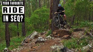
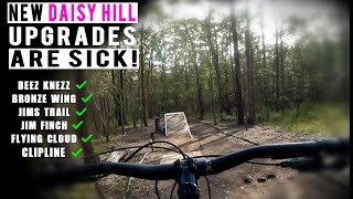
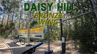
Bronzewing is a highly rated 1 km popular blue difficulty singletrack trail located near Brisbane. This mountain bike primary trail can be used one direction and has a moderate overall physical rating with a 17 m green climb. It features berm, drop, jump, rock garden and other. Adaptive MTB rating: amtb blue. Trail visibility is always easy to follow. On average it takes 3 minutes to complete this trail.

Adaptive Bike Info
aMTB Blue Rating: Intermediate features and steeper terrain.
Local Trail Association
Traditionally Indigenous Territory

Recent Activity on Trail

Past Week
  • 32 rides
  • 14 miles average
6 Months
  • 520 rides
  • 14 miles avg distance
All
  • 3,104 rides
  • Last: Jun 7, 2026
c1c2c3c4
January
February
March
April
May
June
July
August
September
October
November
December
Status:
on May 31, 2026
Variable
Avg: 4.4 (9 votes)
Your vote: 0

view (18,118)
close
3D
Trail Conditions
  • Unknown
  • Snow Groomed
  • Snow Packed
  • Snow Covered
  • Snow Cover Partial
  • Freeze/thaw Cycle
  • Icy
  • Prevalent Mud
  • Wet
  • Variable
  • Ideal
  • Dry
  • Very Dry
Trail Flow (Ridden Direction)
Trailforks scans users ridelogs to determine the most popular direction each trail is ridden. A good flowing trail network will have most trails flowing in a single direction according to their intension.
The colour categories are based on what percentage of riders are riding a trail in its intended direction.
  • > 96%
  • > 90%
  • > 80%
  • > 70%
  • > 50%
  • < 50%
  • bi-directional trail
  • no data
Trail Last Ridden
Trailforks scans ridelogs to determine the last time a trail was ridden.
  • < 2 days
  • < 1 week
  • < 2 weeks
  • < 1 month
  • < 6 months
  • > 6 months
Trail Ridden Direction
The intended direction a trail should be ridden.
  • Downhill Only
  • Downhill Primary
  • Both Directions
  • Uphill Primary
  • Uphill Only
  • One Direction
Contribute Details
Colors indicate trail is missing specified detail.
  • Description
  • Photos
  • Description & Photos
  • Videos
Trail Popularity ?
Trailforks scans ridelogs to determine which trails are ridden the most in the last 9 months. Trails are compared with nearby trails in the same city region with a possible 25 colour shades. Think of this as a heatmap, more rides = more kinetic energy = warmer colors.
  • most popular
  • popular
  • less popular
  • not popular
ATV/ORV/OHV Filter
Max Vehicle Width
inches
US Cell Coverage
Legend
cell carrier legend

Radar Time
Activity Recordings
Trailforks uses anonymized public activity data. ?
Activity Recordings
Trailforks uses anonymized public activity data. ?
Personal Heatmap
Activity Types
all / none
Options
2
Date range month
Winter Trails
Warning A routing network for winter maps does not exist. Selecting trails using the winter trails layer has been disabled.
Missing Trails
Most Popular
Least Popular
Trails are colored based on popularity. The more popular a trail is, the more red. Less popular trails trend towards green.
Jump Magnitude Heatmap
Heatmap of where riders jump on trails. Zoom in to see individual jumps, click circles to view jump details.
BC Backroad Status

Service Road Atlas is a free to use, community-driven service for viewing and creating reports on the numerous back-country service roads around B.C. and Alberta.

map legend
Slope Aspect
Direction the slope faces
Flat N NE E SE S SW W NW
Trails Deemphasized
Trails are shown in grey.
disable
Only show trails with no bike usage.
Enable
Suggested Layers
Based on selected activity type

    Save the current map location and zoom level as your default home location whenever this page is loaded.

    Save
        Directions to bronzewing trailhead (-27.614800, 153.158670)

        Photos

        No photos have been added for Bronzewing yet, add a photo.

        Videos

        4 more »
        youtuber Everything is Brand New at Daisy Hill
        15:59 | 371 | Dec 3, 2022 , Brisbane
        youtuber How can you not like DAISY HILL!
        10:24 | 131 | Sep 2, 2025 , Brisbane
        youtuber These new trails are so much fun! | Daisy Hill MTB
        9:52 | 420 | Feb 8, 2023 , Brisbane
        Daisy Hill | BRONZE WING | Queensland...
        7:03 | 360 | Jan 14, 2023 , Brisbane

        Routes with this trail

        5.0 20 miles 1,915 ft 25
        Nice 33k loop from the main carpark. This picks up almost every trail that is officially part of daisy...
        12 miles 1,025 ft 12 Loop
        20km Loop from Ford Rd Car park. Heading down Wiry Panic, and over to Flying Cloud & Jim Finch before...
        20 miles 1,909 ft 28 Loop
        Nice 33k loop from the main carpark. This picks up almost every trail that is officially part of daisy...

        Reviews / Comments

        No reviews yet, be the first to write a review or ask a question.
        Use trail reports to comment on trail conditions.


        We hope you've been enjoying Trailforks!

        Create a FREE account to view trail comments and much more.

        • By matt-mitchell & contributors
        • #538427 - 1,584 views

        Frequently Asked Questions About Bronzewing

        Where is Bronzewing located?
        Bronzewing is located in Daisy Hill, Brisbane, Australia. It is part of the Daisy Hill trail network. The trailhead is located at coordinates -27.6148, 153.15867.
        How hard is Bronzewing?
        Bronzewing is rated as Blue difficulty. The physical rating is Moderate. The average grade is 1.1%. The climb difficulty is rated Green.
        What is the elevation gain for Bronzewing?
        Bronzewing has 55 ft of elevation gain. The trail has 92 ft of elevation descent. The elevation ranges from 305 ft to 391 ft.
        Is Bronzewing a point to point trail?
        Yes, Bronzewing is a point to point trail. The direction is One Direction. The trail type is singletrack.

        Hit the Trail

        Open in App

        Get this trail on your phone instantly.
        open trail in app

        Download Trail

        Save to wishlist, Garmin & download.
        save the trail

        Find Related Routes

        Find routes and users activities that include this trail.
        find routes for this trail

        You must enter a description before submitting.