




Open in App
Get this trail on your phone instantly.

Broyhill is a 4.3-mile, intermediate-level directional loop that makes excellent use of the rolling terrain along Lake Hickory. Built by Terra Tek Trails, it combines smooth, machine-built singletrack with rougher, hand-built sections, giving the trail considerably more variety than its relatively modest elevation would suggest.
The trail has approximately 300 feet of climbing, concentrated into numerous short, punchy climbs and descents rather than long sustained grades. There are few truly flat sections, so the ride has a continuous up-and-down rhythm that rewards maintaining momentum.
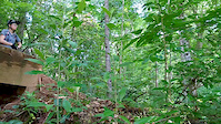
The singletrack is generally tight and twisty, with fast, flowing sections linked by short climbs, descents and technical turns. Smooth berms are a major feature, allowing riders to carry speed through corners, while roots, steeper pitches and optional technical features add challenge without turning the trail into a rock-oriented technical ride.
The trail's setting is another highlight, with sections running close to Lake Hickory and offering scenic water views through the trees. The combination of lake scenery, fast berms, tight woods riding and constantly changing terrain gives Broyhill a surprisingly dynamic character for a relatively short trail.
Overall: Broyhill is a fast, engaging intermediate cross-country trail that blends flow, berms, short steep climbs and descents, roots, technical features and lake scenery into a compact loop. It is substantially more demanding and varied than Springs Loop while remaining accessible to riders who are comfortable with intermediate singletrack.
Broyhill is a multi-use trail shared with hikers and runners. Bicycles travel clockwise, while hikers and runners travel counterclockwise, so riders should remain alert and yield appropriately when encountering other trail users.


| c1 | c2 | c3 | c4 |
|---|---|---|---|
January | February | March | April |
May | June | July | August |
September | October | November | December |

Service Road Atlas is a free to use, community-driven service for viewing and creating reports on the numerous back-country service roads around B.C. and Alberta.
Save the current map location and zoom level as your default home location whenever this page is loaded.
SaveWe hope you've been enjoying Trailforks!
Create a FREE account to view all trail reviews and much more.
 Trailforks Map Team & contributors
You must enter a description before submitting.

