


Open in App
Get this trail on your phone instantly.

Norsk
Adkomstvei, en blanding av skitt og grus, noen hull/humper, men stort sett grei.
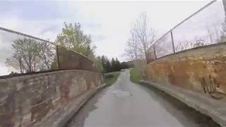
overflaten av bruen er en bue, så det er en kort stigning og nedstigning over bruen, bruen er gammel, men i god stand, og ser ut til å være trygg, vegg og rekkverk.
Vanligvis brukt av turgåere og løpere, er motoriserte kjøretøy ikke tillatt forbi porten nær parkeringsplassen.
Den kan kjøres med en vanlig sykkel, eller grussykkel, hvis du ikke har noe imot noen støt og vibrasjoner.
English
Access road, a mix of dirt & gravel, some holes/bumps, but mostly decent.
the surface of the bridge is an arch, so it's a short climb & descent over the bridge, the bridge is old but in good condition, and seems to be safe, wall and railing.
Commonly used by hikers and runners, motorized vehicles are not allowed past the gate near the parking spot.
It could be ridden with a common bicycle, or gravel bike, if you don't mind some bumps and vibrations.


Service Road Atlas is a free to use, community-driven service for viewing and creating reports on the numerous back-country service roads around B.C. and Alberta.
Save the current map location and zoom level as your default home location whenever this page is loaded.
Save
No reviews yet, be the first to write a review or ask a question.
Use trail reports to comment on trail conditions.
We hope you've been enjoying Trailforks!
Create a FREE account to view all trail reviews and much more.
 TRAILFORKS SSK & contributors
You must enter a description before submitting.

