
more stats
2.1 miles
Distance
323 ft
Climb
-301 ft
Descent
00:24:15
Avg time
21 ft
Altitude change
2,687 ft
Altitude min
2,963 ft
Altitude max
2,687 ft
Altitude start
2,710 ft
Altitude end
0.2%
Grade
-21.8%
Grade max
24.8%
Grade min
5,098 ft
Distance climb
4,701 ft
Distance down
1,152 ft
Distance flat
00:24:15
Avg time

Burnt Mountain Trail Details

  • Activities
    • Mountain Bike
    • Hike
    • Trail Running
  • Riding Area
    Dupont State Recreational Forest
    Cedar Mountain, North Carolina
  • Difficulty Rating
  • Voted Difficulty
    Black Diamond (4 votes)
  • Local Popularity
    90 in Mountain Biking [+]
    • 90 in Trail Running
    • 65 in Hiking
  • Global Ranking
    #20788 in Mountain Biking [+]
    • #86710 in Trail Running
    • #125780 in Hiking
  • State Ranking
    #167 in Mountain Biking · North Carolina [+]
    • #959 in Trail Running
    • #1,510 in Hiking
  • Hiking SAC Scale
    T3 Demanding Mountain Hiking
  • Trail Type
    Singletrack
  • Bike Type
    AM, XC, Fat
  • Climb Difficulty
    Blue
  • Physical Rating
    Hard
  • Trail Visibility
    Always easy to follow
  • Season
    When Open
  • Dogs Allowed
    Yes
  • eBike Allowed
  • TTFs on Trail
    Berm, Drop, Rock Face, Rock Garden, Skinny
  • Ride in Rain
    Yes
  • Land Owner

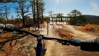
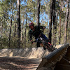
You definitely want to ride Burnt Mountain clockwise. It a decent climb with a few technical sections. Take your time because this part of the forest is exceptionally beautiful. There is an obvious resting area at the top of the hill where you can catch your breath before shooting down a proper old-school enduro trail. This trail is fast, twisty, rocky and rooty. Its got everything Near the end of the trail you find yourself on one of the gnarlier rock gardens in the entire region. BIG drops in rapid succession and loaded with massive roots and rocks. This portion is where Burnt Mountain earns its black diamond rating. This section is some of the most technical riding at Dupont. After surviving (or walking this section) you are back to Corn Mill Shoals road.

Access Info

Park in Corn Mill Shoals parking lot and ride up Corn Mill shoals and the trail entrance will be the on the right after the right turn on Little River

Local Trail Association

Recent Activity on Trail

Past Week
  • 13 rides
  • 25.0 km average
6 Months
  • 357 rides
  • 18.5 km avg distance
All
  • 1,905 rides
  • Last: Oct 4, 2026
c1c2c3c4
January
February
March
April
May
June
July
August
September
October
November
December
update trails status or condition

Burnt Mountain Trail Trail Reports

Status:
on Sep 22, 2026
Variable
Avg: 4.32 (51 votes)
Your vote: 0

view (10,082)
close
      Directions to burnt-mountain-trail trailhead (35.165700, -82.628480)

      Photos

      23 more »
      mtb
      1,152 |
      Aug 27, 2019 @ 2:49pm
      Aug 27, 2019
      mtb
      82 |
      Jul 7, 2026 @ 5:17am
      Jul 7, 2026
      mtb
      367 |
      Oct 12, 2021 @ 11:19am
      Oct 12, 2021
      mtb
      881 |
      Aug 27, 2019 @ 2:49pm
      Aug 27, 2019

      Videos

      14 more »
      Burnt Mtn, DuPont
      mtb
      0:41 | 639 | Dec 31, 2021 , Cedar Mountain
      Burnt Mtn & Big Rock in DuPont
      mtb
      3:06 | 620 | Apr 26, 2021 , Cedar Mountain
      Semi Sendy S1E11 - RIDGELINE//CEDAR & BIG...
      mtb
      14:16 | 437 | Aug 25, 2020 , Cedar Mountain
      Burnt Mountain (Dupont State Forest)
      mtb
      2:41 | 1206 | Apr 14, 2019 , Cedar Mountain

      Routes with this trail

      ★ 4.0 • 6 miles • 744 ft • 3 • Loop •
      This is one of our favorite routes for Big Rock and is featured in Freehub Magazine's Pisgah Photo Book:...
      ★ 5.0 • 6 miles • 803 ft • 3 • Loop •
      The correct way to loop through Burnt Mountain and
      7 miles • 1,279 ft • 4 • Loop •
      this is a loop trail connecting big rock to bunt mountain
      4.4 ★★★★★
      51 Ratings
      5 ★ 57%
      4 ★ 31%
      3 ★ 6%
      2 ★ 2%
      1 ★ 4%

      9 Reviews & Comments

      jon123rjk jon123rjk
      I’m not sure why’d you ride this counter clockwise. Defeats the whole purpose of this trail IMO
      gerkenator gerkenator
      Going clockwise, the climb is manageable and the rocky enduro downhill at the end was fun, even on my old Santa Cruz Tall Boy with 100mm travel. Go clockwise if that’s your jam.
      However, I think I would prefer to ride counter-clockwise. I think almost everyone would need to hike-a-bike up the rocks at the beginning, but then you could enjoy a fun downhill all the way back around.
      Trav1 Trav1
      Mostly a blue with a few black sections.

      We hope you've been enjoying Trailforks!

      Create a FREE account to view all trail reviews and much more.

      • By caleb93TF Pro & contributors
      • #7359 - 11,323 views

      Frequently Asked Questions

      ▼ Where is Burnt Mountain Trail located?
      Burnt Mountain Trail is located in Dupont State Recreational Forest, Cedar Mountain, North Carolina, United States. It is part of the Dupont State Recreational Forest trail network. The trailhead is located at coordinates 35.1657, -82.62848.
      ▼ How hard is Burnt Mountain Trail?
      Burnt Mountain Trail is rated as Black Diamond difficulty. The physical rating is Hard. The average grade is 0.2%. The climb difficulty is rated Blue.
      ▼ What is the elevation gain for Burnt Mountain Trail?
      Burnt Mountain Trail has 323 ft of elevation gain. The trail has 301 ft of elevation descent. The elevation ranges from 2,687 ft to 2,963 ft.
      ▼ How long is Burnt Mountain Trail?
      Burnt Mountain Trail is 2.1 miles long. The trail type is singletrack.
      ▼ Are dogs allowed on Burnt Mountain Trail?
      Yes, dogs are allowed on Burnt Mountain Trail. Please keep dogs on a leash where required and clean up after them.
      ▼ When is the best time of year to ride Burnt Mountain Trail?
      Based on activity log data, the most popular months to ride Burnt Mountain Trail are:
      • April (109 activities)
      • July (109 activities)
      • May (105 activities)
      Check the reports page for current trail conditions.
      ▼ How do I access Burnt Mountain Trail? Where is the closest parking trailhead?
      The closest parking and trailhead locations to Burnt Mountain Trail are: View all parking locations in the area.
      ▼ How long does it take to ride Burnt Mountain Trail?
      Based on recorded activities, it takes an average of 24 minutes to ride Burnt Mountain Trail. The trail is 2.1 miles long. Actual times will vary based on fitness level, conditions, and pace. View recent activity logs for more details.
      ▼ How busy is Burnt Mountain Trail?
      Burnt Mountain Trail is a very popular trail. There have been 9,994 recorded activities on this trail. The trail has received 10,082 check-ins. View recent activity on this trail.

      Hit the Trail

      Open in App

      Get this trail on your phone instantly.

      open trail in app

      Download Trail

      Save to wishlist, Garmin & download.
      save the trail

      Find Related Routes

      Find routes and users activities that include this trail.
      find routes for this trail

      You must enter a description before submitting.