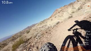

more stats
3.9 miles
Distance
571 ft
Climb
-576 ft
Descent
00:32:04
Avg time
-5 ft
Altitude change
2,830 ft
Altitude min
3,210 ft
Altitude max
3,135 ft
Altitude start
3,130 ft
Altitude end
-0.024%
Grade
-22.598%
Grade max
23.056%
Grade min
2 miles
Distance climb
2 miles
Distance down
1,427 ft
Distance flat
00:32:04
Avg time

Caldera Details

  • Activities
    • Mountain Bike
    • Hike
    • Trail Running
  • Riding Area
    Bootleg Canyon
    Boulder City, Nevada
  • Difficulty Rating
  • Local Popularity
    55 in Mountain Biking heatmap [+]
    • 95 in Trail Running
    • 80 in Hiking
  • Global Ranking
    #104825 in Mountain Biking [+]
    • #72368 in Trail Running
    • #128193 in Hiking
  • State Ranking
    #582 in Mountain Biking · Nevada [+]
    • #363 in Trail Running
    • #632 in Hiking
  • Trail Type
    Singletrack
  • Dogs Allowed
    Yes

This is a great XC trail that loops back and uses the last portion of Boyd out to get you back to the parking lot. Most of this trail is intermediate, but the initial climb from the parking lot is very steep and technical.

Tags

Local Trail Association

Traditionally Indigenous Territory

Recent Activity on Trail

Past Week
  • 1 rides
  • 14 miles average
6 Months
  • 7 rides
  • 13 miles avg distance
All
  • 205 rides
  • Last: Nov 21, 2026
c1c2c3c4
January
February
March
April
May
June
July
August
September
October
November
December
Status:
on May 30, 2026
Ideal
Avg: 3.33 (13 votes)
Your vote: 0

view (1,084)
close
      Directions to caldera-4959 trailhead (35.997860, -114.867780)

      Photos

      4 more »
      mtb
      92 |
      Feb 19, 2026 @ 8:35am
      Feb 19, 2026
      mtb
      105 |
      Feb 19, 2026 @ 8:35am
      Feb 19, 2026
      mtb
      177 |
      Feb 23, 2023 @ 9:42am
      Feb 23, 2023
      mtb
      473 |
      Apr 25, 2005 @ 1:35am
      Apr 25, 2005

      Videos

      5 more »
      youtuber We went MOUNTAIN BIKING in Bootleg Canyon -...
      mtb
      11:08 | 335 | Apr 14, 2024 , Boulder City
      youtuber Outer Caldera at Sunset- Best Bike Trails NV |...
      mtb
      5:23 | 588 | Dec 28, 2021 , Boulder City
      youtuber Bighorn Sheep & Enduro Trails at Bootleg...
      mtb
      40:08 | 222 | Feb 9, 2026 , Boulder City
      Bootleg Canyon
      mtb
      38:25 | 683 | Sep 27, 2020 , Boulder City

      Routes with this trail

      more »
      14 miles • 1,586 ft • 3 • Loop •
      Fun ebike route. Caldera CW Inner CCW
      33 miles • 3,453 ft • 41 • Loop •
      Cross country loop that provides a good tour of Bootleg Canyon
      9 miles • 1,054 ft • 35 •
      The king of vegas is something i just made up
      3.1 ★★★★★
      13 Ratings
      5 ★
      4 ★ 46%
      3 ★ 31%
      2 ★ 8%
      1 ★ 15%

      7 Reviews & Comments

      bizango-x bizango-x
      Rode down the east side of the inner loop and up the east side of the outer loop. That rode really well. I haven’t been on the west sides of the loops.
      BenKoe
      I got onto this trail where it interests with boyscout and lemme tell you I hated it. It seems like rains have really damaged this trail, any place where it's kinda steep or should be flowy it's covered with loose rocks or sandy gravel. The bottom part was fun to be fair, but the part that looks like you'll be descending was awful. Shame because all the other trails I rode here were amazing.
      SlideReady
      Pedaly and technical. Pretty fun for an XC ride but nothing to write home about.

      We hope you've been enjoying Trailforks!

      Create a FREE account to view all trail reviews and much more.

      Frequently Asked Questions

      ▼ Where is Caldera located?
      Caldera is located in Bootleg Canyon, Boulder City, Nevada, United States. It is part of the Bootleg Canyon trail network. The trailhead is located at coordinates 35.99786, -114.86778.
      ▼ How hard is Caldera?
      Caldera is rated as Blue difficulty. The average grade is 0.024%.
      ▼ What is the elevation gain for Caldera?
      Caldera has 571 ft of elevation gain. The trail has 576 ft of elevation descent. The elevation ranges from 2,830 ft to 3,210 ft.
      ▼ How long is Caldera?
      Caldera is 3.9 miles long. The trail type is singletrack.
      ▼ Are dogs allowed on Caldera?
      Yes, dogs are allowed on Caldera. Please keep dogs on a leash where required and clean up after them.
      ▼ When is the best time of year to ride Caldera?
      Based on activity log data, the most popular months to ride Caldera are:
      • March (14 activities)
      • October (11 activities)
      • November (8 activities)
      Check the reports page for current trail conditions.
      ▼ How do I access Caldera? Where is the closest parking trailhead?
      The closest parking and trailhead locations to Caldera are: View all parking locations in the area.
      ▼ How long does it take to ride Caldera?
      Based on recorded activities, it takes an average of 32 minutes to ride Caldera. The trail is 3.9 miles long. Actual times will vary based on fitness level, conditions, and pace. View recent activity logs for more details.
      ▼ How busy is Caldera?
      Caldera is a moderately popular trail. There have been 1,063 recorded activities on this trail. The trail has received 1,084 check-ins. View recent activity on this trail.

      Hit the Trail

      Open in App

      Get this trail on your phone instantly.

      open trail in app

      Download Trail

      Save to wishlist, Garmin & download.
      save the trail

      Find Related Routes

      Find routes and users activities that include this trail.
      find routes for this trail

      You must enter a description before submitting.