


more stats
2.2 miles
Distance
6 ft
Climb
-2,110 ft
Descent
00:53:51
Avg time
-2,104 ft
Altitude change
2,795 ft
Altitude min
4,898 ft
Altitude max
4,898 ft
Altitude start
2,795 ft
Altitude end
-18%
Grade
-88.2%
Grade max
5.5%
Grade min
230 ft
Distance climb
2 miles
Distance down
00:53:51
Avg time

Calmas Sur Details

  • Activities
    • Mountain Bike
    • E-Bike
    • Hike
    • Trail Running
  • Riding Area
    Arguis
    Huesca
  • Difficulty Rating
  • Local Popularity
    60 in Mountain Biking heatmap [+]
    • 75 in E-Biking
    • 100 in Trail Running
    • 5 in Hiking
  • Global Ranking
    #134277 in Mountain Biking [+]
    • #73235 in E-Biking
    • #49963 in Trail Running
    • #321786 in Hiking
  • National Ranking
    #11,943 in Mountain Biking · Spain [+]
    • #11,618 in E-Biking
    • #2,956 in Trail Running
    • #32,316 in Hiking
  • Hiking SAC Scale
    T3 Demanding Mountain Hiking
  • Trail Type
    Wilderness Trail
  • Bike Type
    AM
  • Direction
    Downhill Only
    Popular Direction Shown
  • Climb Difficulty
    Black Diamond
  • Physical Rating
    Hard
  • Trail Visibility
    Always easy to follow
  • eBike Allowed
    Yes up to Class 1
  • TTFs on Trail
    Rock Garden

Sendero que empieza entre algunos bloques de piedra con cierta dificultad, tras ello se enlaza con una parte más empinada y pedregosa donde hay que ir reteniendo la bici mientras se esquivan piedras, con algunas curvas que permiten derrapar. Mientras se va perdiendo altura las vistas de la olla de Huesca son estupendas. A partir de la mitad del sendero ya no hay tanta pendiente y se encuentra más limpio para poder soltar frenos y coger velocidad. Hay pequeños drops que hacen que sea más divertido. Ya en el final se enlazan zonas de velocidad media en canchales de piedras con ciertos apoyos donde ir surfeando entre piedras.

Tags
Rock gardensViews

Recent Activity on Trail

Past Week
  • 0 rides
  •  
6 Months
  • 0 rides
  •  
All
  • 10 rides
  • Last: Oct 15, 2026
c1c2c3c4
January
February
March
April
May
June
July
August
September
October
November
December
update trails status or condition

Calmas Sur Trail Reports

statusdatedescription
May 29, 2024 @ 10:47am
May 29, 2024
Dec 17, 2023 @ 12:08am
Dec 17, 2023
Oct 22, 2023 @ 11:42am
Oct 22, 2023
Sep 24, 2023 @ 10:32am
Sep 24, 2023
Aconsejable guantes largos, la vegetación se como el sendero, se necesita una buen limpieza
May 27, 2023 @ 2:32am
May 27, 2023
more »
Status:
on May 29, 2024
Dry
Avg: 3.99 (2 votes)
Your vote: 0

view (87)
close
      Directions to calmas-sur trailhead (42.292850, -0.447100)

      Photos

      20 more »
      mtb
      41 |
      Sep 29, 2023 @ 5:10am
      Sep 29, 2023
      mtb
      47 |
      Sep 29, 2023 @ 5:10am
      Sep 29, 2023
      mtb
      42 |
      Sep 29, 2023 @ 5:10am
      Sep 29, 2023
      mtb
      31 |
      Sep 29, 2023 @ 5:10am
      Sep 29, 2023

      Videos

      1 more »
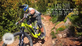
      youtuber Vuelta a GRATAL Enduro MTB en  la Sierra de Guara
      mtb
      6:18 | 190 | Nov 29, 2022 , Huesca
      4.0 ★★★★★
      2 Ratings
      5 ★
      4 ★ 100%
      3 ★
      2 ★
      1 ★

      2 Reviews & Comments

      Crisjaca Crisjaca
      Una buena bajada, no me la esperaba así, disfrutona, parte alta con sus pasos de dificultad por roca madre y escalones, acertada catalogación y texto.
      nevadosenduro nevadosenduro
      Una buena bajada pero está sucia de vegetación en algunos puntos y quizás demiasdo pedregosa a tramos. Si se pudiera limpiar de piedras para poder mantener el ritmo sería muy buena bajada. Hemos quitado alguna que entorpece pero hay demasiadas...

      We hope you've been enjoying Trailforks!

      Create a FREE account to view all trail reviews and much more.

      • By ManuelAbadTF Pro & contributors
      • #497563 - 583 views

      Frequently Asked Questions

      ▼ Where is Calmas Sur located?
      Calmas Sur is located in Arguis, Huesca, Spain. It is part of the Arguis trail network. The trailhead is located at coordinates 42.29285, -0.4471.
      ▼ How hard is Calmas Sur?
      Calmas Sur is rated as Red difficulty. The physical rating is Hard. The average grade is 18%. The climb difficulty is rated Black Diamond.
      ▼ What is the elevation gain for Calmas Sur?
      Calmas Sur has 6 ft of elevation gain. The trail has 2,110 ft of elevation descent. The elevation ranges from 2,795 ft to 4,898 ft.
      ▼ Is Calmas Sur a point to point trail?
      Yes, Calmas Sur is a point to point trail. The direction is Downhill Only. The trail type is wilderness trail.
      ▼ How long is Calmas Sur?
      Calmas Sur is 2.2 miles long. The trail type is wilderness trail.
      ▼ Are dogs allowed on Calmas Sur?
      There is no information about dogs being allowed on Calmas Sur. Check with local trail managers or the trail page for the latest access rules.
      ▼ When is the best time of year to ride Calmas Sur?
      Based on activity log data, the most popular months to ride Calmas Sur are:
      • March (1 activities)
      • April (1 activities)
      • November (1 activities)
      Check the reports page for current trail conditions.
      ▼ How do I access Calmas Sur? Where is the closest parking trailhead?
      The closest parking and trailhead locations to Calmas Sur are: View all parking locations in the area.
      ▼ How long does it take to ride Calmas Sur?
      Based on recorded activities, it takes an average of 54 minutes to ride Calmas Sur. The trail is 2.2 miles long. Actual times will vary based on fitness level, conditions, and pace. View recent activity logs for more details.
      ▼ How busy is Calmas Sur?
      Calmas Sur is a moderately popular trail. There have been 83 recorded activities on this trail. The trail has received 87 check-ins. View recent activity on this trail.

      Hit the Trail

      Open in App

      Get this trail on your phone instantly.

      open trail in app

      Download Trail

      Save to wishlist, Garmin & download.
      save the trail

      Find Related Routes

      Find routes and users activities that include this trail.
      find routes for this trail

      You must enter a description before submitting.

