more stats
3,691 ft
Distance
44 ft
Climb
-147 ft
Descent
00:04:50
Avg time
-103 ft
Altitude change
5,231 ft
Altitude min
5,363 ft
Altitude max
5,359 ft
Altitude start
5,256 ft
Altitude end
-2.8%
Grade
-55.5%
Grade max
9%
Grade min
1,168 ft
Distance climb
1,991 ft
Distance down
528 ft
Distance flat
00:04:50
Avg time

Canberra Details

  • Activities
    • Mountain Bike
    • E-Bike
    • Hike
    • Trail Running
  • Riding Area
    Lindon Nature Park
    Lindon, Utah
  • Ref Number
    #311
  • Difficulty Rating
  • Voted Difficulty
    Black Diamond (1 vote)
  • Local Popularity
    80 in Mountain Biking [+]
    • 70 in E-Biking
    • 70 in Trail Running
    • 70 in Hiking
  • Global Ranking
    #83956 in Mountain Biking [+]
    • #61772 in E-Biking
    • #95875 in Trail Running
    • #85250 in Hiking
  • Hiking SAC Scale
    T1 Hiking
  • Trail Type
    Singletrack
  • Direction
    Both Directions
  • Family Friendly
    Yes
  • Dogs Allowed
    Yes
  • eBike Allowed
    Yes up to Class 3
  • Land Owner
    Uinta-Wasatch-Cache National Forest

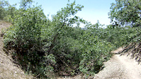
Good option for creating loops rides around the BST. Mostly flows pretty good, with a couple steep pitches, but not too loose. Some great flow dropping off the BST towards the Lindon Nature Park.

Trail Supporters
Traditionally Indigenous Territory

Recent Activity on Trail

Past Week
  • 0 rides
  •  
6 Months
  • 24 rides
  • 11 miles avg distance
All
  • 167 rides
  • Last: Jun 13, 2026
c1c2c3c4
January
February
March
April
May
June
July
August
September
October
November
December
update trails status or condition

Canberra Trail Reports

statusdatedescription
Feb 9, 2026 @ 9:21am (America/Denver)
Feb 9, 2026
Mar 9, 2025 @ 5:44pm
Mar 9, 2025
Jan 15, 2025 @ 7:48am
Jan 15, 2025
This trail was frozen this morning but will be muddy as the day warms up. Horses have chewed up many spots while riding during thaw/mud.
Jan 3, 2025 @ 6:05am
Jan 3, 2025
May 31, 2022 @ 3:22pm
May 31, 2022
more »
Status:
on Feb 9, 2026
Ideal
Avg: 3.79 (4 votes)
Your vote: 0

view (967)
close
3D
Trail Conditions
  • Unknown
  • Snow Groomed
  • Snow Packed
  • Snow Covered
  • Snow Cover Partial
  • Freeze/thaw Cycle
  • Icy
  • Prevalent Mud
  • Wet
  • Variable
  • Ideal
  • Dry
  • Very Dry
Trail Flow (Ridden Direction)
Trailforks scans users ridelogs to determine the most popular direction each trail is ridden. A good flowing trail network will have most trails flowing in a single direction according to their intension.
The colour categories are based on what percentage of riders are riding a trail in its intended direction.
  • > 96%
  • > 90%
  • > 80%
  • > 70%
  • > 50%
  • < 50%
  • bi-directional trail
  • no data
Trail Last Ridden
Trailforks scans ridelogs to determine the last time a trail was ridden.
  • < 2 days
  • < 1 week
  • < 2 weeks
  • < 1 month
  • < 6 months
  • > 6 months
Trail Ridden Direction
The intended direction a trail should be ridden.
  • Downhill Only
  • Downhill Primary
  • Both Directions
  • Uphill Primary
  • Uphill Only
  • One Direction
Contribute Details
Colors indicate trail is missing specified detail.
  • Description
  • Photos
  • Description & Photos
  • Videos
Trail Popularity ?
Trailforks scans ridelogs to determine which trails are ridden the most in the last 9 months. Trails are compared with nearby trails in the same city region with a possible 25 colour shades. Think of this as a heatmap, more rides = more kinetic energy = warmer colors.
  • most popular
  • popular
  • less popular
  • not popular
ATV/ORV/OHV Filter
Max Vehicle Width
inches
US Cell Coverage
Legend
cell carrier legend

Radar Time
Activity Recordings
Trailforks uses anonymized public activity data. ?
Activity Recordings
Trailforks uses anonymized public activity data. ?
Personal Heatmap
Activity Types
all / none
Options
2
Date range month
Winter Trails
Warning A routing network for winter maps does not exist. Selecting trails using the winter trails layer has been disabled.
Missing Trails
Most Popular
Least Popular
Trails are colored based on popularity. The more popular a trail is, the more red. Less popular trails trend towards green.
Jump Magnitude Heatmap
Heatmap of where riders jump on trails. Zoom in to see individual jumps, click circles to view jump details.
BC Backroad Status

Service Road Atlas is a free to use, community-driven service for viewing and creating reports on the numerous back-country service roads around B.C. and Alberta.

map legend
Slope Aspect
Direction the slope faces
Flat N NE E SE S SW W NW
Trails Deemphasized
Trails are shown in grey.
disable
Only show trails with no bike usage.
Enable
Suggested Layers
Based on selected activity type

    Save the current map location and zoom level as your default home location whenever this page is loaded.

    Save
        Directions to canberra trailhead (40.336500, -111.674300)

        Photos

        7 more »
        59 |
        May 18, 2019 @ 1:32pm
        May 18, 2019
        54 |
        May 18, 2019 @ 1:32pm
        May 18, 2019
        47 |
        May 18, 2019 @ 1:32pm
        May 18, 2019
        41 |
        May 18, 2019 @ 1:31pm
        May 18, 2019

        Videos

        1 more »
        BST Lindon
        3:29 | 122 | Mar 19, 2015 , Lindon

        Trail Lists

        Routes with this trail

        3.0 11 miles 2,135 ft 29 Loop
        Dry Canyon Loop - Start by Police Shooting Range. BST to Shooter, to Crankland, to Betty, up to the altar...
        18 miles 4,967 ft 26
        This loop starts at the Orem Water towers above the cemetery and runs across the Bonneville shoreline to...
        11 miles 1,778 ft 10 Out & Back
        This is what I call the classic Crop Circle loop.

        Reviews / Comments

        No reviews yet, be the first to write a review or ask a question.
        Use trail reports to comment on trail conditions.


        We hope you've been enjoying Trailforks!

        Create a FREE account to view trail comments and much more.

        • By toddTF Pro Trailforks & contributors
        • #9481 - 1,696 views

        Frequently Asked Questions About Canberra

        Where is Canberra located?
        Canberra is located in Lindon Nature Park, Lindon, Utah, United States. It is part of the Lindon Nature Park trail network. The trailhead is located at coordinates 40.3365, -111.6743.
        How hard is Canberra?
        Canberra is rated as Blue difficulty. The average grade is 2.8%.
        What is the elevation gain for Canberra?
        Canberra has 44 ft of elevation gain. The trail has 147 ft of elevation descent. The elevation ranges from 5,231 ft to 5,363 ft.
        Is Canberra a point to point trail?
        Canberra is not a point to point trail. The direction is Both Directions. The trail type is singletrack.

        Hit the Trail

        Open in App

        Get this trail on your phone instantly.
        open trail in app

        Download Trail

        Save to wishlist, Garmin & download.
        save the trail

        Find Related Routes

        Find routes and users activities that include this trail.
        find routes for this trail

        You must enter a description before submitting.