

more stats
2.7 miles
Distance
240 ft
Climb
-194 ft
Descent
3,055 ft
High Point
46 ft
Altitude change
2,906 ft
Altitude min
2,906 ft
Altitude start
2,953 ft
Altitude end
0.3%
Grade
-24.7%
Grade max
16%
Grade min
1 mile
Distance climb
1 mile
Distance down
1,512 ft
Distance flat

Capitiellos Details

  • Activities
    • Mountain Bike
    • E-Bike
    • Hike
    • Trail Running
  • Riding Area
    Jarlata
    Sabiñánigo
  • Difficulty Rating
  • Voted Difficulty
    Red (1 vote)
  • Local Popularity
    5 in Mountain Biking heatmap [+]
    • 55 in E-Biking
    • 5 in Trail Running
    • 5 in Hiking
  • Global Ranking
    #164043 in Mountain Biking [+]
    • #99086 in E-Biking
    • #223955 in Trail Running
    • #214485 in Hiking
  • National Ranking
    #16,869 in Mountain Biking · Spain [+]
    • #21,722 in E-Biking
    • #16,211 in Trail Running
    • #13,206 in Hiking
  • Hiking SAC Scale
    T3 Demanding Mountain Hiking
  • Trail Type
    Wilderness Trail
  • Bike Type
    AM
  • Direction
    Both Directions
  • Climb Difficulty
    Black Diamond
  • Physical Rating
    Hard
  • Trail Visibility
    Sometimes hard to follow
  • Dogs Allowed
    Yes
  • eBike Allowed
    Yes up to Class 1
  • TTFs on Trail
    Rock Face, Rock Garden, Roller Coaster

Sendero que recorre la sierra de Capitiellos, sube baja por sendero no muy marcado, con fuertes repechos, escalones...

Tags

Recent Activity on Trail

Past Week
  • 0 rides
  •  
6 Months
  • 0 rides
  •  
All
  • 0 rides
  • Last: Jun 23, 2024
update trails status or condition

Capitiellos Trail Reports

statusdatedescription
Oct 28, 2026 @ 1:55pm (Europe/Madrid)
Oct 28, 2026
May 23, 2026 @ 2:01pm (Europe/Madrid)
May 23, 2026
El sendero está ciclabe al 100% pero no es muy ancho, y a tramos un poco perdedor, por no tener muy claro por donde va el sendero bueno.
more »
Status:
on Oct 28, 2026
Dry
Avg: 3.84 (1 votes)
Your vote: 0

view (3)
close
      Directions to capitiellos trailhead (42.543410, -0.483160)

      Photos

      7 more »
      mtb
      97 |
      Mar 8, 2022 @ 3:38am
      Mar 8, 2022
      mtb
      87 |
      Mar 8, 2022 @ 3:38am
      Mar 8, 2022
      mtb
      79 |
      Mar 8, 2022 @ 3:38am
      Mar 8, 2022
      mtb
      92 |
      Mar 8, 2022 @ 3:37am
      Mar 8, 2022

      Videos

      1 more »
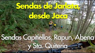
      Sendas de Jarlata, desde Jaca: Sendas de...
      mtb
      4:16 | 159 | Nov 26, 2021 , Sabiñánigo
      3.0 ★★★★★
      1 Ratings
      5 ★
      4 ★
      3 ★ 100%
      2 ★
      1 ★

      2 Reviews & Comments

      Crisjaca Crisjaca
      Por cierto la entrada desde la carretera de Navasa, está lo peor, algo cerrada, con muscular difícil.
      Crisjaca Crisjaca
      Azul+ rojo quizás es demasiado, lo más complicado son las subidas por %de pendiente, no hay pasos complicados pero si puede dar sensación de aéreo al ciclar casi todo por la artista.

      We hope you've been enjoying Trailforks!

      Create a FREE account to view all trail reviews and much more.

      • By CrisjacaTF Pro & contributors
      • #466925 - 517 views

      Frequently Asked Questions

      ▼ Where is Capitiellos located?
      Capitiellos is located in Jarlata, Sabiñánigo, Spain. It is part of the Jarlata trail network. The trailhead is located at coordinates 42.54341, -0.48316.
      ▼ How hard is Capitiellos?
      Capitiellos is rated as Red difficulty. The physical rating is Hard. The average grade is 0.3%. The climb difficulty is rated Black Diamond.
      ▼ What is the elevation gain for Capitiellos?
      Capitiellos has 240 ft of elevation gain. The trail has 194 ft of elevation descent. The elevation ranges from 2,906 ft to 3,055 ft.
      ▼ Is Capitiellos a point to point trail?
      Capitiellos is not a point to point trail. The direction is Both Directions. The trail type is wilderness trail.
      ▼ How long is Capitiellos?
      Capitiellos is 2.7 miles long. The trail type is wilderness trail.
      ▼ Are dogs allowed on Capitiellos?
      Yes, dogs are allowed on Capitiellos. Please keep dogs on a leash where required and clean up after them.
      ▼ How do I access Capitiellos? Where is the closest parking trailhead?
      The closest parking and trailhead locations to Capitiellos are: View all parking locations in the area.
      ▼ How busy is Capitiellos?
      Capitiellos is a less popular trail with lighter traffic. There have been 3 recorded activities on this trail. The trail has received 3 check-ins. View recent activity on this trail.

      Hit the Trail

      Open in App

      Get this trail on your phone instantly.

      open trail in app

      Download Trail

      Save to wishlist, Garmin & download.
      save the trail

      Find Related Routes

      Find routes and users activities that include this trail.
      find routes for this trail

      You must enter a description before submitting.

