
more stats
2.8 miles
Distance
47 ft
Climb
-2,193 ft
Descent
00:34:24
Avg time
-2,146 ft
Altitude change
2,708 ft
Altitude min
4,857 ft
Altitude max
4,853 ft
Altitude start
2,707 ft
Altitude end
-14.3%
Grade
-69.3%
Grade max
17.9%
Grade min
801 ft
Distance climb
3 miles
Distance down
62 ft
Distance flat
00:34:24
Avg time

Cardada Details

  • Activities
    • Mountain Bike
    • E-Bike
    • Hike
    • Trail Running
  • Riding Area
    Cardada Cimetta
    Locarno
  • Ref Number
    #397
  • Difficulty Rating
  • Voted Difficulty
    Blue (1 vote)
  • Local Popularity
    95 in Mountain Biking [+]
    • 100 in E-Biking
    • 5 in Trail Running
    • 5 in Hiking
  • Global Ranking
    #34749 in Mountain Biking [+]
    • #2371 in E-Biking
    • #213648 in Trail Running
    • #204716 in Hiking
  • National Ranking
    #813 in Mountain Biking · Switzerland [+]
    • #38 in E-Biking
    • #6,262 in Trail Running
    • #6,496 in Hiking
  • Hiking SAC Scale
    T1 Hiking
  • Trail Type
    Machine Groomed
  • Bike Type
    AM
  • Trail Visibility
    Always easy to follow
  • Dogs Allowed
    Yes
  • eBike Allowed
    Yes up to Class 1

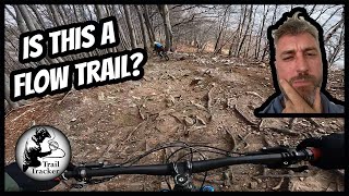
The trail into the Resa Valley first takes you over a grassy ridge before dropping into a dense deciduous forest with plenty of flowing berms. With alternating easy and moderate technical sections.

Tags
BermsFlowy

Trail Supporters

Recent Activity on Trail

Past Week
  • 0 rides
  •  
6 Months
  • 20 rides
  • 33.9 km avg distance
All
  • 144 rides
  • Last: Sep 8, 2019
c1c2c3c4
January
February
March
April
May
June
July
August
September
October
November
December
Status:
on Sep 30, 2026
Dry
Avg: 3.72 (19 votes)
Your vote: 0

view (734)
close
      Directions to cardada trailhead (46.197640, 8.798510)

      Photos

      37 more »
      mtb
      196 |
      Aug 1, 2023 @ 8:43am
      Aug 1, 2023
      mtb
      211 |
      Aug 1, 2023 @ 8:43am
      Aug 1, 2023
      mtb
      209 |
      Aug 1, 2023 @ 8:43am
      Aug 1, 2023
      mtb
      186 |
      Aug 1, 2023 @ 8:43am
      Aug 1, 2023

      Videos

      2 more »
      youtuber MTB Switzerland - Cardada (Ticino)
      mtb
      7:27 | 764 | Mar 30, 2022 , Locarno
      youtuber TICINO LAGO MAGGIORE Cardada-Trail  First...
      mtb
      15:56 | 238 | Apr 25, 2025 , Locarno

      Routes with this trail

      ★ 3.5 • 19 miles • 4,719 ft • 4 • Loop •
      An adventurous circuit route in the surroundings of Cardada and Val Resa that starts and finishes in...
      3.8 ★★★★★
      19 Ratings
      5 ★ 37%
      4 ★ 26%
      3 ★ 16%
      2 ★ 21%
      1 ★

      8 Reviews & Comments

      JasmineRinnofner
      The trail is quite wide at the beginning and a little bit boring. I would not ride it again. Definitely not worth the money for the cable car.
      trailpapst trailpapst
      The trail has been overhauled and is improved a lot compared since my last ride in 2020. It is worth to give a try. But yes some corners are suprising flat at the end and the last section, where a forest road was in 2020 is now narrowed to kind of a single trail. Would I ride it a second time? probably not, there are much better hike trails around... more fun, more panorama, better time.
      shaddoww
      Overall a nice trail. Some of the corners aren't shaped very well. Very sharp without any chance to lean inward as they are completely flat so you have to break close to zero. Trail seems as if it can't deside if wants to be a flow trail or not. Be careful in some of the corners.

      We hope you've been enjoying Trailforks!

      Create a FREE account to view all trail reviews and much more.

      • By troubletoniTF Pro & contributors
      • #144447 - 7,255 views

      Frequently Asked Questions

      ▼ Where is Cardada located?
      Cardada is located in Cardada Cimetta, Locarno, Switzerland. It is part of the Cardada Cimetta trail network. The trailhead is located at coordinates 46.19764, 8.79851.
      ▼ How hard is Cardada?
      Cardada is rated as Blue difficulty. The average grade is 14.3%.
      ▼ What is the elevation gain for Cardada?
      Cardada has 47 ft of elevation gain. The trail has 2,193 ft of elevation descent. The elevation ranges from 2,708 ft to 4,857 ft.
      ▼ How long is Cardada?
      Cardada is 2.8 miles long. The trail type is machine groomed.
      ▼ Are dogs allowed on Cardada?
      Yes, dogs are allowed on Cardada. Please keep dogs on a leash where required and clean up after them.
      ▼ How do I access Cardada? Where is the closest parking trailhead?
      The closest parking and trailhead locations to Cardada are: View all parking locations in the area.
      ▼ How long does it take to ride Cardada?
      Based on recorded activities, it takes an average of 34 minutes to ride Cardada. The trail is 2.8 miles long. Actual times will vary based on fitness level, conditions, and pace. View recent activity logs for more details.
      ▼ How busy is Cardada?
      Cardada is a very popular trail. There have been 729 recorded activities on this trail. The trail has received 734 check-ins. View recent activity on this trail.

      Hit the Trail

      Open in App

      Get this trail on your phone instantly.

      open trail in app

      Download Trail

      Save to wishlist, Garmin & download.
      save the trail

      Find Related Routes

      Find routes and users activities that include this trail.
      find routes for this trail

      You must enter a description before submitting.