
more stats
2.2 miles
Distance
99 ft
Climb
-1,820 ft
Descent
00:18:46
Avg time
-1,721 ft
Altitude change
1,632 ft
Altitude min
3,353 ft
Altitude max
3,353 ft
Altitude start
1,634 ft
Altitude end
-14.8%
Grade
-85%
Grade max
32.1%
Grade min
1,240 ft
Distance climb
2 miles
Distance down
157 ft
Distance flat
00:18:46
Avg time

Cavina Details

  • Activities
    • Mountain Bike
    • E-Bike
    • Hike
    • Trail Running
  • Riding Area
  • Ref Number
    #760
  • Difficulty Rating
  • Local Popularity
    75 in Mountain Biking [+]
    • 70 in E-Biking
    • 5 in Trail Running
    • 5 in Hiking
  • Global Ranking
    #214975 in Mountain Biking [+]
    • #46327 in E-Biking
    • #406980 in Trail Running
    • #407921 in Hiking
  • National Ranking
    #15,203 in Mountain Biking · Italy [+]
    • #5,485 in E-Biking
    • #17,243 in Trail Running
    • #17,225 in Hiking
  • Trail Exposure
    Normal
  • Trail Type
    Mixed
  • Bike Type
    AM
  • Physical Rating
    Hard
  • Trail Visibility
    Always easy to follow
  • Season
    All-Season
  • Dogs Allowed
    Yes
  • eBike Allowed
    Yes up to Class 1
  • TTFs on Trail
    Rock Face, Rock Garden, Skinny
  • Ride in Rain
    Yes
  • Lighting
    No
  • Year Opened
    2025

The Cavina trail is the result of two historic trails, the CAVE and the CAINA, being joined together. Revived in 2025 for the fifth BDG Enduro event, the trail links the initial CAVE section with the second CAINA section, forming a long, continuous descent from Rubbio to Caluga. Due to its length and the type of terrain, it is a physically demanding route. The descent alternates between a fast, smooth first section and a more technical, rocky second section that requires concentration and riding experience.
.
.
.
Il sentiero Cavina nasce dall'unione di due percorsi storici: Il CAVE e il CAINA, da cui prende il nome. Riesumato nel 2025 in occasione della quinta edizione del BDG Enduro, questo trail permette di unire la prima sezione delle CAVE con la seconda parte del CAINA, creando così un'unica lunga discesa che collega Rubbio direttamente a Caluga. Si tratta di un tracciato fisicamente impegnativo sia per la sua lunghezza che per la tipologia di terreno. La discesa alterna una prima parte veloce e scorrevole a una seconda più tecnica e rocciosa che richiede attenzione ed esperienza nella guida.

Access Info

Access Info
To get there, head to Rubbio, continue east along the paved road for 2 km until you reach the start of the trail, which is located right along the road. The trail starts in an open field next to a private paved road.
.
Per arrivare bisogna raggiungere la località Rubbio, proseguire in direzione EST lungo la strada asfaltata per 2km fino all'inizio del sentiero che si trova proprio lungo la strada. Il sentiero parte in un campo aperto a lato di una strada asfaltata privata.

Tags
Rock gardensRock slabsSkinnies

Recent Activity on Trail

Past Week
  • 1 rides
  • 22 miles average
6 Months
  • 5 rides
  • 16 miles avg distance
All
  • 15 rides
  • Last: Nov 8, 2026
c1c2c3c4
January
February
March
April
May
June
July
August
September
October
November
December
update trails status or condition

Cavina Trail Reports

statusdatedescription
Nov 3, 2026 @ 8:29pm (Europe/Rome)
Nov 3, 2026
Terreno ideale. Trail sistemato e pulito. Attenzione ai tratti tecnici con rocce smosse
Mar 29, 2026 @ 10:08am (Europe/San_Marino)
Mar 29, 2026
Pulito e sistemato da poco
Mar 17, 2026 @ 4:20pm (Europe/San_Marino)
Mar 17, 2026
Piccolo tratto chiuso causa lavori forestali, deviazione sul posto
more »
Status:
on Nov 3, 2026
Ideal
no votes yet
Your vote: 0

view (52)
close
      Directions to cavina trailhead (45.803570, 11.673450)

      Photos

      No photos have been added for Cavina yet, add a photo.

      Videos

      1 more »
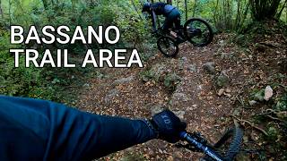
      Bassano Trail Area
      mtb
      15:38 | 7 | Nov 3, 2026 , Bassano del Grappa

      Reviews / Comments

      No reviews yet, be the first to write a review or ask a question.
      Use trail reports to comment on trail conditions.


      We hope you've been enjoying Trailforks!

      Create a FREE account to view all trail reviews and much more.

      • By Jac46 & contributors
      • #909066 - 550 views

      Frequently Asked Questions

      ▼ Where is Cavina located?
      Cavina is located in Bassano del Grappa, Italy. It is part of the Bassano del Grappa trail network. The trailhead is located at coordinates 45.80357, 11.67345.
      ▼ How hard is Cavina?
      Cavina is rated as Red difficulty. The physical rating is Hard. The average grade is 14.8%.
      ▼ What is the elevation gain for Cavina?
      Cavina has 99 ft of elevation gain. The trail has 1,820 ft of elevation descent. The elevation ranges from 1,632 ft to 3,353 ft.
      ▼ How long is Cavina?
      Cavina is 2.2 miles long. The trail type is mixed.
      ▼ Are dogs allowed on Cavina?
      Yes, dogs are allowed on Cavina. Please keep dogs on a leash where required and clean up after them.
      ▼ When is the best time of year to ride Cavina?
      Cavina is best visited during: All-Season.
      ▼ How do I access Cavina? Where is the closest parking trailhead?
      The closest parking and trailhead locations to Cavina are: View all parking locations in the area.
      ▼ How long does it take to ride Cavina?
      Based on recorded activities, it takes an average of 19 minutes to ride Cavina. The trail is 2.2 miles long. Actual times will vary based on fitness level, conditions, and pace. View recent activity logs for more details.
      ▼ How busy is Cavina?
      Cavina is a very popular trail. There have been 52 recorded activities on this trail. The trail has received 52 check-ins. View recent activity on this trail.

      Hit the Trail

      Open in App

      Get this trail on your phone instantly.

      open trail in app

      Download Trail

      Save to wishlist, Garmin & download.
      save the trail

      Find Related Routes

      Find routes and users activities that include this trail.
      find routes for this trail

      You must enter a description before submitting.

