

more stats
3,615 ft
Distance
16 ft
Climb
-463 ft
Descent
00:25:20
Avg time
-447 ft
Altitude change
3,733 ft
Altitude min
4,180 ft
Altitude max
4,180 ft
Altitude start
3,734 ft
Altitude end
-12.4%
Grade
-45.8%
Grade max
17%
Grade min
240 ft
Distance climb
3,373 ft
Distance down
00:25:20
Avg time

Chichonline Details

  • Activities
    • Mountain Bike
    • E-Bike
    • Hike
    • Trail Running
  • Riding Area
    Cabeza Arcón
    Bustarviejo
  • Difficulty Rating
  • Local Popularity
    60 in Mountain Biking [+]
    • 75 in E-Biking
    • 5 in Trail Running
    • 5 in Hiking
  • Global Ranking
    #22028 in Mountain Biking [+]
    • #41421 in E-Biking
    • #381025 in Trail Running
    • #375449 in Hiking
  • National Ranking
    #1,017 in Mountain Biking · Spain [+]
    • #2,972 in E-Biking
    • #42,674 in Trail Running
    • #40,657 in Hiking
  • Hiking SAC Scale
    T2 Mountain Hiking
  • Trail Type
    Singletrack
  • Bike Type
    DH, AM
  • Direction
    Downhill Primary
    Popular Direction Shown
  • Climb Difficulty
    Black Diamond
  • Physical Rating
    Moderate
  • Trail Visibility
    Always easy to follow
  • eBike Allowed
  • TTFs on Trail
    Drop, Rock Face

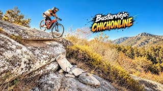
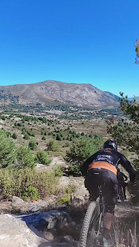
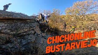
Variante de Suegroland para evitar el hayedo llamada así en honor a nuestro amigo endurero David Chichón que nos dejó en 2026.

Mismo estilo, mismo nivel, mucha losa, muchos escalones con piedras para suavizar, pasos secretos, alguna subida inevitable porque la zona es complicada y muy atentos al tramo de stranger things con la grieta y el paso del upside down.

Pasos técnicos:

KM 0.2 - Paso duo
KM 0.3 - Paso tiralé que hay piedras
KM 0.4 - Paso secreto sube inclinado
KM 0.6 - Tramo mario kart
KM 0.7 - Tramo stranger things
KM 0.7 - Paso del upside down
KM 0.8 - Tramo niña de la curva
KM 0.8 - Paso secreto sube y dropea
KM 0.9 - Paso six seven
KM 0.9 - Paso escaleras al tren
KM 1.0 - Tramo losa tren
KM 1.0 - Paso me bajo del tren
KM 1.1 - Drop final boss

Tags
DropsRock slabs

Recent Activity on Trail

Past Week
  • 1 rides
  • 23.9 km average
6 Months
  • 6 rides
  • 23.7 km avg distance
All
  • 6 rides
  • Last: Oct 18, 2026
c1c2c3c4
January
February
March
April
May
June
July
August
September
October
November
December
update trails status or condition

Chichonline Trail Reports

Status:
on Oct 12, 2026
Dry
Avg: 4.13 (1 votes)
Your vote: 0

view (15)
close
      Directions to chichonline trailhead (40.842610, -3.701660)

      Photos

      No photos have been added for Chichonline yet, add a photo.

      Videos

      6 more »
      youtuber ¡ESTA BAJADA NO ES PARA TODOS!  Nueva...
      mtb
      18:28 | 27 | Oct 1, 2026 , Bustarviejo
      Bustarviejo: Chichonline, uno de los pasos...
      mtb
      0:50 | 96 | Sep 13, 2026 , Bustarviejo
      ChichonLINE
      mtb
      0:35 | 31 | Sep 2, 2026 , Bustarviejo
      youtuber Cabeza Arcón: Chichonline |  Bustarviejo...
      ebike
      16:23 | 46 | Sep 30, 2026 , Bustarviejo
      5.0 ★★★★★
      1 Ratings
      5 ★ 100%
      4 ★
      3 ★
      2 ★
      1 ★

      2 Reviews & Comments

      Alhernan
      Que maravilla de bajada,cuando parecía que no podía mejorarse sale la chichón line, bravo
      pacollopis pacollopis
      Muy trabajado y con muchos pasos arreglados. 👏🏻👏🏻👏🏻👏🏻

      We hope you've been enjoying Trailforks!

      Create a FREE account to view all trail reviews and much more.

      • By antonio-nafriaTF Pro & contributors
      • #941253 - 473 views

      Frequently Asked Questions

      ▼ Where is Chichonline located?
      Chichonline is located in Cabeza Arcón, Bustarviejo, Spain. It is part of the Cabeza Arcón trail network. The trailhead is located at coordinates 40.84261, -3.70166.
      ▼ How hard is Chichonline?
      Chichonline is rated as Red difficulty. The physical rating is Moderate. The average grade is 12.4%. The climb difficulty is rated Black Diamond.
      ▼ What is the elevation gain for Chichonline?
      Chichonline has 16 ft of elevation gain. The trail has 463 ft of elevation descent. The elevation ranges from 3,733 ft to 4,180 ft.
      ▼ Is Chichonline a point to point trail?
      Chichonline is not a point to point trail. The direction is Downhill Primary. The trail type is singletrack.
      ▼ How long is Chichonline?
      Chichonline is 3,615 ft long. The trail type is singletrack.
      ▼ Are dogs allowed on Chichonline?
      There is no information about dogs being allowed on Chichonline. Check with local trail managers or the trail page for the latest access rules.
      ▼ How do I access Chichonline? Where is the closest parking trailhead?
      The closest parking and trailhead locations to Chichonline are: View all parking locations in the area.
      ▼ How long does it take to ride Chichonline?
      Based on recorded activities, it takes an average of 25 minutes to ride Chichonline. The trail is 3,615 ft long. Actual times will vary based on fitness level, conditions, and pace. View recent activity logs for more details.
      ▼ How busy is Chichonline?
      Chichonline is a moderately popular trail. There have been 14 recorded activities on this trail. The trail has received 15 check-ins. View recent activity on this trail.

      Hit the Trail

      Open in App

      Get this trail on your phone instantly.

      open trail in app

      Download Trail

      Save to wishlist, Garmin & download.
      save the trail

      Find Related Routes

      Find routes and users activities that include this trail.
      find routes for this trail

      You must enter a description before submitting.

