

more stats
856 ft
Distance
2 ft
Climb
-14 ft
Descent
00:05:23
Avg time
-12 ft
Altitude change
409 ft
Altitude min
427 ft
Altitude max
426 ft
Altitude start
413 ft
Altitude end
-1.4%
Grade
-8.1%
Grade max
4%
Grade min
105 ft
Distance climb
272 ft
Distance down
390 ft
Distance flat
00:05:23
Avg time

Ścianki Details

  • Activities
    • Mountain Bike
    • E-Bike
  • Riding Area
  • Difficulty Rating
  • Voted Difficulty
    Black Diamond (1 vote)
  • Local Popularity
    75 in Mountain Biking heatmap [+]
    • 75 in E-Biking
  • Global Ranking
    #47439 in Mountain Biking [+]
    • #35410 in E-Biking
  • National Ranking
    #1,236 in Mountain Biking · Poland [+]
    • #606 in E-Biking
  • Trail Type
    Singletrack
  • Bike Type
    AM
  • Direction
    One Direction
  • Climb Difficulty
    Blue
  • Physical Rating
    Moderate
  • Trail Visibility
    Always easy to follow
  • Season
    All year.
  • Dogs Allowed
    Yes
  • eBike Allowed
    Yes up to Class 1
  • Ride in Rain
    Yes
  • Year Opened
    2019

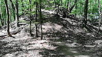
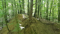
Trasa jednokierunkowa ze względu na jej charakter. Razem 6 ciekawych ścianek (zjazdów) o różnym poziomie trudności. Trasa rozpoczyna się od ulicy Podbórzańskiej, a kończy na terenie starego Bike Parku. Pierwsza ścianka o średnim stopniu trudności - trzeba przy niej pamiętać o prędkości aby bez schodzenia z roweru podjechać na dalszą część trasy. Druga ścianka o średnim poziomie trudności - kilka wariantów do wyboru (jeden - z korzeniem na którym można się oderwać od ziemi). Trzecia ścianka (ścianka Aśki) o najwyższym poziomie trudności - niemal pionowa i robi wrażenie. Czwarta ścianka dość trudna ze względu na jej dużą wysokość, prędkość i sypkie podłoże. Piąta malutka ścianka o średnim poziomie trudności - trudniejszy jest do niej dojazd z powodu wąskiej ścieżki. Ostatnia szósta ścianka o średnim poziomie trudności - kończy się hopką (step up'em?) i przyjemną bandą, odratowana ze starego Bike Parku. Razem jest to dość ciekawa alternatywa do innych tras.

This trail is unsanctioned.

Tags

Recent Activity on Trail

Past Week
  • 1 rides
  • 25 miles average
6 Months
  • 11 rides
  • 12 miles avg distance
All
  • 267 rides
  • Last: Nov 8, 2026
c1c2c3c4
January
February
March
April
May
June
July
August
September
October
November
December
update trails status or condition

Ścianki Trail Reports

Status:
on Mar 27, 2024
Ideal
Avg: 4.28 (8 votes)
Your vote: 0

view (3,080)
close
      Directions to cianki trailhead (53.495440, 14.535690)

      Photos

      11 more »
      mtb
      150 |
      Jun 4, 2019 @ 10:52am
      Jun 4, 2019
      mtb
      91 |
      Jun 3, 2019 @ 1:52pm
      Jun 3, 2019
      mtb
      87 |
      Jun 3, 2019 @ 1:41pm
      Jun 3, 2019
      mtb
      90 |
      Jun 3, 2019 @ 1:41pm
      Jun 3, 2019

      Videos

      3 more »
      Bartek na 4 ściance
      mtb
      0:16 | 165 | Jun 9, 2019 , Szczecin
      Czwarta ścianka
      mtb
      0:07 | 146 | Jun 4, 2019 , Szczecin
      Trzecia najtrudniejsza ścianka na trasie
      mtb
      0:27 | 172 | Jun 3, 2019 , Szczecin
      4.5 ★★★★★
      8 Ratings
      5 ★ 63%
      4 ★ 25%
      3 ★ 13%
      2 ★
      1 ★

      1 Review & Comments

      pawez pawez
      Bardzo fajna trasa. Od teraz musowa miejscówka po drodze z 3 hop na Hopki i Szałas. 3 i 4 ścianka robią wrażenie. Dobra robota Panowie.

      We hope you've been enjoying Trailforks!

      Create a FREE account to view all trail reviews and much more.

      • #187827 - 1,333 views

      Frequently Asked Questions

      ▼ Where is Ścianki located?
      Ścianki is located in Puszcza Wkrzańska, Szczecin, Poland. It is part of the Puszcza Wkrzańska trail network. The trailhead is located at coordinates 53.49544, 14.53569.
      ▼ How hard is Ścianki?
      Ścianki is rated as Red difficulty. The physical rating is Moderate. The average grade is 1.4%. The climb difficulty is rated Blue.
      ▼ What is the elevation gain for Ścianki?
      Ścianki has 2 ft of elevation gain. The trail has 14 ft of elevation descent. The elevation ranges from 409 ft to 427 ft.
      ▼ Is Ścianki a point to point trail?
      Yes, Ścianki is a point to point trail. The direction is One Direction. The trail type is singletrack.
      ▼ How long is Ścianki?
      Ścianki is 856 ft long. The trail type is singletrack.
      ▼ Are dogs allowed on Ścianki?
      Yes, dogs are allowed on Ścianki. Please keep dogs on a leash where required and clean up after them.
      ▼ When is the best time of year to ride Ścianki?
      Ścianki is best visited during: All year..
      ▼ How do I access Ścianki? Where is the closest parking trailhead?
      The closest parking and trailhead locations to Ścianki are: View all parking locations in the area.
      ▼ How long does it take to ride Ścianki?
      Based on recorded activities, it takes an average of 5 minutes to ride Ścianki. The trail is 856 ft long. Actual times will vary based on fitness level, conditions, and pace. View recent activity logs for more details.
      ▼ How busy is Ścianki?
      Ścianki is a very popular trail. There have been 1,389 recorded activities on this trail. The trail has received 3,080 check-ins. View recent activity on this trail.

      Hit the Trail

      Open in App

      Get this trail on your phone instantly.

      open trail in app

      Download Trail

      Save to wishlist, Garmin & download.
      save the trail

      Find Related Routes

      Find routes and users activities that include this trail.
      find routes for this trail

      You must enter a description before submitting.

