
more stats
3,323 ft
Distance
-636 ft
Descent
00:15:13
Avg time
-636 ft
Altitude change
1,770 ft
Altitude min
2,406 ft
Altitude max
2,406 ft
Altitude start
1,772 ft
Altitude end
-19.1%
Grade
-56.9%
Grade max
-5.2%
Grade min
3,323 ft
Distance down
00:15:13
Avg time

Cielo Alto Details

  • Activities
    • Mountain Bike
    • E-Bike
    • Hike
    • Trail Running
  • Riding Area
  • Ref Number
    107B
  • Difficulty Rating
  • Voted Difficulty
    Black (3 votes)
  • Local Popularity
    90 in Mountain Biking [+]
    • 90 in E-Biking
    • 95 in Trail Running
    • 5 in Hiking
  • Global Ranking
    #6612 in Mountain Biking [+]
    • #510 in E-Biking
    • #74689 in Trail Running
    • #158917 in Hiking
  • National Ranking
    #674 in Mountain Biking · Italy [+]
    • #98 in E-Biking
    • #1,825 in Trail Running
    • #4,907 in Hiking
  • Hiking SAC Scale
    T1 Hiking
  • Trail Type
    Singletrack
  • Bike Type
    AM
  • Direction
    Downhill Only
    Popular Direction Shown
  • Climb Difficulty
    Black Diamond
  • Physical Rating
    Moderate
  • Trail Visibility
    Always easy to follow
  • eBike Allowed
    Yes up to Class 1
  • TTFs on Trail
    Rock Face, Rock Garden
  • Land Owner
    A.S.D. Elba Ovest

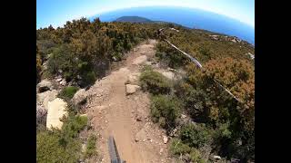
sentiero tecnico e roccioso

Tags
Rock gardensRock slabsViews

Trail Supporters

Local Trail Association

Recent Activity on Trail

Past Week
  • 0 rides
  •  
6 Months
  • 36 rides
  • 18 miles avg distance
All
  • 235 rides
  • Last: Oct 26, 2026
c1c2c3c4
January
February
March
April
May
June
July
August
September
October
November
December
update trails status or condition

Cielo Alto Trail Reports

statusdatedescription
Oct 25, 2026 @ 9:57am (Europe/Rome)
Oct 25, 2026
Dopo le ultime piogge di pochi giorni fa, ora il sentiero può risultare poco godibile anche per biker tecnici.
Oct 10, 2026 @ 9:31am (Europe/Vatican)
Oct 10, 2026
è scavato in maniera esagerata a tal punto da non renderlo divertente
Sep 6, 2026 @ 5:35pm (Europe/Rome)
Sep 6, 2026
Jul 1, 2026 @ 10:19am (Europe/Vatican)
Jul 1, 2026
Jun 6, 2026 @ 6:14am (Europe/Rome)
Jun 5, 2026
some errosion but still good
more »
Status:
on Oct 25, 2026
Ideal
Avg: 4.62 (45 votes)
Your vote: 0

view (1,378)
close
      Directions to cielo-alto trailhead (42.761610, 10.185260)

      Photos

      42 more »
      mtb
      20 |
      Oct 16, 2026 @ 12:25am
      Oct 16, 2026
      mtb
      137 |
      Oct 31, 2024 @ 3:12am
      Oct 31, 2024
      mtb
      107 |
      Oct 15, 2024 @ 2:56pm
      Oct 15, 2024
      mtb
      117 |
      Oct 15, 2024 @ 2:56pm
      Oct 15, 2024

      Videos

      12 more »
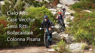
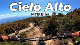
      youtuber MTB Isola d'Elba 25.05.2024 sentiero CIELO ALTO
      mtb
      4:43 | 434 | May 29, 2024 , My City
      youtuber Cielo Alto - Bike Land Elba Ovest
      mtb
      2:57 | 1216 | Apr 27, 2021 , My City
      Belle discese su pregiato granito elbano - La...
      mtb
      16:17 | 3 | Oct 31, 2026 , My City
      Cielo Alto Trail - MTB Elba, Italy
      mtb
      4:37 | 155 | Aug 15, 2026 , My City

      Routes with this trail

      ★ 5.0 • 9 miles • 2,306 ft • 13 • Point to Point •
      Percorso da enduro nel Bike Park Elba Ovest
      ★ 4.4 • 4 miles • 18 ft • 8 • Point to Point •
      Dal cielo al mare ...........
      25 miles • 5,888 ft • 17 •
      Percorso di gara del Campionato Italiano Enduro MTB 2024
      4.7 ★★★★★
      45 Ratings
      5 ★ 76%
      4 ★ 16%
      3 ★ 9%
      2 ★
      1 ★

      22 Reviews & Comments

      mZA2Tf
      A Luglio 2026 fatto sempre in sella, anche se qualche passaggio era davvero al limite. A Ottobre 2026 direi sconsigliato e quasi impraticabile. Canali molto profondi e devastazione del trail a tal punto da dover scendere molte volte dalla bici!
      MatthiasGulde
      Pretty washed out. used to be very nice. Not at the Moment.
      manwen manwen
      Ziemlich ausgewaschen. Praktisch alles fahrbar aber verglichen mit 2024 einiges schwieriger geworden.

      We hope you've been enjoying Trailforks!

      Create a FREE account to view all trail reviews and much more.

      • By Mauri72 & contributors
      • #223488 - 6,631 views

      Frequently Asked Questions

      ▼ Where is Cielo Alto located?
      Cielo Alto is located in Bike Land Elba Ovest, Italy. It is part of the Bike Land Elba Ovest trail network. The trailhead is located at coordinates 42.76161, 10.18526.
      ▼ How hard is Cielo Alto?
      Cielo Alto is rated as Black difficulty. The physical rating is Moderate. The average grade is 19.1%. The climb difficulty is rated Black Diamond.
      ▼ What is the elevation gain for Cielo Alto?
      The trail has 636 ft of elevation descent. The elevation ranges from 1,770 ft to 2,406 ft.
      ▼ Is Cielo Alto a point to point trail?
      Yes, Cielo Alto is a point to point trail. The direction is Downhill Only. The trail type is singletrack.
      ▼ How long is Cielo Alto?
      Cielo Alto is 3,323 ft long. The trail type is singletrack.
      ▼ Are dogs allowed on Cielo Alto?
      There is no information about dogs being allowed on Cielo Alto. Check with local trail managers or the trail page for the latest access rules.
      ▼ When is the best time of year to ride Cielo Alto?
      Based on activity log data, the most popular months to ride Cielo Alto are:
      • October (41 activities)
      • May (33 activities)
      • June (21 activities)
      Check the reports page for current trail conditions.
      ▼ How do I access Cielo Alto? Where is the closest parking trailhead?
      The closest parking and trailhead locations to Cielo Alto are: View all parking locations in the area.
      ▼ How long does it take to ride Cielo Alto?
      Based on recorded activities, it takes an average of 15 minutes to ride Cielo Alto. The trail is 3,323 ft long. Actual times will vary based on fitness level, conditions, and pace. View recent activity logs for more details.
      ▼ How busy is Cielo Alto?
      Cielo Alto is a very popular trail. There have been 1,348 recorded activities on this trail. The trail has received 1,378 check-ins. View recent activity on this trail.

      Hit the Trail

      Open in App

      Get this trail on your phone instantly.

      open trail in app

      Download Trail

      Save to wishlist, Garmin & download.
      save the trail

      Find Related Routes

      Find routes and users activities that include this trail.
      find routes for this trail

      You must enter a description before submitting.