
more stats
3.8 miles
Distance
1,033 ft
Climb
-336 ft
Descent
00:48:40
Avg time
698 ft
Altitude change
3,986 ft
Altitude min
4,834 ft
Altitude max
4,137 ft
Altitude start
4,836 ft
Altitude end
3.4%
Grade
-33.8%
Grade max
36.7%
Grade min
3 miles
Distance climb
4,685 ft
Distance down
1,417 ft
Distance flat
00:48:40
Avg time

Cliff Hanger Details

  • Activities
    • Mountain Bike
    • E-Bike
    • Gravel Bike
    • Hike
    • Trail Running
    • Dirtbike/Moto
    • ATV/ORV/OHV
  • Riding Area
    Amasa Back
    Moab, Utah
  • Difficulty Rating
  • Voted Difficulty
    Black Diamond (2 votes)
  • Local Popularity
    35 in Mountain Biking heatmap [+]
    • 50 in E-Biking
    • 85 in Trail Running
    • 5 in Hiking
    • 70 in Dirtbiking
    • 5 in ATVing/Offroading
    • 5 in Gravel Biking
  • Global Ranking
    #133866 in Mountain Biking [+]
    • #135138 in E-Biking
    • #109165 in Trail Running
    • #329089 in Hiking
    • #5075 in Dirtbiking
    • #5744 in ATVing/Offroading
    • #47277 in Gravel Biking
  • State Ranking
    #2,520 in Mountain Biking · Utah [+]
    • #1,838 in E-Biking
    • #2,340 in Trail Running
    • #5,810 in Hiking
    • #494 in Dirtbiking
    • #691 in ATVing/Offroading
    • #1,004 in Gravel Biking
  • Hiking SAC Scale
    T2 Mountain Hiking
  • Trail Exposure
    High Risk
  • Trail Type
    Doubletrack
  • Bike Type
    AM, XC, Gravel
  • Direction
    Both Directions[+]
    • Both Directions for Gravel Biking
  • Climb Difficulty
    Black Diamond
  • Physical Rating
    Hard
  • Trail Visibility
    Always easy to follow
  • Dogs Allowed
    Yes
  • eBike Allowed
    Yes up to Class 1
  • TTFs on Trail
    Drop, Rock Face, Rock Garden
  • Lighting
    No
  • Land Owner
    BLM

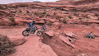
The original route for mtn biking back in the day. Its a quick, technical up or a ledge dropping descent.

Tags
DropsRock gardensRock slabs

Trail Supporters

  • BLM
    BLM
    Land Manager

Local Trail Association

Traditionally Indigenous Territory

Recent Activity on Trail

Past Week
  • 1 rides
  • 26.3 km average
6 Months
  • 3 rides
  • 27.6 km avg distance
All
  • 43 rides
  • Last: Nov 15, 2026
c1c2c3c4
January
February
March
April
May
June
July
August
September
October
November
December
update trails status or condition

Cliff Hanger Trail Reports

statusdatedescription
Oct 18, 2026 @ 2:21pm (America/Denver)
Oct 18, 2026
Oct 2, 2026 @ 10:33am (America/Denver)
Oct 2, 2026
Mar 5, 2024 @ 11:41am
Mar 5, 2024
First time on this trail, scoping to see what it would be like on an eBike. Found it slightly more challenging than Pritchett, likely due to the...
Jan 23, 2023 @ 9:57am
Jan 23, 2023
reporter Snowy and icy in the shade, snow melting creating mud in sunny areas.
Jun 8, 2021 @ 8:00am
Jun 8, 2021
reporter
more »
Status:
on Oct 18, 2026
Ideal
Avg: 3.84 (27 votes)
Your vote: 0

view (623)
close
      Directions to cliff-hanger trailhead (38.524010, -109.601580)

      Photos

      40 more »
      mtb
      9 |
      Nov 13, 2026 @ 4:55am
      Nov 13, 2026
      mtb
      39 |
      Oct 18, 2026 @ 2:27pm
      Oct 18, 2026
      mtb
      30 |
      Oct 18, 2026 @ 1:53pm
      Oct 18, 2026
      mtb
      55 |
      Oct 18, 2026 @ 1:38pm
      Oct 18, 2026

      Videos

      3 more »
      Going down Cliffhanger Road Moab Utah
      mtb
      4:02 | 896 | Nov 9, 2021 , Moab
      youtuber Smashing Rocks to Pothole Arch!
      mtb
      12:41 | 509 | Mar 24, 2021 , Moab
      moto
      0:03 | 5 | Oct 19, 2026 , Moab

      Routes with this trail

      more »
      ★ 5.0 • 8 miles • 1,323 ft • 13 • Loop •
      Captain Ahab black diamond loop (Hymasa)
      ★ 5.0 • 14 miles • 2,106 ft • 12 • Out & Back •
      Amasa Back is an awesome riding area with loads of options. For this route we suggest climbing up either...
      ★ 5.0 • 6 miles • 808 ft • 11 •
      Good option if you don't want to do the full Ahab Loop
      3.8 ★★★★★
      27 Ratings
      5 ★ 26%
      4 ★ 44%
      3 ★ 22%
      2 ★
      1 ★ 7%

      5 Reviews & Comments

      khash khash
      Only giving it 4 starts because it's also a Jeep trail. really fun technical up with some cool technical drops/rock rolls.
      sarondes
      Not sure why this has such a low user rating? This is a super fun down to bomb. Drops, ledges, line selection. Super fun. Climb Hymasa, then up and down Captain Ahad and then climb halfway back up and run the lower portion. Super fun!
      UtahJohn UtahJohn
      I don't know why this is now called Cliffhanger, this used to be Amasa Back 4X4. Cliffhanger I knew was only the section North of Ahab. Maybe my memory is failing me

      We hope you've been enjoying Trailforks!

      Create a FREE account to view all trail reviews and much more.

      • By toddTF Pro Trailforks & contributors
      • #8928 - 14,787 views

      Frequently Asked Questions

      ▼ Where is Cliff Hanger located?
      Cliff Hanger is located in Amasa Back, Moab, Utah, United States. It is part of the Amasa Back trail network. The trailhead is located at coordinates 38.52401, -109.60158.
      ▼ How hard is Cliff Hanger?
      Cliff Hanger is rated as Black Diamond difficulty. The physical rating is Hard. The average grade is 3.4%. The climb difficulty is rated Black Diamond.
      ▼ What is the elevation gain for Cliff Hanger?
      Cliff Hanger has 1,033 ft of elevation gain. The trail has 336 ft of elevation descent. The elevation ranges from 3,986 ft to 4,834 ft.
      ▼ Is Cliff Hanger a point to point trail?
      Cliff Hanger is not a point to point trail. The direction is Both Directions. The trail type is doubletrack.
      ▼ How long is Cliff Hanger?
      Cliff Hanger is 3.8 miles long. The trail type is doubletrack.
      ▼ Are dogs allowed on Cliff Hanger?
      Yes, dogs are allowed on Cliff Hanger. Please keep dogs on a leash where required and clean up after them.
      ▼ When is the best time of year to ride Cliff Hanger?
      Based on activity log data, the most popular months to ride Cliff Hanger are:
      • April (4 activities)
      • November (3 activities)
      • May (2 activities)
      Check the reports page for current trail conditions.
      ▼ How do I access Cliff Hanger? Where is the closest parking trailhead?
      The closest parking and trailhead locations to Cliff Hanger are: View all parking locations in the area.
      ▼ How long does it take to ride Cliff Hanger?
      Based on recorded activities, it takes an average of 49 minutes to ride Cliff Hanger. The trail is 3.8 miles long. Actual times will vary based on fitness level, conditions, and pace. View recent activity logs for more details.
      ▼ How busy is Cliff Hanger?
      Cliff Hanger is a less popular trail with lighter traffic. There have been 594 recorded activities on this trail. The trail has received 623 check-ins. View recent activity on this trail.

      Hit the Trail

      Open in App

      Get this trail on your phone instantly.

      open trail in app

      Download Trail

      Save to wishlist, Garmin & download.
      save the trail

      Find Related Routes

      Find routes and users activities that include this trail.
      find routes for this trail

      You must enter a description before submitting.