

Open in App
Get this trail on your phone instantly.

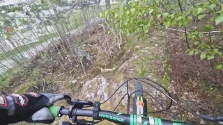
The top turns down to the left and then to the right and follows along the mountain, there is a cliff few meters high, probably over 2 meters, goes quite narrow, close to bushes, as of 2019 it is quite overgrown, which makes it even harder than it already was, might need to walk, after all of this, the trail goes down and with a sharp left turn, if you don't use the brakes, or go too fast you might crash into a tree before making the turn, so be careful, then it goes down trough the rocky section down to the bike path.
as this trail is near a playground please be aware of the surroundings, kids playing, a bell is recommended, and good working brakes.


Service Road Atlas is a free to use, community-driven service for viewing and creating reports on the numerous back-country service roads around B.C. and Alberta.
Save the current map location and zoom level as your default home location whenever this page is loaded.
Save
No reviews yet, be the first to write a review or ask a question.
Use trail reports to comment on trail conditions.
We hope you've been enjoying Trailforks!
Create a FREE account to view all trail reviews and much more.
 TRAILFORKS SSK & contributors
You must enter a description before submitting.

