

This trail is archived
This trail is permanently closed/decommissioned
more stats
1,952 ft
Distance
-40 ft
Descent
00:03:36
Avg time
-40 ft
Altitude change
309 ft
Altitude min
350 ft
Altitude max
350 ft
Altitude start
312 ft
Altitude end
-2.1%
Grade
-11.8%
Grade max
0.6%
Grade min
72 ft
Distance climb
1,273 ft
Distance down
361 ft
Distance flat
00:03:36
Avg time

Connector E Details

  • Activities
    • Mountain Bike
    • E-Bike
    • Hike
    • Trail Running
  • Riding Area
    Lake Crabtree County Park
    Morrisville, North Carolina
  • Difficulty Rating
  • Local Popularity
    50 in Mountain Biking [+]
    • 55 in E-Biking
    • 5 in Trail Running
    • 5 in Hiking
  • Trail Type
    Singletrack
  • Bike Type
    AM, XC
  • Dogs Allowed
    Yes
  • eBike Allowed
  • TTFs on Trail
    Berm, Drop, Jump
  • Land Owner
    Wake County Parks & Recreation

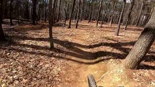
This trail has some advanced features that could make less experienced riders nervous, steep berms for example. All the jumps and drops have ride arounds.

Tags
BermsDropsJumps
Traditionally Indigenous Territory

Recent Activity on Trail

Past Week
  • 0 rides
  •  
6 Months
  • 2 rides
  • 14 miles avg distance
All
  • 1,171 rides
  • Last: Jun 17, 2026
Status:
on Dec 24, 2025
Avg: 4.07 (6 votes)
Your vote: 0

view (11,242)
close
      Directions to connector-e trailhead (35.845420, -78.794170)

      Photos

      No photos have been added for Connector E yet, add a photo.

      Videos

      1 more »
      Connector E/Small Jump Line, Lake Crabtree |...
      mtb
      172 | Mar 9, 2025 , Morrisville

      Routes with this trail

      ★ 3.0 • 6 miles • 334 ft • 10 • Loop •
      My preferred route around Lake Crabtree County Park.
      LCCP Loop + L6 Archived
      7 miles • 348 ft • 21 • Loop •
      LCCP CCW loop that incorporates Loop 6, or also called the lollipop trail.
      LCCP Figure 8 Archived
      7 miles • 317 ft • 22 • Loop •
      Lake Crabtree route that starts at the boat parking lot loops CW from Loop 5, then CCW on the flow trails,...
      4.2 ★★★★★
      6 Ratings
      5 ★ 50%
      4 ★ 17%
      3 ★ 33%
      2 ★
      1 ★

      Reviews / Comments

      No reviews yet, be the first to write a review or ask a question.
      Use trail reports to comment on trail conditions.


      We hope you've been enjoying Trailforks!

      Create a FREE account to view all trail reviews and much more.

      Hit the Trail

      Open in App

      Get this trail on your phone instantly.

      open trail in app

      Download Trail

      Save to wishlist, Garmin & download.
      save the trail

      Find Related Routes

      Find routes and users activities that include this trail.
      find routes for this trail

      You must enter a description before submitting.


