
more stats
2.0 miles
Distance
126 ft
Climb
-1,048 ft
Descent
00:22:44
Avg time
-922 ft
Altitude change
2,179 ft
Altitude min
3,146 ft
Altitude max
3,101 ft
Altitude start
2,178 ft
Altitude end
-8.8%
Grade
-94.1%
Grade max
22.7%
Grade min
2,392 ft
Distance climb
2 miles
Distance down
00:22:44
Avg time

Corniolino Details

  • Activities
    • Mountain Bike
    • E-Bike
    • Hike
    • Trail Running
  • Riding Area
  • Ref Number
    #259
  • Difficulty Rating
  • Local Popularity
    75 in Mountain Biking [+]
    • 50 in E-Biking
    • 5 in Trail Running
    • 5 in Hiking
  • Global Ranking
    #14978 in Mountain Biking [+]
    • #59488 in E-Biking
    • #377879 in Trail Running
    • #137416 in Hiking
  • National Ranking
    #1,481 in Mountain Biking · Italy [+]
    • #7,116 in E-Biking
    • #15,209 in Trail Running
    • #4,505 in Hiking
  • Trail Type
    Singletrack
  • Bike Type
    AM
  • Direction
    Downhill Primary
    Popular Direction Shown
  • Physical Rating
    Moderate
  • Trail Visibility
    Always easy to follow
  • Dogs Allowed
    Yes
  • eBike Allowed
    Yes up to Class 1
  • TTFs on Trail
    Drop, Rock Face

No community description for Corniolino trail has been added yet!

AI Generated Description

Corniolino is a 3 km popular blue difficulty singletrack trail located near Campigna. It has rock slabs. This mountain bike primary trail can be used downhill primary and has a moderate overall physical rating. It features drop and rock face. Trail visibility is always easy to follow. On average it takes 22 minutes to complete this trail.

Tags
DropsRock slabs

Recent Activity on Trail

Past Week
  • 0 rides
  •  
6 Months
  • 2 rides
  • 26 miles avg distance
All
  • 8 rides
  • Last: Oct 10, 2026
c1c2c3c4
January
February
March
April
May
June
July
August
September
October
November
December
update trails status or condition

Corniolino Trail Reports

statusdatedescription
Aug 16, 2026 @ 10:00am (Europe/Rome)
Aug 16, 2026
Perfetto
Aug 9, 2026 @ 10:07am (Europe/Rome)
Aug 9, 2026
Tutto pulito
Jul 14, 2026 @ 10:13pm (Europe/Rome)
Jul 14, 2026
Superlativo ! tutto a posto e molto divertente
Aug 19, 2023 @ 3:38am
Aug 19, 2023
la prima parte è facile poi diventa via via più tecnico, la parte finale presenta diversi tratti esposti occorre attenzione e bassa velocità di...
Aug 5, 2022 @ 1:39am
Aug 5, 2022
Sentiero molto bello e panoramico , lo ho pulito dai rami facendolo a piedi.Parte molto facile e con piccole pendenze per poi diventare più...
more »
Status:
on Aug 16, 2026
Ideal
Avg: 3.99 (2 votes)
Your vote: 0

view (123)
close
      Directions to corniolino trailhead (43.885710, 11.758550)

      Photos

      No photos have been added for Corniolino yet, add a photo.

      Videos

      1 more »
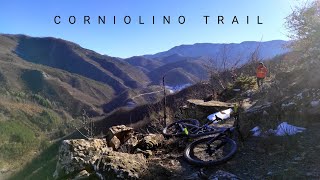
      Corniolino Trail - Corniolo (FC)
      mtb
      5:29 | 352 | Jan 19, 2022 , Campigna
      4.0 ★★★★★
      2 Ratings
      5 ★
      4 ★ 100%
      3 ★
      2 ★
      1 ★

      1 Review & Comments

      kGNASl
      Sentiero che parte con una breve salita per scendere con alcuni tornanti rocciosi e boschivi fino a raggiungere la parte più interessante. Corre parallelo la strada sottostante sopra una bastionata rocciosa, che conduce e lo oltrepassa il rudere di Corniolino. Caratterizzato da alcuni tratti stretti ed esposti. Prevalentemente di roccia e gradinato non è mai troppo ripido. Molto divertente ed estremamente panoramico

      We hope you've been enjoying Trailforks!

      Create a FREE account to view all trail reviews and much more.

      • By gpaolocontiTF Pro & contributors
      • #187342 - 738 views

      Frequently Asked Questions

      ▼ Where is Corniolino located?
      Corniolino is located in Lago di Ridracoli, Campigna, Italy. It is part of the Lago di Ridracoli trail network. The trailhead is located at coordinates 43.88571, 11.75855.
      ▼ How hard is Corniolino?
      Corniolino is rated as Blue difficulty. The physical rating is Moderate. The average grade is 8.8%.
      ▼ What is the elevation gain for Corniolino?
      Corniolino has 126 ft of elevation gain. The trail has 1,048 ft of elevation descent. The elevation ranges from 2,179 ft to 3,146 ft.
      ▼ Is Corniolino a point to point trail?
      Corniolino is not a point to point trail. The direction is Downhill Primary. The trail type is singletrack.
      ▼ How long is Corniolino?
      Corniolino is 2.0 miles long. The trail type is singletrack.
      ▼ Are dogs allowed on Corniolino?
      Yes, dogs are allowed on Corniolino. Please keep dogs on a leash where required and clean up after them.
      ▼ How do I access Corniolino? Where is the closest parking trailhead?
      The closest parking and trailhead locations to Corniolino are: View all parking locations in the area.
      ▼ How long does it take to ride Corniolino?
      Based on recorded activities, it takes an average of 23 minutes to ride Corniolino. The trail is 2.0 miles long. Actual times will vary based on fitness level, conditions, and pace. View recent activity logs for more details.
      ▼ How busy is Corniolino?
      Corniolino is a very popular trail. There have been 121 recorded activities on this trail. The trail has received 123 check-ins. View recent activity on this trail.

      Hit the Trail

      Open in App

      Get this trail on your phone instantly.

      open trail in app

      Download Trail

      Save to wishlist, Garmin & download.
      save the trail

      Find Related Routes

      Find routes and users activities that include this trail.
      find routes for this trail

      You must enter a description before submitting.

