5.5 miles
Distance
1,816 ft
Climb
-103 ft
Descent
02:20:34
Avg time
Supporters, Builders, Maintainers & Land Managers of Cottonwood-Second Water Trail
USFSLand Manager
Details
-
Activities
- Mountain Bike
- E-Bike
- Horse
- Hike
- Trail Running
- Dirtbike/Moto
-
Riding AreaDiamond Fork
Spanish Fork, Utah -
Ref Number#018
-
Difficulty Rating
-
Hiking SAC ScaleT1 Hiking
-
Trail TypeSingletrack
-
DirectionBoth Directions
-
Climb DifficultyBlue
-
Physical RatingModerate
-
Dogs AllowedYes
-
eBike AllowedYes up to Class 1
-
Global Ranking
-
Local Popularity80 in Mountain Biking [+]
- 70 in E-Biking
- 75 in Trail Running
- 85 in Hiking
- 95 in Dirtbiking
- 5 in Horseback
-
Land OwnerUSFS
Fun climbing and descent. A little mix of everything, with some rocky tech and buff singletrack
Traditionally Indigenous Territory
More Stats for Cottonwood-Second Water Trail multi-use trail trail
-
Altitude change1,713 ft
-
Altitude min5,546 ft
-
Altitude max7,279 ft
-
Altitude start5,566 ft
-
Altitude end7,279 ft
-
Grade5.855%
-
Grade max-21.554%
-
Grade min61.564%
-
Distance climb5 miles
-
Distance down2,165 ft
-
Distance flat422 ft
-
Avg time02:20:34
-
Avg reverse time01:16:46
- view trail stats
close
-
Layers w
- Map Content
- More Layers
- Pro
- Pro
- Pro
- Pro
- Pro
- Pro
- Pro
- Pro
-
Upgrade to

3D
Trail Conditions
- Unknown
- Snow Groomed
- Snow Packed
- Snow Covered
- Snow Cover Partial
- Freeze/thaw Cycle
- Icy
- Prevalent Mud
- Wet
- Variable
- Ideal
- Dry
- Very Dry
Trail Flow (Ridden Direction)
Trailforks scans users ridelogs to determine the most popular direction each trail is ridden. A good flowing trail network will have most trails flowing in a single direction according to their intension.
The colour categories are based on what percentage of riders are riding a trail in its intended direction.
The colour categories are based on what percentage of riders are riding a trail in its intended direction.
- > 96%
- > 90%
- > 80%
- > 70%
- > 50%
- < 50%
- bi-directional trail
- no data
Trail Last Ridden
Trailforks scans ridelogs to determine the last time a trail was ridden.
- < 2 days
- < 1 week
- < 2 weeks
- < 1 month
- < 6 months
- > 6 months
Trail Ridden Direction
The intended direction a trail should be ridden.
- Downhill Only
- Downhill Primary
- Both Directions
- Uphill Primary
- Uphill Only
- One Direction
Contribute Details
Colors indicate trail is missing specified detail.
- Description
- Photos
- Description & Photos
- Videos
Trail Popularity ?
Trailforks scans ridelogs to determine which trails are ridden the most in the last 9 months.
Trails are compared with nearby trails in the same city region with a possible 25 colour shades.
Think of this as a heatmap, more rides = more kinetic energy = warmer colors.
- most popular
- popular
- less popular
- not popular
ATV/ORV/OHV Filter
Max Vehicle Width
inches
US Cell Coverage
Legend

Radar Time
x
Activity Recordings
Trailforks users anonymized public ridelogs from the past 6 months.
- mountain biking recent
- mountain biking (>6 month)
- hiking (1 year)
- moto (1 year)
Activity Recordings
Trailforks users anonymized public skilogs from the past 12 months.
- Downhill Ski
- Backcountry Ski
- Nordic Ski
- Snowmobile
Winter Trails
Warning
A routing network for winter maps does not exist. Selecting trails using the winter trails layer has been disabled.
x
Missing Trails
Most Popular
Least Popular
Trails are colored based on popularity. The more popular a trail is, the more red. Less popular trails trend towards green.
Jump Magnitude Heatmap
Heatmap of where riders jump on trails. Zoom in to see individual jumps, click circles to view jump details.
Trails Deemphasized
Trails are shown in grey.
Only show trails with NO bikes.
Save the current map location and zoom level as your default home location whenever this page is loaded.
Save
Directions to cottonwoodsecond-water-trail trailhead
(40.084220, -111.354750)
update trails status or condition
... Trail Reports
view all reports »
Recent Ridelog Activity on Trail
Past Week
- 0 rides
6 Months
- 0 rides
All
- 132 rides
- Last: Aug 5, 2023

Photos
more »
Routes with this trail
Links
8 Reviews & Comments
We hope you've been enjoying Trailforks!
Create a FREE account to view trail comments and much more.
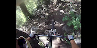
Videos
more »

15:23 |
152 |
May 2, 2022 , Spanish Fork

586 |
May 28, 2017 , Spanish Fork
2:37 |
687 |
Oct 8, 2012 , Spanish Fork
Nearby Trails
- Red Hollow 3 miles
- Monks Hollow (west Loop) 3 miles
- Group Campsite Connector 3 miles
- Monk Hollow Alternate 3 miles
- Monks Hollow (east Loop) 3 miles
- By todd
 Trailforks & contributors
 - #10863 - 3,155 views
- follow/subscribe
- login to download gpx or kml files.
You must enter a description before submitting.