4,027 ft
Distance
101 ft
Climb
-470 ft
Descent
00:22:24
Avg time

Couis Details

  • Activities
    • Mountain Bike
    • E-Bike
    • Hike
    • Trail Running
  • Riding Area
  • Difficulty Rating
  • Voted Difficulty
    Black Diamond (1 vote)
  • Trail Type
    Singletrack
  • Bike Type
    AM
  • Direction
    Downhill Only
    Popular direction shown
  • Physical Rating
    Moderate
  • Alpine Trail
    Yes
  • Dogs Allowed
    Yes
  • eBike Allowed
    Yes up to Class 1
  • TTFs on Trail
    Rock Face
  • Global Ranking
    #52160 in Mountain Biking [+]
    • #6118 in E-Biking
    • #17460 in Hiking
  • Local Popularity
    50 in Mountain Biking [+]
    • 95 in E-Biking
    • 45 in Trail Running
    • 5 in Hiking

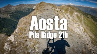
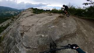
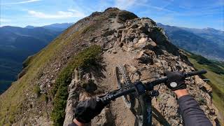
IT: sentiero alpino in cresta. Il terreno è roccioso e il sentiero in alcuni punti è estremamente esposto

EN: alpine ridge trail. The terrain is rocky and the trail is extremely exposed.

Access Info

IT: la partenza del sentiero è accanto all'arrivo della seggiovia.

EN: the start of the trail is next to the arrival of the chairlift

More Stats for Couis mountain bike trail trail
  • Altitude change
    -369 ft
  • Altitude min
    8,356 ft
  • Altitude max
    8,740 ft
  • Altitude start
    8,725 ft
  • Altitude end
    8,356 ft
  • Grade
    -9.169%
  • Grade max
    -40.092%
  • Grade min
    37.874%
  • Distance climb
    852 ft
  • Distance down
    3,020 ft
  • Distance flat
    155 ft
  • Avg time
    00:22:24
  • Avg reverse time
    00:34:19
  • view trail stats
Status:
on Aug 25, 2024
Dry
Avg: 4.08 (5 votes)
Your vote: 0

view (347)
close
3D
Trail Conditions
  • Unknown
  • Snow Groomed
  • Snow Packed
  • Snow Covered
  • Snow Cover Partial
  • Freeze/thaw Cycle
  • Icy
  • Prevalent Mud
  • Wet
  • Variable
  • Ideal
  • Dry
  • Very Dry
Trail Flow (Ridden Direction)
Trailforks scans users ridelogs to determine the most popular direction each trail is ridden. A good flowing trail network will have most trails flowing in a single direction according to their intension.
The colour categories are based on what percentage of riders are riding a trail in its intended direction.
  • > 96%
  • > 90%
  • > 80%
  • > 70%
  • > 50%
  • < 50%
  • bi-directional trail
  • no data
Trail Last Ridden
Trailforks scans ridelogs to determine the last time a trail was ridden.
  • < 2 days
  • < 1 week
  • < 2 weeks
  • < 1 month
  • < 6 months
  • > 6 months
Trail Ridden Direction
The intended direction a trail should be ridden.
  • Downhill Only
  • Downhill Primary
  • Both Directions
  • Uphill Primary
  • Uphill Only
  • One Direction
Contribute Details
Colors indicate trail is missing specified detail.
  • Description
  • Photos
  • Description & Photos
  • Videos
Trail Popularity ?
Trailforks scans ridelogs to determine which trails are ridden the most in the last 9 months. Trails are compared with nearby trails in the same city region with a possible 25 colour shades. Think of this as a heatmap, more rides = more kinetic energy = warmer colors.
  • most popular
  • popular
  • less popular
  • not popular
ATV/ORV/OHV Filter
Max Vehicle Width
inches
US Cell Coverage
Legend
cell carrier legend

Radar Time
x Activity Recordings
Trailforks users anonymized public ridelogs from the past 6 months.
  • mountain biking recent
  • mountain biking (>6 month)
  • hiking (1 year)
  • moto (1 year)
Activity Recordings
Trailforks users anonymized public skilogs from the past 12 months.
  • Downhill Ski
  • Backcountry Ski
  • Nordic Ski
  • Snowmobile
Winter Trails
Warning A routing network for winter maps does not exist. Selecting trails using the winter trails layer has been disabled.
x Missing Trails
Most Popular
Least Popular
Trails are colored based on popularity. The more popular a trail is, the more red. Less popular trails trend towards green.
Jump Magnitude Heatmap
Heatmap of where riders jump on trails. Zoom in to see individual jumps, click circles to view jump details.
Trails Deemphasized
Trails are shown in grey.
disable
Only show trails with NO bikes.
enable

Save the current map location and zoom level as your default home location whenever this page is loaded.

Save
      Directions to couis trailhead (45.653810, 7.309100)

      Recent Ridelog Activity on Trail

      Past Week
      • 0 rides
      •  
      6 Months
      • 4 rides
      • 27 miles avg distance
      All
      • 31 rides
      • Last: Sep 2, 2024

      Photos

      more »
      169 |
      Jul 2, 2022 @ 11:36am
      Jul 2, 2022
      183 |
      Sep 8, 2021 @ 2:21pm
      Sep 8, 2021
      175 |
      Sep 8, 2021 @ 2:11pm
      Sep 8, 2021
      163 |
      Sep 8, 2021 @ 2:13pm
      Sep 8, 2021

      Routes with this trail

      titledistance
      Pila epic freeride tour29 miles
      Pila ridgeline to 21b11 miles

      1 Review & Comments


      We hope you've been enjoying Trailforks!

      Create a FREE account to view trail comments and much more.

      Videos

      more »
      youtuber Pila Ridge Line to 21b - Aosta Valley
      18:27 | 45 | Aug 15, 2024 , Pila
      youtuber Zuccherodante - Bagno di Romagna
      8:41 | 423 | Aug 9, 2021 , Pila
      youtuber Cresta del Couis - Pila
      7:06 | 364 | Aug 20, 2021 , Pila
      youtuber This Italian Ridgeline Is Deadly
      9:56 | 369 | Oct 11, 2021 , Pila
      • By crashtorTF Pro & contributors
      • #64881 - 2,143 views

      You must enter a description before submitting.