



more stats
1.6 miles
Distance
30 ft
Climb
-884 ft
Descent
00:09:36
Avg time
-854 ft
Altitude change
1,483 ft
Altitude min
2,367 ft
Altitude max
2,337 ft
Altitude start
1,483 ft
Altitude end
-9.9%
Grade
-28.7%
Grade max
8.7%
Grade min
778 ft
Distance climb
1 mile
Distance down
148 ft
Distance flat
00:09:36
Avg time

Croyle Run Trail Details

  • Activities
    • Mountain Bike
    • E-Bike
    • Hike
    • Trail Running
  • Riding Area
    Galbraith Gap (Rothrock State Forest)
    State College, Pennsylvania
  • Difficulty Rating
  • Local Popularity
    90 in Mountain Biking heatmap [+]
    • 90 in E-Biking
    • 80 in Trail Running
    • 75 in Hiking
  • Global Ranking
    #35535 in Mountain Biking [+]
    • #117607 in E-Biking
    • #122394 in Trail Running
    • #131551 in Hiking
  • State Ranking
    #446 in Mountain Biking · Pennsylvania [+]
    • #649 in E-Biking
    • #1,911 in Trail Running
    • #2,422 in Hiking
  • Trail Type
    Singletrack
  • Bike Type
    AM, XC
  • Direction
    Downhill Primary
    Popular Direction Shown
  • Climb Difficulty
    Black Diamond
  • Physical Rating
    Moderate
  • Season
    Summer - Fall - Winter
  • Dogs Allowed
    Yes
  • eBike Allowed
  • Year Opened
    2014
  • Land Owner

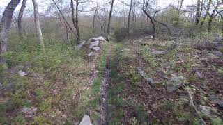
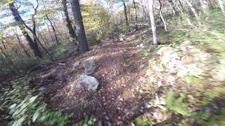
Croyle run is a super fast trail that is a blast to descend on. By the time you reach the bottom, your arms will be screaming even on a full squish 29er.

Access Info

For the top off Greenlee Rd and for the bottom off Beidleheimer Road

Tags

Trail Supporters

  • http://nittanymba.org/
    since 10
    Sponsor

Local Trail Association

Traditionally Indigenous Territory

Recent Activity on Trail

Past Week
  • 1 rides
  • 17.5 km average
6 Months
  • 29 rides
  • 70.9 km avg distance
All
  • 135 rides
  • Last: Nov 18, 2026
c1c2c3c4
January
February
March
April
May
June
July
August
September
October
November
December
update trails status or condition

Croyle Run Trail Trail Reports

statusdatedescription
Sep 1, 2025 @ 10:49am
Sep 1, 2025
Somehow starting to get overgrown again, but very rideable still
Aug 31, 2025 @ 8:42am
Aug 31, 2025
Jul 20, 2025 @ 3:58pm
Jul 20, 2025
Cut brush down to the berms
May 11, 2025 @ 11:49am
May 11, 2025
Large tree down across trail, blocking trail
Oct 20, 2024 @ 3:06pm
Oct 20, 2024
Leaf covered
more »
Status:
on Sep 1, 2025
Dry
Avg: 4.45 (7 votes)
Your vote: 0

view (819)
close
      Directions to croyle-run-trail trailhead (40.719220, -77.790020)

      Photos

      6 more »
      report
      mtb
      48 |
      May 11, 2025 @ 11:49am
      May 11, 2025
      report
      mtb
      67 |
      May 24, 2024 @ 5:03pm
      May 24, 2024
      report
      mtb
      71 |
      Jul 29, 2021 @ 9:51am
      Jul 29, 2021
      report
      mtb
      96 |
      Jul 29, 2021 @ 9:51am
      Jul 29, 2021

      Videos

      3 more »
      Rothrocks Backcountry Riding is Epic!
      mtb
      15:08 | 83 | Jul 8, 2025 , State College
      Croyle Run - Rothrock State Forest (May 2021)
      mtb
      5:02 | 577 | May 21, 2021 , State College
      Croyle Run - Rothrock State Park
      mtb
      5:55 | 442 | Jan 5, 2021 , State College

      Routes with this trail

      more »
      ★ 3.7 • 35 miles • 4,277 ft • 25 • Loop •
      Overview The 36-mile Rothrock TrailMix course provides a combination of some of the best trails within...
      ★ 5.0 • 32 miles • 3,886 ft • 18 •
      This is a close relative to the Rothrock TrailMix NMBA Epic, but with two changes: one, it starts in a...
      32 miles • 3,879 ft • 18 • Loop •
      his is a 32 mile meander starting from Penn Roosevelt State Park will take intermediate/advanced riders...

      Trail Products

      4.9 ★★★★★
      7 Ratings
      5 ★ 86%
      4 ★ 14%
      3 ★
      2 ★
      1 ★

      3 Reviews & Comments

      MooDock
      Trail used to be fast but a bunch of poorly constructed features have been added to the trail
      dtdaniels dtdaniels
      Pretty difficult on a hardtail, but still possible
      Saclydesdale Saclydesdale
      This trail has been closed temporarily while DCNR and NMBA reroute and rehab it in several sections

      We hope you've been enjoying Trailforks!

      Create a FREE account to view all trail reviews and much more.

      • By SaclydesdaleTF Pro NMBA & contributors
      • #21480 - 3,102 views

      Frequently Asked Questions

      ▼ Where is Croyle Run Trail located?
      Croyle Run Trail is located in Galbraith Gap (Rothrock State Forest), State College, Pennsylvania, United States. It is part of the Galbraith Gap (Rothrock State Forest) trail network. The trailhead is located at coordinates 40.71922, -77.79002.
      ▼ How hard is Croyle Run Trail?
      Croyle Run Trail is rated as Black Diamond difficulty. The physical rating is Moderate. The average grade is 9.9%. The climb difficulty is rated Black Diamond.
      ▼ What is the elevation gain for Croyle Run Trail?
      Croyle Run Trail has 30 ft of elevation gain. The trail has 884 ft of elevation descent. The elevation ranges from 1,483 ft to 2,367 ft.
      ▼ Is Croyle Run Trail a point to point trail?
      Croyle Run Trail is not a point to point trail. The direction is Downhill Primary. The trail type is singletrack.
      ▼ How long is Croyle Run Trail?
      Croyle Run Trail is 1.6 miles long. The trail type is singletrack.
      ▼ Are dogs allowed on Croyle Run Trail?
      Yes, dogs are allowed on Croyle Run Trail. Please keep dogs on a leash where required and clean up after them.
      ▼ When is the best time of year to ride Croyle Run Trail?
      Based on activity log data, the most popular months to ride Croyle Run Trail are:
      • July (17 activities)
      • May (15 activities)
      • August (10 activities)
      Check the reports page for current trail conditions.
      ▼ How do I access Croyle Run Trail? Where is the closest parking trailhead?
      The closest parking and trailhead locations to Croyle Run Trail are: View all parking locations in the area.
      ▼ How long does it take to ride Croyle Run Trail?
      Based on recorded activities, it takes an average of 10 minutes to ride Croyle Run Trail. The trail is 1.6 miles long. Actual times will vary based on fitness level, conditions, and pace. View recent activity logs for more details.
      ▼ How busy is Croyle Run Trail?
      Croyle Run Trail is a very popular trail. There have been 805 recorded activities on this trail. The trail has received 819 check-ins. View recent activity on this trail.

      Hit the Trail

      Open in App

      Get this trail on your phone instantly.

      open trail in app

      Download Trail

      Save to wishlist, Garmin & download.
      save the trail

      Find Related Routes

      Find routes and users activities that include this trail.
      find routes for this trail

      You must enter a description before submitting.

