
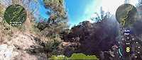
more stats
2.3 miles
Distance
135 ft
Climb
-479 ft
Descent
00:47:41
Avg time
-344 ft
Altitude change
1,868 ft
Altitude min
2,212 ft
Altitude max
2,212 ft
Altitude start
1,867 ft
Altitude end
-2.8%
Grade
-27.6%
Grade max
23.6%
Grade min
2,933 ft
Distance climb
2 miles
Distance down
1,115 ft
Distance flat
00:47:41
Avg time

Cucaracha Details

  • Activities
    • Mountain Bike
    • E-Bike
    • Winter Fat Bike
    • Hike
    • Trail Running
  • Riding Area
  • Difficulty Rating
  • Local Popularity
    85 in Mountain Biking [+]
    • 95 in E-Biking
    • 5 in Trail Running
    • 5 in Hiking
    • 5 in Winter Fat Biking
  • Global Ranking
    #104199 in Mountain Biking [+]
    • #62262 in E-Biking
    • #373390 in Trail Running
    • #366095 in Hiking
    • #37103 in Winter Fat Biking
  • National Ranking
    #7,765 in Mountain Biking · Spain [+]
    • #6,609 in E-Biking
    • #40,764 in Trail Running
    • #38,458 in Hiking
    • #955 in Winter Fat Biking
  • Hiking SAC Scale
    T2 Mountain Hiking
  • Trail Type
    Singletrack
  • Bike Type
    AM, XC, Fat
  • Direction
    Downhill Primary
    Popular Direction Shown
  • Climb Difficulty
    Blue
  • Physical Rating
    Hard
  • Trail Visibility
    Sometimes hard to follow
  • Dogs Allowed
    Yes
  • eBike Allowed
    Yes up to Class 1

Sendero con fuertes repechones, algún paso mas técnico, salida con fuerte rampa de bajada

Tags
Faint trail

Recent Activity on Trail

Past Week
  • 0 rides
  •  
6 Months
  • 1 rides
  • 28 miles avg distance
All
  • 2 rides
  • Last: May 10, 2026
c1c2c3c4
January
February
March
April
May
June
July
August
September
October
November
December
update trails status or condition

Cucaracha Trail Reports

no reports have been added for Cucaracha yet, add a trail report.
Trail reports are used to indicate a trails current condition and inform builders and other users about any issues on a trail.
Status:
Avg: 3.98 (1 votes)
Your vote: 0

view (14)
close
      Directions to cucaracha trailhead (41.749640, -0.504490)

      Photos

      3 more »
      ebike
      33 |
      Jan 21, 2025 @ 8:00am
      Jan 21, 2025
      ebike
      35 |
      Jan 21, 2025 @ 8:00am
      Jan 21, 2025
      ebike
      29 |
      Jan 21, 2025 @ 8:00am
      Jan 21, 2025

      Videos

      1 more »
      Tramo Senda Cucaracha
      ebike
      2:49 | 14 | Sep 9, 2025 , Sariñena
      4.0 ★★★★★
      1 Ratings
      5 ★
      4 ★ 100%
      3 ★
      2 ★
      1 ★

      3 Reviews & Comments

      Tejota Tejota
      Esta senda por los pasos tecnicos q lleva tendria que ser roja. Si mal no recuerdo hay un drop vertical de 1 metro de altura, que alguno se ha dejado alli la camara de la rueda por lo que se ve alrededor. Luego hay una subida complicada de hacer montado por no decir imposible. Muchisima maleza en algun tramo que dificulta el transito y ya la guinda del pastel es la terminacion en forma de talud de 4 metros casi vertical q mucha gente lo vera imposible de ejecutar. Si bien unos 400 mts antes de meterte en la terminacion final puedes bajar campo de labor a traves y evitarlo.
      jabaluismi jabaluismi
      Sendero sube-baja, estrecho pero ciclable.
      Barro pegajoso, e
      vitar después de lluvias

      We hope you've been enjoying Trailforks!

      Create a FREE account to view all trail reviews and much more.

      • By CrisjacaTF Pro & contributors
      • #477909 - 468 views

      Frequently Asked Questions

      ▼ Where is Cucaracha located?
      Cucaracha is located in Sierra de Alcubierre Huesca, Sariñena, Spain. It is part of the Sierra de Alcubierre Huesca trail network. The trailhead is located at coordinates 41.74964, -0.50449.
      ▼ How hard is Cucaracha?
      Cucaracha is rated as Blue difficulty. The physical rating is Hard. The average grade is 2.8%. The climb difficulty is rated Blue.
      ▼ What is the elevation gain for Cucaracha?
      Cucaracha has 135 ft of elevation gain. The trail has 479 ft of elevation descent. The elevation ranges from 1,868 ft to 2,212 ft.
      ▼ Is Cucaracha a point to point trail?
      Cucaracha is not a point to point trail. The direction is Downhill Primary. The trail type is singletrack.
      ▼ How long is Cucaracha?
      Cucaracha is 2.3 miles long. The trail type is singletrack.
      ▼ Are dogs allowed on Cucaracha?
      Yes, dogs are allowed on Cucaracha. Please keep dogs on a leash where required and clean up after them.
      ▼ How do I access Cucaracha? Where is the closest parking trailhead?
      The closest parking and trailhead locations to Cucaracha are: View all parking locations in the area.
      ▼ How long does it take to ride Cucaracha?
      Based on recorded activities, it takes an average of 48 minutes to ride Cucaracha. The trail is 2.3 miles long. Actual times will vary based on fitness level, conditions, and pace. View recent activity logs for more details.
      ▼ How busy is Cucaracha?
      Cucaracha is a very popular trail. There have been 14 recorded activities on this trail. The trail has received 14 check-ins. View recent activity on this trail.

      Hit the Trail

      Open in App

      Get this trail on your phone instantly.

      open trail in app

      Download Trail

      Save to wishlist, Garmin & download.
      save the trail

      Find Related Routes

      Find routes and users activities that include this trail.
      find routes for this trail

      You must enter a description before submitting.

