
more stats
4,131 ft
Distance
9 ft
Climb
-394 ft
Descent
00:03:32
Avg time
-385 ft
Altitude change
6,977 ft
Altitude min
7,361 ft
Altitude max
7,361 ft
Altitude start
6,978 ft
Altitude end
-9.3%
Grade
-52.4%
Grade max
9.3%
Grade min
240 ft
Distance climb
3,573 ft
Distance down
318 ft
Distance flat
00:03:32
Avg time

Dana Details

  • Activities
    • Mountain Bike
    • E-Bike
  • Difficulty Rating
  • Local Popularity
    85 in Mountain Biking heatmap [+]
    • 85 in E-Biking
  • Global Ranking
    #45891 in Mountain Biking [+]
    • #24443 in E-Biking
  • National Ranking
    #2,321 in Mountain Biking · France [+]
    • #1,778 in E-Biking
  • Trail Type
    Machine Groomed
  • Bike Type
    DH, AM
  • Direction
    Downhill Only
    Popular Direction Shown
  • Physical Rating
    Moderate
  • Season
    July - August
  • Dogs Allowed
    Yes
  • eBike Allowed
    Yes up to Class 1
  • TTFs on Trail
    Berm, Bridge, Drop, Jump
  • Year Opened
    2015
  • Land Owner
    La Plagne Tarentaise

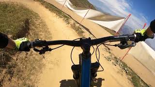
Une superbe piste bleue qui joue parfaitement avec le terrain vallonné du Colorado. Succession de virages relevés, et quelques sauts évitables ou enroulables pour se faire plaisir et progresser

A nice and beautiful blue downhill track, which plays with the hilly terrain of the Colorado area. Berms, jumps that can be rollable or skip, to have some fun and get better!

Access Info

Plagne Centre, télésiège du Colorado
Plagne Centre, Colorado chairlift

Tags
BermsBridgesDropsJumps

Trail Supporters

  • BikeSolutions
    Sponsor

Recent Activity on Trail

Past Week
  • 0 rides
  •  
6 Months
  • 24 rides
  • 20 miles avg distance
All
  • 57 rides
  • Last: Aug 27, 2026
Status:
on Aug 10, 2026
Very Dry
Avg: 4.32 (3 votes)
Your vote: 0

view (382)
close
      Directions to dana trailhead (45.494230, 6.674680)

      Photos

      No photos have been added for Dana yet, add a photo.

      Videos

      1 more »
      D'Ana + Blue Canyon - La Plagne Bike Park...
      mtb
      7:22 | 295 | Sep 11, 2023 , Bourg St. Maurice

      Routes with this trail

      more »
      ★ 2.0 • 49 miles • 12,222 ft • 14 • Loop • Race •
      Une course idéale pour les amateurs avec des boucles successives à difficulté variable en forme de...
      5.0 ★★★★★
      3 Ratings
      5 ★ 100%
      4 ★
      3 ★
      2 ★
      1 ★

      Reviews / Comments

      No reviews yet, be the first to write a review or ask a question.
      Use trail reports to comment on trail conditions.


      We hope you've been enjoying Trailforks!

      Create a FREE account to view all trail reviews and much more.

      Nearby Trails

      • By maxigelTF Pro & contributors
      • #104458 - 712 views

      Frequently Asked Questions

      ▼ Where is Dana located?
      Dana is located in Bourg St. Maurice, France. The trailhead is located at coordinates 45.49423, 6.67468.
      ▼ How hard is Dana?
      Dana is rated as Blue difficulty. The physical rating is Moderate. The average grade is 9.3%.
      ▼ What is the elevation gain for Dana?
      Dana has 9 ft of elevation gain. The trail has 394 ft of elevation descent. The elevation ranges from 6,977 ft to 7,361 ft.
      ▼ Is Dana a point to point trail?
      Yes, Dana is a point to point trail. The direction is Downhill Only. The trail type is machine groomed.
      ▼ How long is Dana?
      Dana is 4,131 ft long. The trail type is machine groomed.
      ▼ Are dogs allowed on Dana?
      Yes, dogs are allowed on Dana. Please keep dogs on a leash where required and clean up after them.
      ▼ When is the best time of year to ride Dana?
      Dana is best visited during: July - August.
      ▼ How do I access Dana? Where is the closest parking trailhead?
      The closest parking and trailhead locations to Dana are:
      ▼ How long does it take to ride Dana?
      Based on recorded activities, it takes an average of 4 minutes to ride Dana. The trail is 4,131 ft long. Actual times will vary based on fitness level, conditions, and pace. View recent activity logs for more details.
      ▼ How busy is Dana?
      Dana is a very popular trail. There have been 339 recorded activities on this trail. The trail has received 382 check-ins. View recent activity on this trail.

      Hit the Trail

      Open in App

      Get this trail on your phone instantly.

      open trail in app

      Download Trail

      Save to wishlist, Garmin & download.
      save the trail

      Find Related Routes

      Find routes and users activities that include this trail.
      find routes for this trail

      You must enter a description before submitting.

