This trail is permanently closed/decommissioned
more stats
948 ft
Distance
-247 ft
Descent
00:05:21
Avg time
-247 ft
Altitude change
958 ft
Altitude min
1,205 ft
Altitude max
1,205 ft
Altitude start
958 ft
Altitude end
-26.1%
Grade
-119.4%
Grade max
-0.3%
Grade min
791 ft
Distance down
157 ft
Distance flat
00:05:21
Avg time

Danger Mouse Details

  • Activities
    • Mountain Bike
    • E-Bike
  • Riding Area
    Cademuir
    Peebles
  • Difficulty Rating
  • Local Popularity
    60 in Mountain Biking [+]
    • 70 in E-Biking
  • Global Ranking
    #41060 in Mountain Biking [+]
    • #49719 in E-Biking
  • Trail Type
    Singletrack
  • Bike Type
    DH, AM
  • Climb Difficulty
    Blue
  • Physical Rating
    Easy
  • eBike Allowed
    Yes up to Class 1
  • TTFs on Trail
    Berm

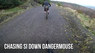
Starts off quite flat but then gets v. steep further down. Lots of berms etc and fun to ride but quite difficult in places. There is a new drop near the top of the trail which is approx. 2 feet

Access Info

Starts using the old start to Cademuir DH

This trail is unsanctioned.

Recent Activity on Trail

Past Week
  • 3 rides
  • 7 miles average
6 Months
  • 14 rides
  • 9 miles avg distance
All
  • 151 rides
  • Last: Jul 2, 2026
c1c2c3c4
January
February
March
April
May
June
July
August
September
October
November
December
update trails status or condition

Danger Mouse Trail Reports

statusdatedescription
May 15, 2026 @ 7:27pm (Europe/London)
May 15, 2026
Open at weekends. Sketchy section adjacent to felled area before right hand step down. Several large trees across trail just before and on middle...
Nov 12, 2025 @ 2:29pm (Europe/London)
Nov 12, 2025
Closed during harvesting works
Nov 10, 2025 @ 3:24pm (Europe/London)
Nov 10, 2025
HARESTING = Closed on Weekdays / Only accessible on Weekends
Mar 9, 2025 @ 9:11am
Mar 9, 2025
Rejected
Ok
Mar 2, 2025 @ 8:19am
Mar 2, 2025
Tree down just before it gets steep. Difficult to get round so blocks the trail
more »
Status:
on May 15, 2026
Avg: 4.49 (8 votes)
Your vote: 0

view (4,519)
close
3D
Trail Conditions
  • Unknown
  • Snow Groomed
  • Snow Packed
  • Snow Covered
  • Snow Cover Partial
  • Freeze/thaw Cycle
  • Icy
  • Prevalent Mud
  • Wet
  • Variable
  • Ideal
  • Dry
  • Very Dry
Trail Flow (Ridden Direction)
Trailforks scans users ridelogs to determine the most popular direction each trail is ridden. A good flowing trail network will have most trails flowing in a single direction according to their intension.
The colour categories are based on what percentage of riders are riding a trail in its intended direction.
  • > 96%
  • > 90%
  • > 80%
  • > 70%
  • > 50%
  • < 50%
  • bi-directional trail
  • no data
Trail Last Ridden
Trailforks scans ridelogs to determine the last time a trail was ridden.
  • < 2 days
  • < 1 week
  • < 2 weeks
  • < 1 month
  • < 6 months
  • > 6 months
Trail Ridden Direction
The intended direction a trail should be ridden.
  • Downhill Only
  • Downhill Primary
  • Both Directions
  • Uphill Primary
  • Uphill Only
  • One Direction
Contribute Details
Colors indicate trail is missing specified detail.
  • Description
  • Photos
  • Description & Photos
  • Videos
Trail Popularity ?
Trailforks scans ridelogs to determine which trails are ridden the most in the last 9 months. Trails are compared with nearby trails in the same city region with a possible 25 colour shades. Think of this as a heatmap, more rides = more kinetic energy = warmer colors.
  • most popular
  • popular
  • less popular
  • not popular
ATV/ORV/OHV Filter
Max Vehicle Width
inches
US Cell Coverage
Legend
cell carrier legend

Radar Time
Activity Recordings
Trailforks uses anonymized public activity data. ?
Activity Recordings
Trailforks uses anonymized public activity data. ?
Personal Heatmap
Activity Types
all / none
Options
2
Date range month
Winter Trails
Warning A routing network for winter maps does not exist. Selecting trails using the winter trails layer has been disabled.
Missing Trails
Most Popular
Least Popular
Trails are colored based on popularity. The more popular a trail is, the more red. Less popular trails trend towards green.
Jump Magnitude Heatmap
Heatmap of where riders jump on trails. Zoom in to see individual jumps, click circles to view jump details.
BC Backroad Status

Service Road Atlas is a free to use, community-driven service for viewing and creating reports on the numerous back-country service roads around B.C. and Alberta.

map legend
Slope Aspect
Direction the slope faces
Flat N NE E SE S SW W NW
Trails Deemphasized
Trails are shown in grey.
disable
Only show trails with no bike usage.
Enable
Suggested Layers
Based on selected activity type

    Save the current map location and zoom level as your default home location whenever this page is loaded.

    Save
        Directions to danger-mouse trailhead (55.628060, -3.201200)

        Photos

        7 more »
        151 |
        Jul 17, 2021 @ 9:18am
        Jul 17, 2021
        52 |
        Jan 24, 2024 @ 4:48am
        Jan 24, 2024
        63 |
        Feb 6, 2022 @ 3:53am
        Feb 6, 2022
        66 |
        Feb 6, 2022 @ 3:53am
        Feb 6, 2022

        Videos

        2 more »
        youtuber Cademuir Dangermouse
        0:53 | 819 | Dec 11, 2018 , Peebles
        youtuber Cademuir Enduro - Thrills, Spills and Bails!
        14:57 | 441 | Dec 9, 2018 , Peebles

        Routes with this trail

        21 miles 3,860 ft 28 Point to Point Race
        Race route for the Tweedlove Vallelujah race 2018

        1 Review & Comments


        We hope you've been enjoying Trailforks!

        Create a FREE account to view trail comments and much more.

        • #100233 - 2,289 views

        Frequently Asked Questions About Danger Mouse

        Where is Danger Mouse located?
        Danger Mouse is located in Cademuir, Peebles, United Kingdom. It is part of the Cademuir trail network. The trailhead is located at coordinates 55.62806, -3.2012.
        How hard is Danger Mouse?
        Danger Mouse is rated as Black difficulty. The physical rating is Easy. The average grade is 26.1%. The climb difficulty is rated Blue.
        What is the elevation gain for Danger Mouse?
        The trail has 247 ft of elevation descent. The elevation ranges from 958 ft to 1,205 ft.
        How long is Danger Mouse?
        Danger Mouse is 948 ft long. The trail type is singletrack.

        Hit the Trail

        Open in App

        Get this trail on your phone instantly.
        open trail in app

        Download Trail

        Save to wishlist, Garmin & download.
        save the trail

        Find Related Routes

        Find routes and users activities that include this trail.
        find routes for this trail

        You must enter a description before submitting.