more stats
1.5 miles
Distance
609 ft
Climb
-926 ft
Descent
1,601 ft
High Point
-317 ft
Altitude change
817 ft
Altitude min
1,166 ft
Altitude start
850 ft
Altitude end
-3.9%
Grade
-73.6%
Grade max
52.7%
Grade min
3,031 ft
Distance climb
4,718 ft
Distance down
279 ft
Distance flat

Dashboard Main Details

  • Activities
    • Dirtbike/Moto
    • Mountain Bike
    • E-Bike
    • Hike
    • Trail Running
  • Riding Area
    Tamihi (Chilliwack River)
    Chilliwack, British Columbia
  • Difficulty Rating
  • Voted Difficulty
    Black Diamond (1 vote)
  • Local Popularity
    5 in Mountain Biking [+]
    • 5 in E-Biking
    • 5 in Trail Running
    • 5 in Hiking
    • 30 in Dirtbiking
  • Global Ranking
    #414233 in Mountain Biking [+]
    • #218872 in E-Biking
    • #299359 in Trail Running
    • #302376 in Hiking
    • #4302 in Dirtbiking
  • Provincial Ranking
    #12,729 in Mountain Biking · British Columbia [+]
    • #8,156 in E-Biking
    • #12,591 in Trail Running
    • #12,527 in Hiking
    • #1,608 in Dirtbiking
  • Hiking SAC Scale
    T1 Hiking
  • Trail Type
    Singletrack
  • Direction
    Both Directions
    Popular Direction Shown
  • Dogs Allowed
    Yes
  • eBike Allowed
  • Land Owner
    Dual Sport BC

Very Narrow Single Track. Loose sections

Tags
Loose

Local Trail Association

Traditionally Indigenous Territory

Recent Activity on Trail

Past Week
  • 0 rides
  •  
6 Months
  • 0 rides
  •  
All
  • 0 rides
  • Last: Sep 5, 2020
update trails status or condition

Dashboard Main Trail Reports

statusdatedescription
Sep 30, 2026 @ 12:16pm (Pacific/Midway)
Sep 30, 2026
Not approved
I rode from the bottom and had to turn around at the washout. Maybe the top is clear.
May 18, 2026 @ 2:57pm (America/Vancouver)
May 18, 2026
Land slide bridge gone trail washed out. Should be fixed or closed. Loose dirt and shale rock before washout hard to turn around
May 17, 2026 @ 2:12pm (America/Vancouver)
May 17, 2026
Landslide trail washout. No way to turn around trail should be closed. Loose dirt and shale rock before washout
May 16, 2026 @ 6:54pm (America/Vancouver)
May 16, 2026
Land slide trail washout. Unsafe should be closed. Loose dirt and shale rock before landslide
May 16, 2026 @ 6:54pm (America/Vancouver)
May 16, 2026
Land slide Trail washout should be closed no way through
more »
Status:
on May 18, 2026
no votes yet
Your vote: 0

view (38)
close
      Directions to dashboard-main trailhead (49.067010, -121.914860)

      Photos

      30 more »
      mtb
      72 |
      Oct 11, 2023 @ 5:20pm
      Oct 11, 2023
      report
      mtb
      55 |
      Oct 2, 2026 @ 8:55am
      Oct 2, 2026
      report
      mtb
      62 |
      Mar 24, 2024 @ 8:25am
      Mar 24, 2024
      moto
      83 |
      Oct 21, 2023 @ 12:35pm
      Oct 21, 2023

      Videos

      1 more »
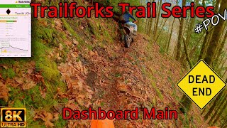
      Trailforks Narrow Enduro DEAD END Trail...
      moto
      12:17 | 262 | Apr 14, 2022 , Chilliwack

      2 Reviews & Comments

      ebQbG26e
      There is no way to turn around on this trail

      We hope you've been enjoying Trailforks!

      Create a FREE account to view all trail reviews and much more.

      • By TomcycleTF Pro DSBC & contributors
      • #236778 - 876 views

      Frequently Asked Questions

      ▼ Where is Dashboard Main located?
      Dashboard Main is located in Tamihi (Chilliwack River), Chilliwack, British Columbia, Canada. It is part of the Tamihi (Chilliwack River) trail network. The trailhead is located at coordinates 49.06701, -121.91486.
      ▼ How hard is Dashboard Main?
      Dashboard Main is rated as Black Diamond difficulty. The average grade is 3.9%.
      ▼ What is the elevation gain for Dashboard Main?
      Dashboard Main has 609 ft of elevation gain. The trail has 926 ft of elevation descent. The elevation ranges from 817 ft to 1,601 ft.
      ▼ Is Dashboard Main a point to point trail?
      Dashboard Main is not a point to point trail. The direction is Both Directions. The trail type is singletrack.
      ▼ How long is Dashboard Main?
      Dashboard Main is 1.5 miles long. The trail type is singletrack.
      ▼ Are dogs allowed on Dashboard Main?
      Yes, dogs are allowed on Dashboard Main. Please keep dogs on a leash where required and clean up after them.
      ▼ How do I access Dashboard Main? Where is the closest parking trailhead?
      The closest parking and trailhead locations to Dashboard Main are: View all parking locations in the area.
      ▼ How busy is Dashboard Main?
      Dashboard Main is a less popular trail with lighter traffic. There have been 37 recorded activities on this trail. The trail has received 38 check-ins. View recent activity on this trail.

      Hit the Trail

      Open in App

      Get this trail on your phone instantly.

      open trail in app

      Download Trail

      Save to wishlist, Garmin & download.
      save the trail

      Find Related Routes

      Find routes and users activities that include this trail.
      find routes for this trail

      You must enter a description before submitting.