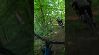
more stats
2,382 ft
Distance
-166 ft
Descent
00:02:52
Avg time
-168 ft
Altitude change
636 ft
Altitude min
804 ft
Altitude max
804 ft
Altitude start
636 ft
Altitude end
-7.1%
Grade
-26.6%
Grade max
43 ft
Distance climb
1,801 ft
Distance down
538 ft
Distance flat
00:02:52
Avg time

Der Venediger Details

  • Activities
    • Mountain Bike
    • E-Bike
    • Winter Fat Bike
    • Hike
    • Trail Running
  • Riding Area
    Trailpark L.E.
    Lutherstadt Eisleben
  • Ref Number
    #8
  • Difficulty Rating
  • Local Popularity
    70 in Mountain Biking [+]
    • 45 in E-Biking
    • 5 in Trail Running
    • 5 in Hiking
    • 5 in Winter Fat Biking
  • Global Ranking
    #68955 in Mountain Biking [+]
    • #58849 in E-Biking
    • #367572 in Trail Running
    • #368679 in Hiking
    • #11017 in Winter Fat Biking
  • National Ranking
    #2,566 in Mountain Biking · Germany [+]
    • #3,136 in E-Biking
    • #5,290 in Trail Running
    • #5,937 in Hiking
    • #302 in Winter Fat Biking
  • Trail Type
    Singletrack
  • Bike Type
    DH, AM
  • Direction
    Downhill Only[+]
    Popular Direction Shown
    • Downhill Only for E-Biking
    • Downhill Only for Trail Running
    • Downhill Only for Hiking
    • Downhill Only for Winter Fat Biking
  • Dogs Allowed
    Yes
  • eBike Allowed
    Yes up to Class 1
  • TTFs on Trail
    Drop, Jump

Der "Trailpark L.E." ist ein Netzwerk von Wegen süd-westlich der Lutherstadt Eisleben.

Die Benutzung dieser Wege erfolgt auf eigene Gefahr!

Bitte beachtet dabei folgende Verhaltensweisen:

- Lasst keinen Müll im Wald zurück. Wenn ihr fremden Müll im Wald seht, nehmt ihn am Besten mit!

- Macht keinen unnötigen Lärm, insbesondere in der Nähe von Siedlungen.

- Behandelt andere Nutzer (bspw. Anwohner, Wanderer und vor allem Jäger und Forstarbeiter!!!) mit Respekt, seid höflich und lasst Ihnen den Vortritt.

- Achtet die Natur, haltet euer Fahrrad unter Kontrolle.

- UND SETZT VERDAMMT NOCHMAL EINEN HELM AUF!!!

Damit tragt Ihr zum Erhalt der Wege bei.

Tags
DropsJumps

Local Trail Association

Recent Activity on Trail

Past Week
  • 0 rides
  •  
6 Months
  • 19 rides
  • 26.9 km avg distance
All
  • 68 rides
  • Last: Oct 27, 2026
c1c2c3c4
January
February
March
April
May
June
July
August
September
October
November
December
update trails status or condition

Der Venediger Trail Reports

statusdatedescription
Sep 15, 2026 @ 4:46pm (Europe/Berlin)
Sep 15, 2026
Alle gefährlichen Stelle sind beseitigt! Am Start ist leider eine Forstmaschine durch!? Aber nichts schlimmes!
Jun 9, 2026 @ 4:57pm (Europe/Berlin)
Jun 9, 2026
Das Kraut ist weg!?
May 26, 2026 @ 4:56pm (Europe/Berlin)
May 26, 2026
Sehr gut zu fahren trotz ein wenig Kraut hier und da
Apr 28, 2026 @ 4:47pm (Europe/Berlin)
Apr 28, 2026
Ein paar überarbeitete Stellen! Top!
Mar 13, 2026 @ 2:20pm (Europe/Berlin)
Mar 13, 2026
Werksboden!
more »
Status:
on Sep 15, 2026
Ideal
Avg: 4.45 (5 votes)
Your vote: 0

view (346)
close
      Directions to der-venediger trailhead (51.490080, 11.551550)

      Photos

      2 more »
      mtb
      54 |
      Apr 12, 2026 @ 11:35am
      Apr 12, 2026
      mtb
      48 |
      Apr 12, 2026 @ 11:35am
      Apr 12, 2026

      Videos

      1 more »
      Green Machine
      mtb
      0:47 | 272 | May 19, 2025 , Lutherstadt Eisleben

      Routes with this trail

      ★ 5.0 • 20 miles • 2,199 ft • 26 • Loop •
      Der "Trailpark L.E." ist ein Netzwerk von Wegen süd-westlich der Lutherstadt Eisleben. Bitte beachtet...
      5.0 ★★★★★
      5 Ratings
      5 ★ 100%
      4 ★
      3 ★
      2 ★
      1 ★

      1 Review & Comments


      We hope you've been enjoying Trailforks!

      Create a FREE account to view all trail reviews and much more.

      • By RotwildreiterTF Pro & contributors
      • #261562 - 780 views

      Frequently Asked Questions

      ▼ Where is Der Venediger located?
      Der Venediger is located in Trailpark L.E., Lutherstadt Eisleben, Germany. It is part of the Trailpark L.E. trail network. The trailhead is located at coordinates 51.49008, 11.55155.
      ▼ How hard is Der Venediger?
      Der Venediger is rated as Red difficulty. The average grade is 7.1%.
      ▼ What is the elevation gain for Der Venediger?
      The trail has 166 ft of elevation descent. The elevation ranges from 636 ft to 804 ft.
      ▼ Is Der Venediger a point to point trail?
      Yes, Der Venediger is a point to point trail. The direction is Downhill Only. The trail type is singletrack.
      ▼ How long is Der Venediger?
      Der Venediger is 2,382 ft long. The trail type is singletrack.
      ▼ Are dogs allowed on Der Venediger?
      Yes, dogs are allowed on Der Venediger. Please keep dogs on a leash where required and clean up after them.
      ▼ When is the best time of year to ride Der Venediger?
      Based on activity log data, the most popular months to ride Der Venediger are:
      • March (10 activities)
      • April (9 activities)
      • June (9 activities)
      Check the reports page for current trail conditions.
      ▼ How do I access Der Venediger? Where is the closest parking trailhead?
      The closest parking and trailhead locations to Der Venediger are: View all parking locations in the area.
      ▼ How long does it take to ride Der Venediger?
      Based on recorded activities, it takes an average of 3 minutes to ride Der Venediger. The trail is 2,382 ft long. Actual times will vary based on fitness level, conditions, and pace. View recent activity logs for more details.
      ▼ How busy is Der Venediger?
      Der Venediger is a very popular trail. There have been 348 recorded activities on this trail. The trail has received 346 check-ins. View recent activity on this trail.

      Hit the Trail

      Open in App

      Get this trail on your phone instantly.

      open trail in app

      Download Trail

      Save to wishlist, Garmin & download.
      save the trail

      Find Related Routes

      Find routes and users activities that include this trail.
      find routes for this trail

      You must enter a description before submitting.