more stats
2,031 ft
Distance
38 ft
Climb
-122 ft
Descent
00:02:47
Avg time
-84 ft
Altitude change
197 ft
Altitude min
300 ft
Altitude max
300 ft
Altitude start
217 ft
Altitude end
-4.1%
Grade
-26.4%
Grade max
19.7%
Grade min
407 ft
Distance climb
1,201 ft
Distance down
423 ft
Distance flat
00:02:47
Avg time

Deviation Details

  • Activities
    • Mountain Bike
    • E-Bike
    • Winter Fat Bike
    • Hike
    • Trail Running
  • Riding Area
    Crocodile XC MTB Park
    Christchurch
  • AKA
    Upper Deviation
  • Difficulty Rating
  • Voted Difficulty
    Green (1 vote)
  • Local Popularity
    95 in Mountain Biking [+]
    • 90 in E-Biking
    • 85 in Trail Running
    • 65 in Hiking
  • Global Ranking
    #17857 in Mountain Biking [+]
    • #3434 in E-Biking
  • Hiking SAC Scale
    T1 Hiking
  • Trail Type
    Singletrack
  • Bike Type
    AM, XC, Fat
  • Direction
    One Direction[+]
    Popular Direction Shown
    • One Direction for E-Biking
    • One Direction for Trail Running
    • One Direction for Hiking
  • Climb Difficulty
    Green
  • Physical Rating
    Moderate
  • Trail Visibility
    Always easy to follow
  • eBike Allowed
    Yes up to Class 1
  • TTFs on Trail
    Berm, Jump
  • Ride in Rain
    Yes
  • Year Opened
    2013
  • Land Owner
    Dan Van Asch

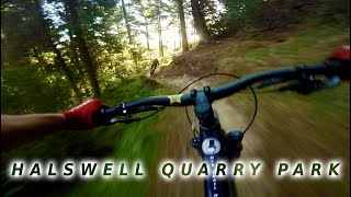
Deviation was built in 2013by D&E Track & Trail and 32 volunteers from Christchurch Singletrack Club. It bypasses some of the Crocodile track.
The uppermost section is double track but becomes a downhill flow trail below the water reservoir. The track presents only mild technical challenge and is enjoyable by riders of a wide skill range.

Access Info

Easy: Climb C2, fork right onto Tiga's and turn left to cross the creek.
Intermediate: As above, but take the left fork and follow Crocodile to the creek.
Harder: Climb Crocodile from the entrance hub.
No trail climbing: Follow Kennedy's Bush Road to the start of Crocodile Down.

Trail Supporters
  • Sponsor
Local Trail Association
Traditionally Indigenous Territory

Recent Activity on Trail

Past Week
  • 5 rides
  • 9 miles average
6 Months
  • 184 rides
  • 10 miles avg distance
All
  • 996 rides
  • Last: Jun 16, 2026
c1c2c3c4
January
February
March
April
May
June
July
August
September
October
November
December
Status:
on Mar 25, 2026
Dry
Avg: 4.19 (9 votes)
Your vote: 0

view (9,570)
close
3D
Trail Conditions
  • Unknown
  • Snow Groomed
  • Snow Packed
  • Snow Covered
  • Snow Cover Partial
  • Freeze/thaw Cycle
  • Icy
  • Prevalent Mud
  • Wet
  • Variable
  • Ideal
  • Dry
  • Very Dry
Trail Flow (Ridden Direction)
Trailforks scans users ridelogs to determine the most popular direction each trail is ridden. A good flowing trail network will have most trails flowing in a single direction according to their intension.
The colour categories are based on what percentage of riders are riding a trail in its intended direction.
  • > 96%
  • > 90%
  • > 80%
  • > 70%
  • > 50%
  • < 50%
  • bi-directional trail
  • no data
Trail Last Ridden
Trailforks scans ridelogs to determine the last time a trail was ridden.
  • < 2 days
  • < 1 week
  • < 2 weeks
  • < 1 month
  • < 6 months
  • > 6 months
Trail Ridden Direction
The intended direction a trail should be ridden.
  • Downhill Only
  • Downhill Primary
  • Both Directions
  • Uphill Primary
  • Uphill Only
  • One Direction
Contribute Details
Colors indicate trail is missing specified detail.
  • Description
  • Photos
  • Description & Photos
  • Videos
Trail Popularity ?
Trailforks scans ridelogs to determine which trails are ridden the most in the last 9 months. Trails are compared with nearby trails in the same city region with a possible 25 colour shades. Think of this as a heatmap, more rides = more kinetic energy = warmer colors.
  • most popular
  • popular
  • less popular
  • not popular
ATV/ORV/OHV Filter
Max Vehicle Width
inches
US Cell Coverage
Legend
cell carrier legend

Radar Time
Activity Recordings
Trailforks uses anonymized public activity data. ?
Activity Recordings
Trailforks uses anonymized public activity data. ?
Personal Heatmap
Activity Types
all / none
Options
2
Date range month
Winter Trails
Warning A routing network for winter maps does not exist. Selecting trails using the winter trails layer has been disabled.
Missing Trails
Most Popular
Least Popular
Trails are colored based on popularity. The more popular a trail is, the more red. Less popular trails trend towards green.
Jump Magnitude Heatmap
Heatmap of where riders jump on trails. Zoom in to see individual jumps, click circles to view jump details.
BC Backroad Status

Service Road Atlas is a free to use, community-driven service for viewing and creating reports on the numerous back-country service roads around B.C. and Alberta.

map legend
Slope Aspect
Direction the slope faces
Flat N NE E SE S SW W NW
Trails Deemphasized
Trails are shown in grey.
disable
Only show trails with no bike usage.
Enable
Suggested Layers
Based on selected activity type

    Save the current map location and zoom level as your default home location whenever this page is loaded.

    Save
        Directions to deviation trailhead (-43.598940, 172.590090)

        Photos

        2 more »
        41 |
        Sep 9, 2025 @ 7:23pm
        Sep 9, 2025
        63 |
        Apr 14, 2023 @ 12:19pm
        Apr 14, 2023
        151 |
        Jun 15, 2022 @ 8:52pm
        Jun 15, 2022

        Videos

        1 more »
        Halswell Quarry Revisited | MTB Trail Magic
        11:40 | 498 | May 25, 2019 , Christchurch

        Routes with this trail

        1 mile 362 ft 8 Loop
        The loop takes you 2km on singletrack trails through the trees, out into the farm area, and back through...

        Reviews / Comments

        No reviews yet, be the first to write a review or ask a question.
        Use trail reports to comment on trail conditions.


        We hope you've been enjoying Trailforks!

        Create a FREE account to view trail comments and much more.

        • By jamesreidridesTF Pro MBA & contributors
        • #63515 - 7,878 views

        Frequently Asked Questions About Deviation

        Where is Deviation located?
        Deviation is located in Crocodile XC MTB Park, Christchurch, New Zealand. It is part of the Crocodile XC MTB Park trail network. The trailhead is located at coordinates -43.59894, 172.59009.
        How hard is Deviation?
        Deviation is rated as Blue difficulty. The physical rating is Moderate. The average grade is 4.1%. The climb difficulty is rated Green.
        What is the elevation gain for Deviation?
        Deviation has 38 ft of elevation gain. The trail has 122 ft of elevation descent. The elevation ranges from 197 ft to 300 ft.
        Is Deviation a point to point trail?
        Yes, Deviation is a point to point trail. The direction is One Direction. The trail type is singletrack.

        Hit the Trail

        Open in App

        Get this trail on your phone instantly.
        open trail in app

        Download Trail

        Save to wishlist, Garmin & download.
        save the trail

        Find Related Routes

        Find routes and users activities that include this trail.
        find routes for this trail

        You must enter a description before submitting.