

more stats
1,506 ft
Distance
-120 ft
Descent
00:03:04
Avg time
-120 ft
Altitude change
233 ft
Altitude min
353 ft
Altitude max
353 ft
Altitude start
233 ft
Altitude end
-8%
Grade
-16.5%
Grade max
-0.7%
Grade min
1,506 ft
Distance down
00:03:04
Avg time

DH Details

  • Activities
    • Mountain Bike
    • E-Bike
    • Hike
    • Trail Running
  • Riding Area
    Epping Forest
    London
  • Difficulty Rating
  • Local Popularity
    50 in Mountain Biking heatmap [+]
    • 80 in E-Biking
    • 5 in Trail Running
    • 5 in Hiking
  • Global Ranking
    #122755 in Mountain Biking [+]
    • #110539 in E-Biking
    • #308095 in Trail Running
    • #298438 in Hiking
  • National Ranking
    #4,302 in Mountain Biking · United Kingdom [+]
    • #4,876 in E-Biking
    • #6,377 in Trail Running
    • #5,554 in Hiking
  • Trail Type
    Singletrack
  • Bike Type
    AM, XC
  • Direction
    Downhill Primary
  • Physical Rating
    Moderate
  • Dogs Allowed
    Yes
  • eBike Allowed
    Yes up to Class 1
  • TTFs on Trail
    Berm, Drop, Jump, Gap Jump, Log Ride
  • Land Owner
    Corporation of London

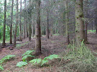
Various line options through here, with some jumps and berms.

This trail is unsanctioned.

Tags
BermsDropsJumpsSkinnies

Recent Activity on Trail

Past Week
  • 0 rides
  •  
6 Months
  • 4 rides
  • 13 miles avg distance
All
  • 64 rides
  • Last: Nov 10, 2026
c1c2c3c4
January
February
March
April
May
June
July
August
September
October
November
December
update trails status or condition

DH Trail Reports

statusdatedescription
Jul 18, 2024 @ 9:45am
Jul 18, 2024
Oct 30, 2023 @ 8:30am
Oct 30, 2023
Jan 5, 2022 @ 2:59am
Jan 5, 2022
Jul 12, 2020 @ 2:01am
Jul 12, 2020
Some trails hard to find
Jun 30, 2020 @ 9:56am
Jun 30, 2020
reporter Some dug features flattened. Still plenty of natural feature to play with. Some lines fallen out of use
more »
Status:
on Jul 18, 2024
Ideal
Avg: 3.66 (6 votes)
Your vote: 0

view (425)
close
      Directions to dh-94937 trailhead (51.673050, 0.048230)

      Photos

      5 more »
      mtb
      DH
      318 |
      May 14, 2020 @ 5:31am
      May 14, 2020
      mtb
      DH
      318 |
      May 14, 2020 @ 5:31am
      May 14, 2020
      mtb
      DH
      255 |
      May 14, 2020 @ 5:30am
      May 14, 2020
      mtb
      DH
      255 |
      May 14, 2020 @ 5:30am
      May 14, 2020

      Videos

      38 more »
      nethersilton
      mtb
      0:21 | 388 | Aug 21, 2011 , London
      Ambergate
      mtb
      0:09 | 219 | May 30, 2011 , London
      Ambergate
      mtb
      0:11 | 130 | May 30, 2011 , London
      Ambergate
      mtb
      0:11 | 142 | May 30, 2011 , London

      Routes with this trail

      more »
      ★ 5.0 • 8 miles • 830 ft • 21 • Loop •
      nice circular route included many trails, downhill sections etc. should be doable for average fit person...
      27 miles • 2,364 ft • 127 • Loop •
      Decent length route from Epping taking in most decent trails down through Theydon, Loughton, Chingford,...
      8 miles • 830 ft • 21 • Loop •
      nice circular route included many trails, downhill sections etc. should be doable for average fit person...
      3.4 ★★★★★
      6 Ratings
      5 ★ 17%
      4 ★ 33%
      3 ★ 17%
      2 ★ 33%
      1 ★

      4 Reviews & Comments

      Raymond82
      A lot better and faster flowing. Getting ridden more this year, think due to lockdown.
      Steve1eod
      Some nicely spaced jumps, not to difficult.
      Reubenosborne Reubenosborne
      Super gnarly terrain but one of the best downhill trails in Epping forest

      We hope you've been enjoying Trailforks!

      Create a FREE account to view all trail reviews and much more.

      • #94937 - 4,324 views

      Frequently Asked Questions

      ▼ Where is DH located?
      DH is located in Epping Forest, London, United Kingdom. It is part of the Epping Forest trail network. The trailhead is located at coordinates 51.67305, 0.04823.
      ▼ How hard is DH?
      DH is rated as Red difficulty. The physical rating is Moderate. The average grade is 8%.
      ▼ What is the elevation gain for DH?
      The trail has 120 ft of elevation descent. The elevation ranges from 233 ft to 353 ft.
      ▼ Is DH a point to point trail?
      DH is not a point to point trail. The direction is Downhill Primary. The trail type is singletrack.
      ▼ How long is DH?
      DH is 1,506 ft long. The trail type is singletrack.
      ▼ Are dogs allowed on DH?
      Yes, dogs are allowed on DH. Please keep dogs on a leash where required and clean up after them.
      ▼ How do I access DH? Where is the closest parking trailhead?
      The closest parking and trailhead locations to DH are: View all parking locations in the area.
      ▼ How long does it take to ride DH?
      Based on recorded activities, it takes an average of 3 minutes to ride DH. The trail is 1,506 ft long. Actual times will vary based on fitness level, conditions, and pace. View recent activity logs for more details.
      ▼ How busy is DH?
      DH is a moderately popular trail. There have been 393 recorded activities on this trail. The trail has received 425 check-ins. View recent activity on this trail.

      Hit the Trail

      Open in App

      Get this trail on your phone instantly.

      open trail in app

      Download Trail

      Save to wishlist, Garmin & download.
      save the trail

      Find Related Routes

      Find routes and users activities that include this trail.
      find routes for this trail

      You must enter a description before submitting.

