
more stats
545 ft
Distance
-51 ft
Descent
00:01:12
Avg time
-49 ft
Altitude change
8,458 ft
Altitude min
8,509 ft
Altitude max
8,509 ft
Altitude start
8,461 ft
Altitude end
-9%
Grade
-31.6%
Grade max
0.8%
Grade min
10 ft
Distance climb
443 ft
Distance down
43 ft
Distance flat
00:01:12
Avg time

DH Option 2 Details

  • Activities
    • Mountain Bike
  • Riding Area
    Floyd Hill Open Space
    Idaho Springs, Colorado
  • Difficulty Rating
  • Voted Difficulty
    Double Black Diamond (3 votes)
  • Local Popularity
    80 in Mountain Biking heatmap
  • Global Ranking
    #60121 in Mountain Biking
  • State Ranking
    #1,057 in Mountain Biking · Colorado
  • Trail Type
    Singletrack
  • Direction
    Downhill Only
    Popular Direction Shown
  • Dogs Allowed
    Yes

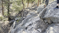
Instead of taking the rock berm, you roll up and over the berm where you have this option to drop down a cutoff. What makes this difficult is the very steep boulder face that drops to a rutted out dirt patch. Not easy to roll without going over the bars. You have to lean back and keep your wheel in front of you without getting to much speed from the top drop in.

Tags
Berms

Local Trail Association

Traditionally Indigenous Territory

Recent Activity on Trail

Past Week
  • 1 rides
  • 8 miles average
6 Months
  • 22 rides
  • 7 miles avg distance
All
  • 373 rides
  • Last: Nov 14, 2026
c1c2c3c4
January
February
March
April
May
June
July
August
September
October
November
December
Status:
on May 8, 2026
Ideal
Avg: 4.16 (6 votes)
Your vote: 0

view (5,651)
close
      Directions to dh-option-2 trailhead (39.727260, -105.409750)

      Photos

      4 more »
      mtb
      660 |
      Jan 31, 2020 @ 6:44am
      Jan 31, 2020
      mtb
      607 |
      Jan 31, 2020 @ 6:37am
      Jan 31, 2020
      mtb
      2,450 |
      Aug 22, 2019 @ 11:34am
      Aug 22, 2019
      mtb
      466 |
      Sep 21, 2019 @ 8:25pm
      Sep 21, 2019

      Videos

      1 more »
      mtb
      0:10 | | Apr 9, 2021 , Idaho Springs
      4.4 ★★★★★
      6 Ratings
      5 ★ 83%
      4 ★
      3 ★
      2 ★
      1 ★ 17%

      2 Reviews & Comments

      Jborges91 Jborges91
      Hardest optional line on the trail in my opinion but very doable just be ready for the runout once you get past the slab. Super fun line

      We hope you've been enjoying Trailforks!

      Create a FREE account to view all trail reviews and much more.

      • By toddTF Pro Trailforks & contributors
      • #220053 - 2,298 views

      Frequently Asked Questions

      ▼ Where is DH Option 2 located?
      DH Option 2 is located in Floyd Hill Open Space, Idaho Springs, Colorado, United States. It is part of the Floyd Hill Open Space trail network. The trailhead is located at coordinates 39.72726, -105.40975.
      ▼ How hard is DH Option 2?
      DH Option 2 is rated as Double Black Diamond difficulty. The average grade is 9%.
      ▼ What is the elevation gain for DH Option 2?
      The trail has 51 ft of elevation descent. The elevation ranges from 8,458 ft to 8,509 ft.
      ▼ Is DH Option 2 a point to point trail?
      Yes, DH Option 2 is a point to point trail. The direction is Downhill Only. The trail type is singletrack.
      ▼ How long is DH Option 2?
      DH Option 2 is 545 ft long. The trail type is singletrack.
      ▼ Are dogs allowed on DH Option 2?
      Yes, dogs are allowed on DH Option 2. Please keep dogs on a leash where required and clean up after them.
      ▼ How do I access DH Option 2? Where is the closest parking trailhead?
      The closest parking and trailhead locations to DH Option 2 are: View all parking locations in the area.
      ▼ How long does it take to ride DH Option 2?
      Based on recorded activities, it takes an average of 1 minute to ride DH Option 2. The trail is 545 ft long. Actual times will vary based on fitness level, conditions, and pace. View recent activity logs for more details.
      ▼ How busy is DH Option 2?
      DH Option 2 is a very popular trail. There have been 3,926 recorded activities on this trail. The trail has received 5,651 check-ins. View recent activity on this trail.

      Hit the Trail

      Open in App

      Get this trail on your phone instantly.

      open trail in app

      Download Trail

      Save to wishlist, Garmin & download.
      save the trail

      Find Related Routes

      Find routes and users activities that include this trail.
      find routes for this trail

      You must enter a description before submitting.