more stats
740 ft
Distance
-153 ft
Descent
00:04:36
Avg time
-153 ft
Altitude change
2,125 ft
Altitude min
2,278 ft
Altitude max
2,278 ft
Altitude start
2,125 ft
Altitude end
-20.69%
Grade
-41.762%
Grade max
-1.738%
Grade min
740 ft
Distance down
00:04:36
Avg time

Disciple 13 Details

  • Activities
    • Mountain Bike
    • Hike
    • Trail Running
  • Riding Area
    Devon River Valley
    Devon, Alberta
  • Difficulty Rating
  • Voted Difficulty
    Double Black Diamond (2 votes)
  • Local Popularity
    45 in Mountain Biking [+]
    • 5 in Trail Running
    • 5 in Hiking
  • Global Ranking
    #68811 in Mountain Biking [+]
    • #123255 in Trail Running
    • #124886 in Hiking
  • Trail Type
    Singletrack
  • Bike Type
    DH, AM
  • Direction
    Downhill Only
    Popular Direction Shown
  • Season
    Apr - Oct
  • Dogs Allowed
    Yes
  • TTFs on Trail
    Berm, Drop, Jump, Gap Jump, Skinny

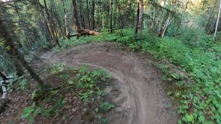
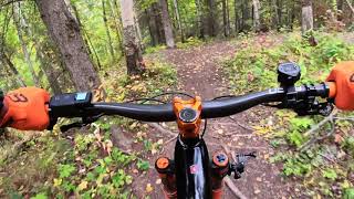
A steep, fun downhill trail that starts with a few drops + a couple berms, and finishes off with a steep forest descent down to the bottom of the ravine valley floor. The beginning drops can be 'by-passed' if you take the right hand side of the trail. Sit back and let 'er rip at the end

Access Info

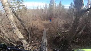
Take a quick detour through the church parking lot to find the trailhead. The bottom of this downhill trail connects to the Legacy trail, and will take you back in to the bike park if you take a left when exiting on to the paved path near the river. Trail is a DOWNHILL so do not walk back up.

This trail is unsanctioned.

Disclaimer

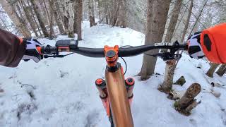
Do NOT ride when trails are WET!

Recent Activity on Trail

Past Week
  • 0 rides
  •  
6 Months
  • 0 rides
  •  
All
  • 73 rides
  • Last: Jun 23, 2026
c1c2c3c4
January
February
March
April
May
June
July
August
September
October
November
December
update trails status or condition

Disciple 13 Trail Reports

statusdatedescription
Apr 26, 2024 @ 10:20am
Apr 26, 2024
Usual soft muddy trail connector at the trail end.
Nov 13, 2023 @ 2:06am
Nov 13, 2023
Sep 5, 2022 @ 1:25pm
Sep 5, 2022
It’s clear. Send it.
Aug 14, 2022 @ 2:12pm
Aug 14, 2022
Jun 2, 2022 @ 1:04pm
Jun 2, 2022
Mint
more »
Status:
on Apr 26, 2024
Dry
Avg: 4.33 (9 votes)
Your vote: 0

view (704)
close
3D
Trail Conditions
  • Unknown
  • Snow Groomed
  • Snow Packed
  • Snow Covered
  • Snow Cover Partial
  • Freeze/thaw Cycle
  • Icy
  • Prevalent Mud
  • Wet
  • Variable
  • Ideal
  • Dry
  • Very Dry
Trail Flow (Ridden Direction)
Trailforks scans users ridelogs to determine the most popular direction each trail is ridden. A good flowing trail network will have most trails flowing in a single direction according to their intension.
The colour categories are based on what percentage of riders are riding a trail in its intended direction.
  • > 96%
  • > 90%
  • > 80%
  • > 70%
  • > 50%
  • < 50%
  • bi-directional trail
  • no data
Trail Last Ridden
Trailforks scans ridelogs to determine the last time a trail was ridden.
  • < 2 days
  • < 1 week
  • < 2 weeks
  • < 1 month
  • < 6 months
  • > 6 months
Trail Ridden Direction
The intended direction a trail should be ridden.
  • Downhill Only
  • Downhill Primary
  • Both Directions
  • Uphill Primary
  • Uphill Only
  • One Direction
Contribute Details
Colors indicate trail is missing specified detail.
  • Description
  • Photos
  • Description & Photos
  • Videos
Trail Popularity ?
Trailforks scans ridelogs to determine which trails are ridden the most in the last 9 months. Trails are compared with nearby trails in the same city region with a possible 25 colour shades. Think of this as a heatmap, more rides = more kinetic energy = warmer colors.
  • most popular
  • popular
  • less popular
  • not popular
ATV/ORV/OHV Filter
Max Vehicle Width
inches
US Cell Coverage
Legend
cell carrier legend

Radar Time
Activity Recordings
Trailforks uses anonymized public activity data. ?
Activity Recordings
Trailforks uses anonymized public activity data. ?
Personal Heatmap
Activity Types
all / none
Options
2
Date range month
Winter Trails
Warning A routing network for winter maps does not exist. Selecting trails using the winter trails layer has been disabled.
Missing Trails
Most Popular
Least Popular
Trails are colored based on popularity. The more popular a trail is, the more red. Less popular trails trend towards green.
Jump Magnitude Heatmap
Heatmap of where riders jump on trails. Zoom in to see individual jumps, click circles to view jump details.
BC Backroad Status

Service Road Atlas is a free to use, community-driven service for viewing and creating reports on the numerous back-country service roads around B.C. and Alberta.

map legend
Slope Aspect
Direction the slope faces
Flat N NE E SE S SW W NW
Trails Deemphasized
Trails are shown in grey.
disable
Only show trails with no bike usage.
Enable
Suggested Layers
Based on selected activity type

    Save the current map location and zoom level as your default home location whenever this page is loaded.

    Save
        Directions to disciple-13 trailhead (53.367890, -113.736064)

        Photos

        2 more »
        253 |
        Aug 31, 2019 @ 12:59pm
        Aug 31, 2019
        390 |
        Oct 6, 2018 @ 2:59pm
        Oct 6, 2018

        Videos

        12 more »
        Disciple 13 - Bike Trail - Devon, Alberta
        0:05 | 897 | Aug 22, 2021 , Devon
        Disciple 13 in Devon
        0:09 | 441 | May 2, 2021 , Devon
        #ridelocalyegwinter - Disciple 13
        3:59 | 201 | Jan 10, 2021 , Devon
        Devon - Disciple 13
        0:53 | 409 | Jan 10, 2021 , Devon

        Trail Lists

        2 Reviews & Comments


        We hope you've been enjoying Trailforks!

        Create a FREE account to view trail comments and much more.

        • #104844 - 3,732 views

        Frequently Asked Questions About Disciple 13

        Where is Disciple 13 located?
        Disciple 13 is located in Devon River Valley, Devon, Alberta, Canada. It is part of the Devon River Valley trail network. The trailhead is located at coordinates 53.36789, -113.73606.
        How hard is Disciple 13?
        Disciple 13 is rated as Black Diamond difficulty. The average grade is 20.69%.
        What is the elevation gain for Disciple 13?
        The trail has 153 ft of elevation descent. The elevation ranges from 2,125 ft to 2,278 ft.
        Is Disciple 13 a point to point trail?
        Yes, Disciple 13 is a point to point trail. The direction is Downhill Only. The trail type is singletrack.

        Hit the Trail

        Open in App

        Get this trail on your phone instantly.
        open trail in app

        Download Trail

        Save to wishlist, Garmin & download.
        save the trail

        Find Related Routes

        Find routes and users activities that include this trail.
        find routes for this trail

        You must enter a description before submitting.