more stats
1.9 miles
Distance
14 ft
Climb
-1,579 ft
Descent
00:12:24
Avg time
-1,565 ft
Altitude change
6,957 ft
Altitude min
8,522 ft
Altitude max
8,522 ft
Altitude start
6,959 ft
Altitude end
-15.4%
Grade
-65.6%
Grade max
9.8%
Grade min
249 ft
Distance climb
2 miles
Distance down
502 ft
Distance flat
00:12:24
Avg time

DMI Details

  • Activities
    • Mountain Bike
  • Riding Area
  • AKA
    Don't Mention It
  • Difficulty Rating
  • Voted Difficulty
    Black Diamond (2 votes)
  • Local Popularity
    40 in Mountain Biking
  • Global Ranking
    #105564 in Mountain Biking
  • Trail Type
    Singletrack
  • Bike Type
    DH, AM
  • Direction
    Downhill Only
    Popular Direction Shown
  • Climb Difficulty
    Blue
  • Physical Rating
    Moderate
  • Trail Visibility
    Sometimes hard to follow
  • TTFs on Trail
    Berm, Jump, Gap Jump
  • Land Owner

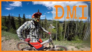
This is definitely a shuttle ride unless you want to ride up Powder Mountain Road.

Drop a vehicle off at the bottom of the trail adjacent to the avalanche road closure gate.

Start you ride in the Timberline parking lot and begin the moderate climb to the top of the Sundown lift via the Slowpoke cat track trail. After reaching the top of the Sundown lift continue down the ski trail for a little bit until you see an obvious berm heading into the trees on the right side of the trail.

Settle in and enjoy the ride. The trail is moderate at first then picks up speed quickly. The berms are perfect and the scenery is spectacular.

After you wrap up the upper section the trail is steep and fast. brakes will get hot if you let them. Did I mention it is steep? It is definitely a brake burner.

At the lower section in the trees the berms are so smooth and well set. The tree riding at the end of the trail are worth the wait.

When you exit the last set of pines you come out on an old dirt road. Stop at the dirt road and share some high 5's all around because you will simply want to. Now just follow the road to the gate and do it again Keep and eye out for local residents using the road as their walking path. Many people enjoy the area so be super polite and give them a great big dose of friendly MTB karma.

BY the way, DMI stands for "Don't Mention It"

Traditionally Indigenous Territory

Recent Activity on Trail

Past Week
  • 0 rides
  •  
6 Months
  • 0 rides
  •  
All
  • 42 rides
  • Last: May 11, 2026
c1c2c3c4
January
February
March
April
May
June
July
August
September
October
November
December
update trails status or condition

DMI Trail Reports

Status:
on May 24, 2024
Avg: 3.99 (6 votes)
Your vote: 0

view (290)
close
3D
Trail Conditions
  • Unknown
  • Snow Groomed
  • Snow Packed
  • Snow Covered
  • Snow Cover Partial
  • Freeze/thaw Cycle
  • Icy
  • Prevalent Mud
  • Wet
  • Variable
  • Ideal
  • Dry
  • Very Dry
Trail Flow (Ridden Direction)
Trailforks scans users ridelogs to determine the most popular direction each trail is ridden. A good flowing trail network will have most trails flowing in a single direction according to their intension.
The colour categories are based on what percentage of riders are riding a trail in its intended direction.
  • > 96%
  • > 90%
  • > 80%
  • > 70%
  • > 50%
  • < 50%
  • bi-directional trail
  • no data
Trail Last Ridden
Trailforks scans ridelogs to determine the last time a trail was ridden.
  • < 2 days
  • < 1 week
  • < 2 weeks
  • < 1 month
  • < 6 months
  • > 6 months
Trail Ridden Direction
The intended direction a trail should be ridden.
  • Downhill Only
  • Downhill Primary
  • Both Directions
  • Uphill Primary
  • Uphill Only
  • One Direction
Contribute Details
Colors indicate trail is missing specified detail.
  • Description
  • Photos
  • Description & Photos
  • Videos
Trail Popularity ?
Trailforks scans ridelogs to determine which trails are ridden the most in the last 9 months. Trails are compared with nearby trails in the same city region with a possible 25 colour shades. Think of this as a heatmap, more rides = more kinetic energy = warmer colors.
  • most popular
  • popular
  • less popular
  • not popular
ATV/ORV/OHV Filter
Max Vehicle Width
inches
US Cell Coverage
Legend
cell carrier legend

Radar Time
Activity Recordings
Trailforks uses anonymized public activity data. ?
Activity Recordings
Trailforks uses anonymized public activity data. ?
Personal Heatmap
Activity Types
all / none
Options
2
Date range month
Winter Trails
Warning A routing network for winter maps does not exist. Selecting trails using the winter trails layer has been disabled.
Missing Trails
Most Popular
Least Popular
Trails are colored based on popularity. The more popular a trail is, the more red. Less popular trails trend towards green.
Jump Magnitude Heatmap
Heatmap of where riders jump on trails. Zoom in to see individual jumps, click circles to view jump details.
BC Backroad Status

Service Road Atlas is a free to use, community-driven service for viewing and creating reports on the numerous back-country service roads around B.C. and Alberta.

map legend
Slope Aspect
Direction the slope faces
Flat N NE E SE S SW W NW
Trails Deemphasized
Trails are shown in grey.
disable
Only show trails with no bike usage.
Enable
Suggested Layers
Based on selected activity type

    Save the current map location and zoom level as your default home location whenever this page is loaded.

    Save
        Directions to dmi trailhead (41.371980, -111.790350)

        Photos

        9 more »
        217 |
        Aug 9, 2020 @ 7:17pm
        Aug 9, 2020
        223 |
        Aug 9, 2020 @ 7:16pm
        Aug 9, 2020
        275 |
        Oct 12, 2019 @ 4:18pm
        Oct 12, 2019
        267 |
        Oct 12, 2019 @ 4:16pm
        Oct 12, 2019

        Videos

        1 more »
        DMI Powder Mountain
        10:48 | 1495 | Dec 3, 2019 , Eden

        7 Reviews & Comments


        We hope you've been enjoying Trailforks!

        Create a FREE account to view trail comments and much more.

        • By thanson110 & contributors
        • #225530 - 5,070 views

        Frequently Asked Questions About DMI

        Where is DMI located?
        DMI is located in Powder Mountain Resort, Eden, Utah, United States. It is part of the Powder Mountain Resort trail network. The trailhead is located at coordinates 41.37198, -111.79035.
        How hard is DMI?
        DMI is rated as Black Diamond difficulty. The physical rating is Moderate. The average grade is 15.4%. The climb difficulty is rated Blue.
        What is the elevation gain for DMI?
        DMI has 14 ft of elevation gain. The trail has 1,579 ft of elevation descent. The elevation ranges from 6,957 ft to 8,522 ft.
        Is DMI a point to point trail?
        Yes, DMI is a point to point trail. The direction is Downhill Only. The trail type is singletrack.

        Hit the Trail

        Open in App

        Get this trail on your phone instantly.
        open trail in app

        Download Trail

        Save to wishlist, Garmin & download.
        save the trail

        Find Related Routes

        Find routes and users activities that include this trail.
        find routes for this trail

        You must enter a description before submitting.