
more stats
2,953 ft
Distance
59 ft
Climb
-146 ft
Descent
00:07:33
Avg time
-89 ft
Altitude change
302 ft
Altitude min
402 ft
Altitude max
402 ft
Altitude start
312 ft
Altitude end
-3%
Grade
-24.5%
Grade max
18.3%
Grade min
866 ft
Distance climb
1,886 ft
Distance down
200 ft
Distance flat
00:07:33
Avg time

Dr. Quads Details

  • Activities
    • Mountain Bike
    • E-Bike
    • Hike
    • Trail Running
    • Snowshoe
  • Riding Area
    Don Valley
    Toronto, Ontario
  • Difficulty Rating
  • Voted Difficulty
    Double Black Diamond (5 votes)
  • Local Popularity
    85 in Mountain Biking heatmap [+]
    • 85 in E-Biking
    • 95 in Trail Running
    • 95 in Hiking
    • 5 in Snowshoeing
  • Global Ranking
    #40203 in Mountain Biking [+]
    • #2823 in E-Biking
    • #80674 in Trail Running
    • #90792 in Hiking
    • #3856 in Snowshoeing
  • Provincial Ranking
    #19 in Mountain Biking · Ontario [+]
    • #2 in E-Biking
    • #17 in Trail Running
    • #19 in Hiking
    • #1 in Snowshoeing
  • Trail Type
    Singletrack
  • Bike Type
    AM, XC, DJ
  • Direction
    Both Directions
    Popular Direction Shown
  • Climb Difficulty
    Double Black Diamond
  • Physical Rating
    Extreme
  • Season
    Apr-Oct
  • Dogs Allowed
    Yes
  • eBike Allowed
    Yes up to Class 1
  • TTFs on Trail
    Bridge, Ladder Bridge, Log Ride, Rock Garden, Skinny, Other
  • Land Owner
    City of Toronto / Toronto Region Conservation Authority

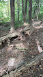
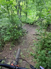
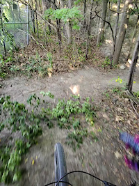
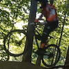
A technical trail that rides on the edge of a steep cliff. Large sections of ladder bridge work on the trail

Access Info

From Sauriol trail and Gravel trail further south.

This trail is unsanctioned.

Tags
BridgesRock gardensSkinnies

Recent Activity on Trail

Past Week
  • 2 rides
  • 11 miles average
6 Months
  • 62 rides
  • 16 miles avg distance
All
  • 498 rides
  • Last: Nov 13, 2026
c1c2c3c4
January
February
March
April
May
June
July
August
September
October
November
December
update trails status or condition

Dr. Quads Trail Reports

statusdatedescription
Sep 5, 2026 @ 9:53am (America/Toronto)
Sep 5, 2026
A bit wet at the start—keep an eye out for low trees. One almost took my head off!
Aug 22, 2026 @ 10:00am (America/Toronto)
Aug 22, 2026
Aug 22, 2026 @ 9:05am (America/Toronto)
Aug 22, 2026
The first small bridge after the formerly zig-zag now straight bridge did indeed need replacing, in contrast to my overly optimistic comment from...
Jul 31, 2026 @ 11:30am (America/Toronto)
Jul 31, 2026
I did wipe out on the sand berm, ha! Trail is not getting much action. The new jump from last year had sticks all over it and no tire tracks. ...
Jul 29, 2026 @ 3:21pm (America/Toronto)
Jul 29, 2026
Some sandy spots and a few bridges missing planks, but it’s rideable!
more »
Status:
on Sep 5, 2026
Variable
Avg: 3.66 (21 votes)
Your vote: 0

view (2,294)
close
      Directions to dr-quads trailhead (43.712760, -79.318630)

      Photos

      23 more »
      mtb
      398 |
      Jun 27, 2020 @ 2:35pm
      Jun 27, 2020
      mtb
      45 |
      Sep 27, 2026 @ 10:59pm
      Sep 27, 2026
      mtb
      56 |
      Sep 27, 2026 @ 10:55pm
      Sep 27, 2026
      mtb
      175 |
      Oct 26, 2023 @ 3:02pm
      Oct 26, 2023

      Videos

      4 more »
      youtuber Dr. Quads Trail Review by Good Trails MTB
      mtb
      2589 | Sep 3, 2017 , Toronto
      Skinny Bypass
      mtb
      0:13 | 15 | Sep 27, 2026 , Toronto
      Dr Quads Sketch Line
      mtb
      0:30 | 37 | Sep 30, 2025 , Toronto
      Dr Quads Bridges
      mtb
      0:46 | 34 | Sep 30, 2025 , Toronto

      Routes with this trail

      more »
      ★ 5.0 • 59 miles • 5,018 ft • 111 • Loop •
      100k loop through the greater Don Valley, the route has almost no repeat sections. Consists mostly of...
      ★ 5.0 • 24 miles • 2,515 ft • 41 •
      40 km of the best trails in the Don! Not for the timid :P
      35 miles • 2,804 ft • 265 • Loop •
      55k of the best the Don has to offer! Starts/ends at Loblaws.
      3.6 ★★★★★
      21 Ratings
      5 ★ 33%
      4 ★ 24%
      3 ★ 19%
      2 ★ 14%
      1 ★ 10%

      10 Reviews & Comments

      leonboni leonboni
      For anyone wondering, this trail is accessible from the top of the 'Thunderdome' (metal switchback climb structure on the EAST Don). You can get on the last third of kitchen sink from there and access Dr. Quads.

      Keep in mind: the wooden features can be sketchy in some areas as they're old, and some are high consequence of failure.
      jon-p
      low hanging branch as you start the downhill after the climb. Watch out as it is head height and hard to spot.
      artvandelay33 artvandelay33
      This trail feels like it's uphill both ways

      We hope you've been enjoying Trailforks!

      Create a FREE account to view all trail reviews and much more.

      • #41020 - 10,103 views

      Frequently Asked Questions

      ▼ Where is Dr. Quads located?
      Dr. Quads is located in Don Valley, Toronto, Ontario, Canada. It is part of the Don Valley trail network. The trailhead is located at coordinates 43.71276, -79.31863.
      ▼ How hard is Dr. Quads?
      Dr. Quads is rated as Black Diamond difficulty. The physical rating is Extreme. The average grade is 3%. The climb difficulty is rated Double Black Diamond.
      ▼ What is the elevation gain for Dr. Quads?
      Dr. Quads has 59 ft of elevation gain. The trail has 146 ft of elevation descent. The elevation ranges from 302 ft to 402 ft.
      ▼ Is Dr. Quads a point to point trail?
      Dr. Quads is not a point to point trail. The direction is Both Directions. The trail type is singletrack.
      ▼ How long is Dr. Quads?
      Dr. Quads is 2,953 ft long. The trail type is singletrack.
      ▼ Are dogs allowed on Dr. Quads?
      Yes, dogs are allowed on Dr. Quads. Please keep dogs on a leash where required and clean up after them.
      ▼ When is the best time of year to ride Dr. Quads?
      Based on activity log data, the most popular months to ride Dr. Quads are:
      • September (45 activities)
      • June (37 activities)
      • May (33 activities)
      Check the reports page for current trail conditions.
      ▼ How do I access Dr. Quads? Where is the closest parking trailhead?
      The closest parking and trailhead locations to Dr. Quads are: View all parking locations in the area.
      ▼ How long does it take to ride Dr. Quads?
      Based on recorded activities, it takes an average of 8 minutes to ride Dr. Quads. The trail is 2,953 ft long. Actual times will vary based on fitness level, conditions, and pace. View recent activity logs for more details.
      ▼ How busy is Dr. Quads?
      Dr. Quads is a very popular trail. There have been 2,224 recorded activities on this trail. The trail has received 2,294 check-ins. View recent activity on this trail.

      Hit the Trail

      Open in App

      Get this trail on your phone instantly.

      open trail in app

      Download Trail

      Save to wishlist, Garmin & download.
      save the trail

      Find Related Routes

      Find routes and users activities that include this trail.
      find routes for this trail

      You must enter a description before submitting.

