close
-
Layers w
- Weather Layers
- Pro
- Pro
- Pro
- Pro
- Pro
- Pro
- More Layers
- Pro
- Pro
- Pro
- Pro
-
Upgrade to

3D
Trail Conditions
- Unknown
- Snow Groomed
- Snow Packed
- Snow Covered
- Snow Cover Partial
- Freeze/thaw Cycle
- Icy
- Prevalent Mud
- Wet
- Variable
- Ideal
- Dry
- Very Dry
Trail Flow (Ridden Direction)
Trailforks scans users ridelogs to determine the most popular direction each trail is ridden. A good flowing trail network will have most trails flowing in a single direction according to their intension.
The colour categories are based on what percentage of riders are riding a trail in its intended direction.
The colour categories are based on what percentage of riders are riding a trail in its intended direction.
- > 96%
- > 90%
- > 80%
- > 70%
- > 50%
- < 50%
- bi-directional trail
- no data
Trail Last Ridden
Trailforks scans ridelogs to determine the last time a trail was ridden.
- < 2 days
- < 1 week
- < 2 weeks
- < 1 month
- < 6 months
- > 6 months
Trail Ridden Direction
The intended direction a trail should be ridden.
- Downhill Only
- Downhill Primary
- Both Directions
- Uphill Primary
- Uphill Only
- One Direction
Contribute Details
Colors indicate trail is missing specified detail.
- Description
- Photos
- Description & Photos
- Videos
Trail Popularity ?
Trailforks scans ridelogs to determine which trails are ridden the most in the last 9 months.
Trails are compared with nearby trails in the same city region with a possible 25 colour shades.
Think of this as a heatmap, more rides = more kinetic energy = warmer colors.
- most popular
- popular
- less popular
- not popular
ATV/ORV/OHV Filter
Max Vehicle Width
inches
US Cell Coverage
Legend

Radar Time
Activity Recordings
Trailforks uses anonymized public activity data.
?
Activity Recordings
Trailforks uses anonymized public activity data.
?
Personal Heatmap
▶
Activity Types
all
/
none
▶
Options
2
Date range
month
–
Winter Trails
Warning
A routing network for winter maps does not exist. Selecting trails using the winter trails layer has been disabled.
Missing Trails
Most Popular
Least Popular
Trails are colored based on popularity. The more popular a trail is, the more red. Less popular trails trend towards green.
Jump Magnitude Heatmap
Heatmap of where riders jump on trails. Zoom in to see individual jumps, click circles to view jump details.
BC Backroad Status
![map legend]()
Service Road Atlas is a free to use, community-driven service for viewing and creating reports on the numerous back-country service roads around B.C. and Alberta.

Slope Aspect
Direction the slope faces
Trails Deemphasized
Trails are shown in grey.
Only show trails with no bike usage.
Suggested Layers
Based on selected activity type
Save the current map location and zoom level as your default home location whenever this page is loaded.
SaveToronto, the capital of the province of Ontario, is a major Canadian city along Lake Ontario’s northwestern shore. It's a dynamic metropolis with a core of soaring skyscrapers, all dwarfed by the iconic, free-standing CN Tower. Toronto also has many green spaces, from the orderly oval of Queen’s Park to 400-acre High Park and its trails, sports facilities and zoo.
Located in the heart of Toronto, the Don Valley offers a wide assortment of trail opportunities. With trails ranging from wide-open single track, to ravine-wall expert trails, to tight man-made TTFs, the Don has something for every level of mountain biker.
Located in the heart of Toronto, the Don Valley offers a wide assortment of trail opportunities. With trails ranging from wide-open single track, to ravine-wall expert trails, to tight man-made TTFs, the Don has something for every level of mountain biker.
Links
Activities Click to view
- Mountain Bike
1,292 trails
- E-Bike
950 trails
- Gravel Bike
18 trails
- Adaptive Bike
2 trails
- Winter Fat Bike
9 trails
- Horse
9 trails
- Hike
1,291 trails
- Trail Running
1,279 trails
- Snowshoe
806 trails
- Downhill Ski
10 trails
- Nordic Ski
443 trails
Region Details
- 513
- 174
- 279
- 180
- 90
- 16
Region Status
Open as of 1 dayStats
- Avg Trail Rating
- Trails (view details)
- 1,285
- Trails Mountain Bike
- 1,292
- Trails E-Bike
- 950
- Trails Gravel Bike
- 18
- Trails Adaptive Bike
- 2
- Trails Winter Fat Bike
- 9
- Trails Horse
- 9
- Trails Hike
- 1,291
- Trails Trail Running
- 1,279
- Trails Snowshoe
- 806
- Trails Downhill Ski
- 10
- Trails Backcountry Ski
- 4
- Trails Nordic Ski
- 443
- Total Distance
- 422 miles
- Total Descent
- 22,706 ft
- Total Vertical
- 520 ft
- Highest Trailhead
- 763 ft
- Reports
- 24,644
- Photos
- 3,114
- Ridden Counter
- 286,654
Sub Regions
-
Biidaasige Park
- 4
-
Cedarvale
- 5
- 5
-
Central Toronto
- 20
- 20
-
Crothers Woods
- 1
- 6
- 13
-
David A. Balfour Ravine Park
- 2
- 7
- 5
- 1
-
Don Valley
- 31
- 90
- 86
- 70
- 13
-
Don Valley Brick Works Park
- 8
-
Earl Bales Park
- 9
- 12
- 12
- 2
- 1
-
G. Ross Lord Park
- 1
- 8
-
Gatineau Hydro Corridor
- 14
- 11
-
High Park
- 1
- 8
- 2
- 1
-
Humber River Valley
- 15
- 34
- 16
- 5
-
Sherwood Park
- 1
- 1
-
Toronto Port Lands
- 8
- 12
- 4
-
Warden Woods
- 2
- 13
- 16
- 6
- 4
-
West Don Parklands
- 1
- 18
- 11
- 1
Popular Toronto Mountain Biking Trails
• 100 ★ 4.4 • 1 mile • 148 ft • 2,392 •
Rolling up and down trail along the valley wall with some challenging rooted climbs and a few steep descents depending on which line riders take. It can take a few rides to learn when and where to carry your speed to overcome the next...
• 95 ★ 4.4 • 1,470 ft • 22 ft • 2,105 •
Fun downhill trail with multiple air features and also the climb back out when returning to Redway lot.
• 100 ★ 4.1 • 2,093 ft • 8 ft • 2,028 •
Solid trail with enough flow and technical features to keep things interesting. Good for progression
• 100 ★ 4.0 • 974 ft • 46 ft • 1,998 •
Multi directional trail, watch for users coming from the other direction. Most use it as a switchback climb from the service road back to Redway parking lot. *2006 or so the trails around Loblaws was rerouted/closed for what currently...
• 100 ★ 4.0 • 1,775 ft • 59 ft • 1,895 •
Highly rated popular blue difficulty singletrack. This mountain bike primary trail can be used both directions and has a moderate overall physical rating with a 59 ft blue climb. It features drop and jump. On average it takes 3 minutes to complete this trail.
• 95 ★ 4.0 • 1,558 ft • 37 ft • 1,790 •
Easier of the 2 Sanitation Plant trails. Rock gardens and tight switchbacks. Takes you over to The Ridge.
Toronto Mountain Bike Routes
★ 5.0 • 37 miles • 1,589 ft • 16 • Loop •
A mostly paved loop linking together the don trail, waterfront trail, highland creek trail, and Gatineau...
★ 3.8 • 14 miles • 752 ft • 41 •
this is a roughly 25km route, best for seasoned cyclocross riders, or for beginning mountain/hybrid...
★ 5.0 • 59 miles • 5,018 ft • 111 • Loop •
100k loop through the greater Valley, the route has almost no repeat sections. Consists mostly of...
★ 4.0 • 24 miles • 2,002 ft • 50 • Loop •
A route linking together the all the hardest trails throughout the Don Valley. This is a physically...
★ 4.7 • 10 miles • 435 ft • 9 • Loop •
Nice, long forested route through the middle of Toronto! A tad tricky the first time, then it flows...
★ 3.9 • 16 miles • 1,371 ft • 56 •
Big loop in the Don featuring a good mix of the standards and the more difficult trails at the north end.
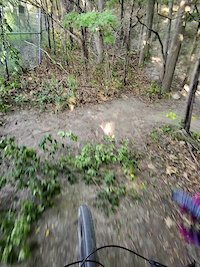
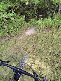
Photos of Toronto Mountain Bike
Videos of Toronto Mountain Bike
trail: Trinity Bellwoods X-ing
0:12 |
15 |
May 1, 2026
trail: Donaconda
0:22 |
34 |
Apr 19, 2026

trail: Castle Frank
0:43 |
51 |
Mar 29, 2026

trail: Mimico Creek Trail
0:21 |
14 |
Nov 19, 2025
trail: Leviathan
0:44 |
52 |
Sep 30, 2025
trail: Dr. Quads
0:30 |
28 |
Sep 30, 2025
trail: Dr. Quads
0:46 |
26 |
Sep 30, 2025
0:43 |
9 |
Sep 30, 2025
Current Trail Warnings
| status | trail | date | condition | user | info |
|---|---|---|---|---|---|
| Donaconda | Jul 6, 2026 @ 8:14pm (America/Toronto) 3 days | Ideal | artvandelay33 | Tree down before the bridge jump thing.... | |
| Humber Woods | Jun 20, 2026 @ 4:59pm (America/Toronto) Jun 20, 2026 | Variable | KeirenH | tree down | |
| The Rockets | Jun 20, 2026 @ 12:29pm (America/Toronto) Jun 20, 2026 | Unknown | lpl5iA | Construction is impassable. Had to go up... |
Recent Trail Reports
| status | trail | date | condition | info | user |
|---|---|---|---|---|---|
| Bunny Run | Jul 8, 2026 @ 10:48am (America/Toronto) 1 day | Ideal | luisell | ||
| Trail Apples | Jul 8, 2026 @ 10:48am (America/Toronto) 1 day | Ideal | luisell | ||
| Around Around Horses | Jul 8, 2026 @ 10:48am (America/Toronto) 1 day | Ideal | luisell | ||
| Rehabilitated | Jul 8, 2026 @ 10:48am (America/Toronto) 1 day | Variable | luisell | ||
| Secret Hidden Trail | Jul 8, 2026 @ 10:48am (America/Toronto) 1 day | Ideal | luisell | ||
| Swamp | Jul 8, 2026 @ 10:48am (America/Toronto) 1 day | Variable | luisell | ||
| Climbmax | Jul 8, 2026 @ 10:48am (America/Toronto) 1 day | Ideal | luisell | ||
| Hot Laps Shortcut | Jul 8, 2026 @ 10:48am (America/Toronto) 1 day | Dry | luisell | ||
| Bunny Poop | Jul 8, 2026 @ 10:48am (America/Toronto) 1 day | Dry | luisell | ||
| Moreau Trail Run | Jul 8, 2026 @ 8:48am (America/Toronto) 1 day | Ideal | leonboni |
Activity Feed
| username | action | type | title | date |
|---|---|---|---|---|
| luisell | add | report | activity #98743776 and 8 more | Jul 8, 2026 @ 3:49pm 21 hours |
| leonboni | add | report | activity #98739147 and 6 more | Jul 8, 2026 @ 2:29pm 23 hours |
| leonboni | add | report | activity #98739106 and 2 more | Jul 8, 2026 @ 2:28pm 23 hours |
| ShadrackMuffMXJ24x | comment | trail | activity #98723470 | Jul 8, 2026 @ 10:45am 1 day |
| ShadrackMuffMXJ24x | vote | trail | activity #98723173 and 6 more | Jul 8, 2026 @ 10:43am 1 day |
Recent Comments
| username | type | title | comment | date |
|---|---|---|---|---|
| trail | Trail is accessible, but is in process of... | Jul 8, 2026 @ 10:45am 1 day | ||
| report | Thanks! Looking forward. | Jul 6, 2026 @ 11:33am Jul 6, 2026 | ||
| report | hmm, that is a tricky business, being at the... | Jul 4, 2026 @ 6:03am Jul 4, 2026 | ||
| trail | I'd recommend scouting this out before riding... | Jul 3, 2026 @ 6:04pm Jul 3, 2026 | ||
| report | It should be open. There is also a new line... | Jul 2, 2026 @ 10:06pm Jul 2, 2026 |
Local Badges
-

Completionist9 awarded -

Top 10 Trails80 awarded -
Completionist12 awarded -
Completionist2 awarded -
Completionist117 awarded -
Completionist0 awarded
Bike & Skill Parks
| name | type | city | rating |
|---|---|---|---|
| Crother's Woods Skill Park / Pump Track | skill park | Toronto | |
| Sunnyside Bike Park | skill park | Toronto | |
| Ashbridges Bay Skatepark | skill park | Toronto |
Local Products
Activity Type Stats
| activitytype | trails | distance | descent | descent distance | total vertical | rating | global rank | state rank | photos | reports | routes | ridelogs |
|---|---|---|---|---|---|---|---|---|---|---|---|---|
| Mountain Bike | 1,292 | 409 miles | 22,093 ft | 130 miles | 518 ft | #10 | #1 | 2,949 | 24,568 | 69 | 236,922 | |
| E-Bike | 950 | 323 miles | 16,995 ft | 104 miles | 518 ft | #69 | #34 | 2 | 23,084 | 26 | 4,223 | |
| Gravel Bike | 18 | #15 | #31 | 2 | 201 | 16 | 1,040 | |||||
| Adaptive Bike | 2 | #61 | #61 | 101 | 10 | |||||||
| Winter Fat Bike | 9 | #15 | #49 | 1 | 240 | 8 | 74 | |||||
| Horse | 9 | 3 miles | 92 ft | 4,715 ft | 322 ft | #349 | #13 | 2,314 | 10 | |||
| Hike | 1,291 | 409 miles | 21,581 ft | 129 miles | 518 ft | #35 | #1 | 147 | 24,309 | 20 | 6,062 | |
| Trail Running | 1,279 | 406 miles | 21,076 ft | 128 miles | 518 ft | 11 | 24,206 | 24 | 31,646 | |||
| Snowshoe | 806 | 262 miles | 13,360 ft | 82 miles | 518 ft | #1 | #1 | 1,808 | 5 | 103 | ||
| Downhill Ski | 10 | 1 mile | 364 ft | 3,369 ft | 164 ft | #287 | #9 | 59 | 37 | |||
| Backcountry Ski | 4 | 2 miles | 89 ft | 3,054 ft | 161 ft | 67 | 11 | |||||
| Nordic Ski | 443 | 174 miles | 6,129 ft | 50 miles | 463 ft | #23 | #1 | 668 | 2 | 302 |
Frequently Asked Questions About Toronto
▼
What are the best places to ride in Toronto?
Toronto has 18 areas to explore for mountain biking. The top rated areas are:
▼
What are the highest rated mountain biking trails in Toronto?
The highest rated mountain biking trails in Toronto are:
- Trash Panda (4.8/5)
- 3 Rocks to Redway Road Downhill (4.7/5)
- Leviathan (4.6/5)
- Moartown (4.5/5)
- Party Atmosphere (4.5/5)
▼
What is the best time of the year to ride in Toronto?
Based on ride log data, the most popular months to ride in Toronto are:
- July (2,726 activities)
- June (2,392 activities)
- August (2,236 activities)
▼
Where can I park to ride in Toronto?
There are 51 parking locations listed in Toronto. The most popular parking spots are:
- ET Seton Park North Lot "Parking Lot#2"
- Don Mills Underpass Parking
- Loblaws Parking Lot Trailhead
- ET Seton Park - The Circle
- Lower Redway Lot
Activities
Trails
- By brenthillier
 NSMBA TRAILFORKS & contributors
 - Admins: Wyrmblight, TORONTO
- #3424 - 160,261 views
- toronto activity log | embed map of Toronto mountain bike trails | toronto mountain biking points of interest polygons
Downloading of trail gps tracks in kml & gpx formats is enabled for Toronto.
You must login to download files.