


Open in App
Get this trail on your phone instantly.

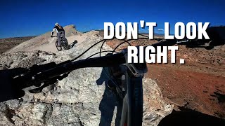
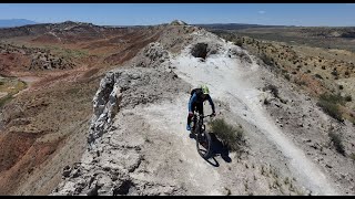
Typically ridden from south to north. Fun singletrack with gradual ups and downs. Trail has some exposure as you are riding along the top of a ridge, however, there are often trails farther from the edge if you feel uncomfortable.
This section of trail ends with two options:
* a hike-a-bike up a gnarly little face followed by some dastardly descents
OR
* a tamer escape hatch trail to a road arriving at the same location
| c1 | c2 | c3 | c4 |
|---|---|---|---|
January | February | March | April |
May | June | July | August |
September | October | November | December |

Service Road Atlas is a free to use, community-driven service for viewing and creating reports on the numerous back-country service roads around B.C. and Alberta.
Save the current map location and zoom level as your default home location whenever this page is loaded.
SaveWe hope you've been enjoying Trailforks!
Create a FREE account to view trail comments and much more.
You must enter a description before submitting.

