
more stats
1.6 miles
Distance
146 ft
Climb
-153 ft
Descent
00:14:58
Avg time
-8 ft
Altitude change
1,203 ft
Altitude min
1,267 ft
Altitude max
1,236 ft
Altitude start
1,227 ft
Altitude end
-0.1%
Grade
-14.7%
Grade max
15.8%
Grade min
2,228 ft
Distance climb
2,474 ft
Distance down
3,599 ft
Distance flat
00:14:58
Avg time

Dynamite Details

  • Activities
    • Mountain Bike
    • E-Bike
    • Winter Fat Bike
    • Hike
    • Trail Running
    • Snowshoe
  • Riding Area
    Cuyuna Lakes - Sagamore Unit
    Crosby-Ironton, Minnesota
  • Difficulty Rating
  • Local Popularity
    40 in Mountain Biking heatmap [+]
    • 40 in E-Biking
    • 5 in Trail Running
    • 45 in Hiking
    • 5 in Snowshoeing
    • 5 in Winter Fat Biking
  • Global Ranking
    #20750 in Mountain Biking [+]
    • #48776 in E-Biking
    • #216725 in Trail Running
    • #144853 in Hiking
    • #4194 in Snowshoeing
    • #3193 in Winter Fat Biking
  • State Ranking
    #108 in Mountain Biking · Minnesota [+]
    • #244 in E-Biking
    • #1,749 in Trail Running
    • #1,492 in Hiking
    • #115 in Snowshoeing
    • #102 in Winter Fat Biking
  • Hiking SAC Scale
    T1 Hiking
  • Trail Type
    Singletrack
  • Bike Type
    AM, XC, Fat
  • Climb Difficulty
    Blue
  • Trail Visibility
    Always easy to follow
  • eBike Allowed
    Yes up to Class 1
  • Year Opened
    2022
  • Land Owner
    Minnesota Department of Natural Resources (MNDNR)

No community description for Dynamite trail has been added yet!

AI Generated Description

Dynamite is a 2 mile moderately popular black diamond difficulty singletrack trail located near Crosby-Ironton Minnesota. This mountain bike primary trail with a 146 ft blue climb. Trail visibility is always easy to follow. On average it takes 14 minutes to complete this trail.

Access Info

From Buffalo Run trail

Tags

Trail Supporters

Local Trail Association

Recent Activity on Trail

Past Week
  • 0 rides
  •  
6 Months
  • 39 rides
  • 19 miles avg distance
All
  • 243 rides
  • Last: Nov 1, 2026
update trails status or condition

Dynamite Trail Reports

Status:
on Nov 5, 2026
Freeze/thaw Cycle
Avg: 4.1 (4 votes)
Your vote: 0

view (1,277)
close
      Directions to dynamite-549738 trailhead (46.452640, -94.058560)

      Photos

      No photos have been added for Dynamite yet, add a photo.

      Videos

      2 more »
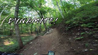
      Dynamite, Cuyuna, MN
      mtb
      11:32 | 506 | Oct 12, 2024 , Crosby-Ironton
      Trail Review - Sagamore Unit's Dynamite
      mtb
      19:10 | 725 | Oct 24, 2022 , Crosby-Ironton

      Routes with this trail

      more »
      ★ 5.0 • 102 miles • 5,825 ft • 97 • Loop •
      100+ mile MTB trail loop that could be sagged from Yawkey Trail Head
      4.5 ★★★★★
      4 Ratings
      5 ★ 75%
      4 ★
      3 ★ 25%
      2 ★
      1 ★

      9 Reviews & Comments

      TheWholeTrail
      Blind run so take with a grain of salt. Jumps were always a surprise. Very sharp corners, narrow, and little trail speed for the size of jumps. I guess if you had it memorized and pedaled at every chance maybe? But I think because of these factors, the trail doesn’t seem to get much use and has narrowed up with vegetation.
      Snelbrown
      There’s two sections of tree down. One you have to climb over and another one you have to duck . 6/7 11pm
      absquared absquared
      Linked up with Bisons Run took us 1h in 33C heat. We rode this blind after riding Tioga all day so we didnt quite have the energy to hit the surprise jumps throughout, they also could have possibly been slightly smaller to conserve speed and make the flow more enjoyable. That being said, its awesome that theyre there at all. Big ole rock gardens are beautiful too!

      We hope you've been enjoying Trailforks!

      Create a FREE account to view all trail reviews and much more.

      • By CycleKriegTF Pro & contributors
      • #549738 - 1,839 views

      Frequently Asked Questions

      ▼ Where is Dynamite located?
      Dynamite is located in Cuyuna Lakes - Sagamore Unit, Crosby-Ironton, Minnesota, United States. It is part of the Cuyuna Lakes - Sagamore Unit trail network. The trailhead is located at coordinates 46.45264, -94.05856.
      ▼ How hard is Dynamite?
      Dynamite is rated as Black Diamond difficulty. The average grade is 0.1%. The climb difficulty is rated Blue.
      ▼ What is the elevation gain for Dynamite?
      Dynamite has 146 ft of elevation gain. The trail has 153 ft of elevation descent. The elevation ranges from 1,203 ft to 1,267 ft.
      ▼ How long is Dynamite?
      Dynamite is 1.6 miles long. The trail type is singletrack.
      ▼ Are dogs allowed on Dynamite?
      There is no information about dogs being allowed on Dynamite. Check with local trail managers or the trail page for the latest access rules.
      ▼ How do I access Dynamite? Where is the closest parking trailhead?
      The closest parking and trailhead locations to Dynamite are: View all parking locations in the area.
      ▼ How long does it take to ride Dynamite?
      Based on recorded activities, it takes an average of 15 minutes to ride Dynamite. The trail is 1.6 miles long. Actual times will vary based on fitness level, conditions, and pace. View recent activity logs for more details.
      ▼ How busy is Dynamite?
      Dynamite is a moderately popular trail. There have been 1,192 recorded activities on this trail. The trail has received 1,277 check-ins. View recent activity on this trail.

      Hit the Trail

      Open in App

      Get this trail on your phone instantly.

      open trail in app

      Download Trail

      Save to wishlist, Garmin & download.
      save the trail

      Find Related Routes

      Find routes and users activities that include this trail.
      find routes for this trail

      You must enter a description before submitting.