
more stats
443 ft
Distance
558 ft
High Point
-1 ft
Altitude change
554 ft
Altitude min
555 ft
Altitude start
554 ft
Altitude end
-0.2%
Grade
-1.4%
Grade max
1.3%
Grade min
56 ft
Distance climb
148 ft
Distance down
240 ft
Distance flat

E-18utsikten Details

  • Activities
    • Mountain Bike
  • Riding Area
    Sekkelsten
    Askim
  • Difficulty Rating
  • Local Popularity
    5 in Mountain Biking heatmap
  • Global Ranking
    #145248 in Mountain Biking
  • National Ranking
    #1,034 in Mountain Biking · Norway
  • Trail Type
    Singletrack
  • Bike Type
    AM, XC
  • Direction
    Downhill Primary
  • Climb Difficulty
    Black Diamond
  • Physical Rating
    Moderate
  • Trail Visibility
    Sometimes hard to follow
  • Dogs Allowed
    Yes
  • eBike Allowed
    Yes up to Class 1

Norsk
Det er best å sykle stien fra bruen og ned, på grunn av den bratte nedoverbakke noen få meter før slutten av stien.
Løypa starter lett med noen få meter med ganske flat smal sti, men den blir brattere, og på få meter er du på toppen, eller bare fjell, med falmet løype, det er ingen løypemarkører der, stien fortsetter til høyre langs den bare steinen / bergplatene med en venstre med en ned og opp seksjon fulgt av høyresving og deretter den bratte delen og deretter enkel forbindelse til den andre stien.
som du kanskje kan sykle opp hvis du er en avansert nok rytter, men nybegynnere kan slite.

English
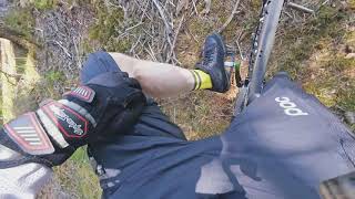
It's best to ride the trail from the bridge and down, due to the steep downhill few meters before the end of the trail.
The trail starts off easy with few meters of pretty flat narrow singletrack but it gets steeper, and then in few meters you are on the top, or bare rock, with faded trail, there are no trail markers there, the trail continues to the right along the bare rock/rock slabs with a left with a down and up section followed by right turn then the steep section and then easy connecting to the other trail.
which you might be able to ride up if you are an advanced enough rider, but beginners might struggle.

Tags
BridgesFaint trailRock slabs

Recent Activity on Trail

Past Week
  • 0 rides
  •  
6 Months
  • 0 rides
  •  
All
  • 0 rides
  •  
update trails status or condition

E-18utsikten Trail Reports

no reports have been added for E-18utsikten yet, add a trail report.
Trail reports are used to indicate a trails current condition and inform builders and other users about any issues on a trail.
Status:
Avg: 3.98 (1 votes)
Your vote: 0

view (0)
close
      Directions to e18utsikten trailhead (59.573630, 11.213120)

      Photos

      20 more »
      mtb
      51 |
      Aug 3, 2020 @ 1:34pm
      Aug 3, 2020
      mtb
      58 |
      Aug 3, 2020 @ 1:33pm
      Aug 3, 2020
      mtb
      40 |
      Aug 3, 2020 @ 1:31pm
      Aug 3, 2020
      mtb
      46 |
      Aug 3, 2020 @ 1:19pm
      Aug 3, 2020

      Videos

      1 more »
      23 06 2020 new bikepath at Sagveien &...
      mtb
      16:11 | 322 | Sep 27, 2020 , Askim
      4.0 ★★★★★
      1 Ratings
      5 ★
      4 ★ 100%
      3 ★
      2 ★
      1 ★

      Reviews / Comments

      No reviews yet, be the first to write a review or ask a question.
      Use trail reports to comment on trail conditions.


      We hope you've been enjoying Trailforks!

      Create a FREE account to view all trail reviews and much more.

      Frequently Asked Questions

      ▼ Where is E-18utsikten located?
      E-18utsikten is located in Sekkelsten, Askim, Norway. It is part of the Sekkelsten trail network. The trailhead is located at coordinates 59.57363, 11.21312.
      ▼ How hard is E-18utsikten?
      E-18utsikten is rated as Red difficulty. The physical rating is Moderate. The average grade is 0.2%. The climb difficulty is rated Black Diamond.
      ▼ Is E-18utsikten a point to point trail?
      E-18utsikten is not a point to point trail. The direction is Downhill Primary. The trail type is singletrack.
      ▼ How long is E-18utsikten?
      E-18utsikten is 443 ft long. The trail type is singletrack.
      ▼ Are dogs allowed on E-18utsikten?
      Yes, dogs are allowed on E-18utsikten. Please keep dogs on a leash where required and clean up after them.
      ▼ How do I access E-18utsikten? Where is the closest parking trailhead?
      The closest parking and trailhead locations to E-18utsikten are: View all parking locations in the area.
      ▼ How busy is E-18utsikten?
      E-18utsikten is a less popular trail with lighter traffic. View recent activity on this trail.

      Hit the Trail

      Open in App

      Get this trail on your phone instantly.

      open trail in app

      Download Trail

      Save to wishlist, Garmin & download.
      save the trail

      Find Related Routes

      Find routes and users activities that include this trail.
      find routes for this trail

      You must enter a description before submitting.

