
more stats
1.6 miles
Distance
27 ft
Climb
-226 ft
Descent
00:09:02
Avg time
-201 ft
Altitude change
5,353 ft
Altitude min
5,574 ft
Altitude max
5,554 ft
Altitude start
5,354 ft
Altitude end
-2.5%
Grade
-14.1%
Grade max
7%
Grade min
1,339 ft
Distance climb
4,879 ft
Distance down
1,978 ft
Distance flat
00:09:02
Avg time

Eagle (West) Details

  • Activities
    • Mountain Bike
    • E-Bike
    • Gravel Bike
    • Horse
    • Hike
    • Trail Running
  • Riding Area
  • Difficulty Rating
  • Local Popularity
    80 in Mountain Biking heatmap [+]
    • 70 in E-Biking
    • 70 in Trail Running
    • 50 in Hiking
    • 5 in Horseback
    • 95 in Gravel Biking
  • Global Ranking
    #91366 in Mountain Biking [+]
    • #40787 in E-Biking
    • #129034 in Trail Running
    • #151030 in Hiking
    • #22830 in Horseback
    • #1279 in Gravel Biking
  • State Ranking
    #1,777 in Mountain Biking · Colorado [+]
    • #451 in E-Biking
    • #3,710 in Trail Running
    • #4,630 in Hiking
    • #636 in Horseback
    • #29 in Gravel Biking
  • Trail Type
    Singletrack
  • Bike Type
    XC, Gravel
  • Climb Difficulty
    Blue
  • Physical Rating
    Moderate
  • Trail Visibility
    Always easy to follow
  • Dogs Allowed
    Yes
  • eBike Allowed
    Yes up to Class 2
  • Land Owner

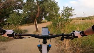
The lower half of Eagle trail was rerouted and improved in 2024 as part of the Boulder Valley Ranch redesign project. Gone is the steep babyhead plunge to Sage and in its place is a bike-optimized downhill roller coast. The eastern end of the trail is still on the ranch access road and will remain so, there's more improvements on the docket for 2025 to the upper portion off the mesa top. This trail was previous rated blue (as an average of a green road with a black section) it's now a solid green appropriate for kids and beginners but is a hoot for people of all abilities.

Tags
Kid friendly

Local Trail Association

Recent Activity on Trail

Past Week
  • 2 rides
  • 13 miles average
6 Months
  • 62 rides
  • 18 miles avg distance
All
  • 289 rides
  • Last: Nov 14, 2026
c1c2c3c4
January
February
March
April
May
June
July
August
September
October
November
December
update trails status or condition

Eagle (West) Trail Reports

statusdatedescription
Aug 9, 2026 @ 4:35pm (America/Denver)
Aug 9, 2026
May 22, 2026 @ 5:23pm (America/Denver)
May 22, 2026
reporter Trail is open. Please update conditions if you ride
May 18, 2026 @ 11:40am (America/Denver)
May 18, 2026
reporter Closed for muddy conditions. Status will be updated when trail reopens
May 5, 2026 @ 8:54am (America/Denver)
May 5, 2026
reporter Closed for muddy conditions. Status will be updated when trail reopens
Dec 20, 2025 @ 9:02am (America/Denver)
Dec 20, 2025
reporter Trail is open. Please update conditions if you ride
more »
Status:
on Aug 9, 2026
Dry
Avg: 3.59 (4 votes)
Your vote: 0

view (3,376)
close
      Directions to eagle-west trailhead (40.076400, -105.277550)

      Photos

      14 more »
      mtb
      18 |
      Oct 27, 2026 @ 2:55pm
      Oct 27, 2026
      mtb
      15 |
      Oct 29, 2026 @ 3:32pm
      Oct 29, 2026
      mtb
      95 |
      Sep 30, 2024 @ 12:36pm
      Sep 30, 2024
      mtb
      69 |
      Sep 30, 2024 @ 12:36pm
      Sep 30, 2024

      Videos

      1 more »
      Eagle - Boulder Valley Ranch - Boulder -...
      mtb
      6:57 | 309 | Mar 27, 2024 , Boulder

      Routes with this trail

      more »
      64 miles • 6,122 ft • 18 • Out & Back •
      YOU WILL MOST LIKELY PERISH Want an epic ride? Well we've got one for you! We've linked trails to get you...
      10 miles • 443 ft • 5 • Out & Back •
      The trails at Boulder Valley Ranch offer a great beginner experience. They are mostly wide, fairly flat,...
      66 miles • 6,921 ft • 23 • Out & Back •
      If The Little Burrito just isn't enough, try that ride but start from Boulder. Catch the Foothills Trail...
      3.0 ★★★★★
      4 Ratings
      5 ★
      4 ★
      3 ★ 100%
      2 ★
      1 ★

      1 Review & Comments

      Kdub91712 Kdub91712
      Saw two rattlesnakes about a minute apart near the side of the wide trail. Also some gophers or prairie dogs that don’t move out of the way very quickly…

      We hope you've been enjoying Trailforks!

      Create a FREE account to view all trail reviews and much more.

      • By toddTF Pro Trailforks & contributors
      • #13700 - 3,531 views

      Frequently Asked Questions

      ▼ Where is Eagle (West) located?
      Eagle (West) is located in Boulder Valley Ranch / Boulder Reservoir, Boulder, Colorado, United States. It is part of the Boulder Valley Ranch / Boulder Reservoir trail network. The trailhead is located at coordinates 40.0764, -105.27755.
      ▼ How hard is Eagle (West)?
      Eagle (West) is rated as Green difficulty. The physical rating is Moderate. The average grade is 2.5%. The climb difficulty is rated Blue.
      ▼ What is the elevation gain for Eagle (West)?
      Eagle (West) has 27 ft of elevation gain. The trail has 226 ft of elevation descent. The elevation ranges from 5,353 ft to 5,574 ft.
      ▼ How long is Eagle (West)?
      Eagle (West) is 1.6 miles long. The trail type is singletrack.
      ▼ Are dogs allowed on Eagle (West)?
      Yes, dogs are allowed on Eagle (West). Please keep dogs on a leash where required and clean up after them.
      ▼ How do I access Eagle (West)? Where is the closest parking trailhead?
      The closest parking and trailhead locations to Eagle (West) are: View all parking locations in the area.
      ▼ How long does it take to ride Eagle (West)?
      Based on recorded activities, it takes an average of 9 minutes to ride Eagle (West). The trail is 1.6 miles long. Actual times will vary based on fitness level, conditions, and pace. View recent activity logs for more details.
      ▼ How busy is Eagle (West)?
      Eagle (West) is a very popular trail. There have been 3,267 recorded activities on this trail. The trail has received 3,376 check-ins. View recent activity on this trail.

      Hit the Trail

      Open in App

      Get this trail on your phone instantly.

      open trail in app

      Download Trail

      Save to wishlist, Garmin & download.
      save the trail

      Find Related Routes

      Find routes and users activities that include this trail.
      find routes for this trail

      You must enter a description before submitting.