more stats
2.7 miles
Distance
67 ft
Climb
-1,427 ft
Descent
00:20:17
Avg time
-1,361 ft
Altitude change
4,370 ft
Altitude min
5,731 ft
Altitude max
5,731 ft
Altitude start
4,370 ft
Altitude end
-9.6%
Grade
-53.3%
Grade max
14.6%
Grade min
1,240 ft
Distance climb
2 miles
Distance down
784 ft
Distance flat
00:20:17
Avg time

Easy Wind Details

  • Activities
    • Mountain Bike
  • Riding Area
    Sun Peaks Bike Park
    Sun Peaks, British Columbia
  • Difficulty Rating
  • Local Popularity
    60 in Mountain Biking
  • Global Ranking
    #70942 in Mountain Biking
  • Trail Type
    Machine Groomed
  • Bike Type
    DH
  • Direction
    Downhill Only
    Popular Direction Shown
  • Trail Visibility
    Always easy to follow
  • Land Owner

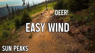
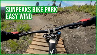
After mastering the Progression Park, Easy Wind is the introductory trail for chairlift access riding. Low berms, smooth rollers, and panoramic views are all features of this top-to-bottom trail.

Trail Supporters
  • Sun Peaks Trail Crew
    Builder

Bike Park

Traditionally Indigenous Territory

Recent Activity on Trail

Past Week
  • 5 rides
  • 6 miles average
6 Months
  • 10 rides
  • 12 miles avg distance
All
  • 208 rides
  • Last: Jun 28, 2026
c1c2c3c4
January
February
March
April
May
June
July
August
September
October
November
December
update trails status or condition

Easy Wind Trail Reports

statusdatedescription
Oct 4, 2025 @ 8:14am (America/Vancouver)
Oct 4, 2025
The bike park is now closed for the season, see you all in 2026! :D \m/
Jul 8, 2025 @ 11:31am
Jul 8, 2025
Jul 3, 2025 @ 12:20pm
Jul 3, 2025
Stop and the bugs will get ya
Jul 2, 2025 @ 4:01pm
Jul 2, 2025
I think they’ve worked on it a bit from previous years when the camber seemed off. A nice cruise down. Gets a bit tight in a few spots for the...
Sep 1, 2024 @ 1:08pm
Sep 1, 2024
Mama bear and bear cub near the top. Mama didn't seem to care about bikers, but make some noise.
more »
Status:
on Oct 4, 2025
Avg: 2.91 (9 votes)
Your vote: 0

view (888)
close
3D
Trail Conditions
  • Unknown
  • Snow Groomed
  • Snow Packed
  • Snow Covered
  • Snow Cover Partial
  • Freeze/thaw Cycle
  • Icy
  • Prevalent Mud
  • Wet
  • Variable
  • Ideal
  • Dry
  • Very Dry
Trail Flow (Ridden Direction)
Trailforks scans users ridelogs to determine the most popular direction each trail is ridden. A good flowing trail network will have most trails flowing in a single direction according to their intension.
The colour categories are based on what percentage of riders are riding a trail in its intended direction.
  • > 96%
  • > 90%
  • > 80%
  • > 70%
  • > 50%
  • < 50%
  • bi-directional trail
  • no data
Trail Last Ridden
Trailforks scans ridelogs to determine the last time a trail was ridden.
  • < 2 days
  • < 1 week
  • < 2 weeks
  • < 1 month
  • < 6 months
  • > 6 months
Trail Ridden Direction
The intended direction a trail should be ridden.
  • Downhill Only
  • Downhill Primary
  • Both Directions
  • Uphill Primary
  • Uphill Only
  • One Direction
Contribute Details
Colors indicate trail is missing specified detail.
  • Description
  • Photos
  • Description & Photos
  • Videos
Trail Popularity ?
Trailforks scans ridelogs to determine which trails are ridden the most in the last 9 months. Trails are compared with nearby trails in the same city region with a possible 25 colour shades. Think of this as a heatmap, more rides = more kinetic energy = warmer colors.
  • most popular
  • popular
  • less popular
  • not popular
ATV/ORV/OHV Filter
Max Vehicle Width
inches
US Cell Coverage
Legend
cell carrier legend

Radar Time
Activity Recordings
Trailforks uses anonymized public activity data. ?
Activity Recordings
Trailforks uses anonymized public activity data. ?
Personal Heatmap
Activity Types
all / none
Options
2
Date range month
Winter Trails
Warning A routing network for winter maps does not exist. Selecting trails using the winter trails layer has been disabled.
Missing Trails
Most Popular
Least Popular
Trails are colored based on popularity. The more popular a trail is, the more red. Less popular trails trend towards green.
Jump Magnitude Heatmap
Heatmap of where riders jump on trails. Zoom in to see individual jumps, click circles to view jump details.
BC Backroad Status

Service Road Atlas is a free to use, community-driven service for viewing and creating reports on the numerous back-country service roads around B.C. and Alberta.

map legend
Slope Aspect
Direction the slope faces
Flat N NE E SE S SW W NW
Trails Deemphasized
Trails are shown in grey.
disable
Only show trails with no bike usage.
Enable
Suggested Layers
Based on selected activity type

    Save the current map location and zoom level as your default home location whenever this page is loaded.

    Save
        Directions to easy-wind trailhead (50.903670, -119.880110)

        Photos

        6 more »
        44 |
        Aug 2, 2024 @ 7:06pm
        Aug 2, 2024
        39 |
        Aug 2, 2024 @ 7:06pm
        Aug 2, 2024
        84 |
        Jul 23, 2022 @ 4:39pm
        Jul 23, 2022
        89 |
        Jul 23, 2022 @ 4:39pm
        Jul 23, 2022

        Videos

        2 more »
        youtuber Easy Wind - Sun Peaks Bike Park New Trail 2022
        10:01 | 301 | Aug 22, 2022 , Sun Peaks
        Sun Peaks Bike Park, Easy Wind, Green Trail in...
        17:54 | 187 | May 27, 2023 , Sun Peaks

        3 Reviews & Comments


        We hope you've been enjoying Trailforks!

        Create a FREE account to view trail comments and much more.

        • By sunpeaksbikeparkTF Pro SPBP & contributors
        • #551536 - 1,117 views

        Frequently Asked Questions About Easy Wind

        Where is Easy Wind located?
        Easy Wind is located in Sun Peaks Bike Park, Sun Peaks, British Columbia, Canada. It is part of the Sun Peaks Bike Park trail network. The trailhead is located at coordinates 50.90367, -119.88011.
        How hard is Easy Wind?
        Easy Wind is rated as Green difficulty. The average grade is 9.6%.
        What is the elevation gain for Easy Wind?
        Easy Wind has 67 ft of elevation gain. The trail has 1,427 ft of elevation descent. The elevation ranges from 4,370 ft to 5,731 ft.
        Is Easy Wind a point to point trail?
        Yes, Easy Wind is a point to point trail. The direction is Downhill Only. The trail type is machine groomed.

        Hit the Trail

        Open in App

        Get this trail on your phone instantly.
        open trail in app

        Download Trail

        Save to wishlist, Garmin & download.
        save the trail

        Find Related Routes

        Find routes and users activities that include this trail.
        find routes for this trail

        You must enter a description before submitting.