
more stats
2,011 ft
Distance
-106 ft
Descent
00:01:27
Avg time
-108 ft
Altitude change
147 ft
Altitude min
255 ft
Altitude max
255 ft
Altitude start
148 ft
Altitude end
-5.4%
Grade
-17.8%
Grade max
-1.3%
Grade min
1,982 ft
Distance down
30 ft
Distance flat
00:01:27
Avg time

Eferka Details

  • Activities
    • Mountain Bike
    • E-Bike
    • Horse
    • Hike
    • Trail Running
  • Riding Area
  • Difficulty Rating
  • Voted Difficulty
    Blue (2 votes)
  • Local Popularity
    100 in Mountain Biking heatmap [+]
    • 95 in E-Biking
    • 95 in Trail Running
    • 80 in Hiking
    • 5 in Horseback
  • Global Ranking
    #16625 in Mountain Biking [+]
    • #12 in E-Biking
    • #63109 in Trail Running
    • #92380 in Hiking
    • #1054 in Horseback
  • National Ranking
    #495 in Mountain Biking · Poland [+]
    • #1 in E-Biking
    • #536 in Trail Running
    • #831 in Hiking
    • #1 in Horseback
  • Hiking SAC Scale
    T1 Hiking
  • Trail Exposure
    Normal
  • Trail Type
    Singletrack
  • Bike Type
    AM, XC
  • Direction
    Downhill Only[+]
    Popular Direction Shown
    • Downhill Only for E-Biking
    • Downhill Only for Trail Running
    • Downhill Only for Hiking
    • Downhill Only for Horseback
  • Climb Difficulty
    Green
  • Physical Rating
    Easy
  • Trail Visibility
    Always easy to follow
  • Season
    All year.
  • Dogs Allowed
    Yes
  • eBike Allowed
    Yes up to Class 1
  • TTFs on Trail
    Berm, Jump
  • Ride in Rain
    Yes
  • Lighting
    No
  • Land Owner
    Lasy Miejskie Szczecin

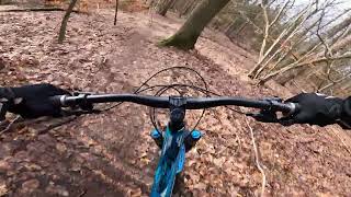
Naturalny singiel wzdłuz strumienia Zielonka.

Natural singletrack alongside Zielonka stream.

This trail is unsanctioned.

Disclaimer

This trail is Unsanctioned, Ride at your own Risk!

Tags
BermsJumps

Recent Activity on Trail

Past Week
  • 3 rides
  • 19 miles average
6 Months
  • 71 rides
  • 17 miles avg distance
All
  • 400 rides
  • Last: Nov 13, 2026
c1c2c3c4
January
February
March
April
May
June
July
August
September
October
November
December
Status:
on Nov 11, 2026
Ideal
Avg: 4.16 (7 votes)
Your vote: 0

view (2,322)
close
      Directions to eferka trailhead (53.474120, 14.506900)

      Photos

      6 more »
      mtb
      131 |
      Jul 6, 2021 @ 5:21am
      Jul 6, 2021
      mtb
      125 |
      Jul 6, 2021 @ 5:21am
      Jul 6, 2021
      mtb
      155 |
      Jan 13, 2021 @ 1:43am
      Jan 13, 2021
      mtb
      357 |
      Aug 5, 2009 @ 3:18pm
      Aug 5, 2009

      Videos

      2 more »
      Miś aka Eferka - Puszcza Wkrzańska
      mtb
      0:36 | 100 | Feb 13, 2024 , Szczecin
      Short Enduro trail
      mtb
      0:28 | 333 | Apr 29, 2012 , Szczecin

      Routes with this trail

      more »
      23 miles • 2,304 ft • 14 •
      trasa na rower MTB po Puszczy Wkrzańskiej
      4.5 ★★★★★
      7 Ratings
      5 ★ 57%
      4 ★ 29%
      3 ★ 14%
      2 ★
      1 ★

      21 Reviews & Comments

      pawez pawez
      No jakoś się nie dziwię. Nie rozumiem dlaczego urzędnicy mają taki problem ze wszystkim. Szkoda, że nie ma tam ludzi, którzy nie potrafią podłapać ciekawych pomysłów. Tym bardziej, że szlaki już są wyznaczone przez samych rowerzystów, wszystko jest wymyślone, tylko trzeba by to przenieść do lasu.
      vvoitas
      To jeszcze Pjotera skróć i zacznij w tym samym miejscu co misia. No chyba że masz inne założenia.
      foxxb foxxb
      Rzućcie okiem na Misia po poprawce, może tak zostać? Tworzy to możliwość dojazdu do niego w dwóch miejscach i jest spójne z całą siecią.

      We hope you've been enjoying Trailforks!

      Create a FREE account to view all trail reviews and much more.

      • #170088 - 1,480 views

      Frequently Asked Questions

      ▼ Where is Eferka located?
      Eferka is located in Puszcza Wkrzańska, Szczecin, Poland. It is part of the Puszcza Wkrzańska trail network. The trailhead is located at coordinates 53.47412, 14.5069.
      ▼ How hard is Eferka?
      Eferka is rated as Green difficulty. The physical rating is Easy. The average grade is 5.4%. The climb difficulty is rated Green.
      ▼ What is the elevation gain for Eferka?
      The trail has 106 ft of elevation descent. The elevation ranges from 147 ft to 255 ft.
      ▼ Is Eferka a point to point trail?
      Yes, Eferka is a point to point trail. The direction is Downhill Only. The trail type is singletrack.
      ▼ How long is Eferka?
      Eferka is 2,011 ft long. The trail type is singletrack.
      ▼ Are dogs allowed on Eferka?
      Yes, dogs are allowed on Eferka. Please keep dogs on a leash where required and clean up after them.
      ▼ When is the best time of year to ride Eferka?
      Eferka is best visited during: All year..
      ▼ How do I access Eferka? Where is the closest parking trailhead?
      The closest parking and trailhead locations to Eferka are: View all parking locations in the area.
      ▼ How long does it take to ride Eferka?
      Based on recorded activities, it takes an average of 1 minute to ride Eferka. The trail is 2,011 ft long. Actual times will vary based on fitness level, conditions, and pace. View recent activity logs for more details.
      ▼ How busy is Eferka?
      Eferka is a very popular trail. There have been 2,202 recorded activities on this trail. The trail has received 2,322 check-ins. View recent activity on this trail.

      Hit the Trail

      Open in App

      Get this trail on your phone instantly.

      open trail in app

      Download Trail

      Save to wishlist, Garmin & download.
      save the trail

      Find Related Routes

      Find routes and users activities that include this trail.
      find routes for this trail

      You must enter a description before submitting.

