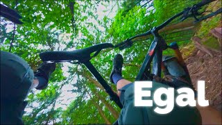
more stats
712 ft
Distance
-171 ft
Descent
00:03:19
Avg time
-171 ft
Altitude change
1,140 ft
Altitude min
1,311 ft
Altitude max
1,311 ft
Altitude start
1,142 ft
Altitude end
-24.1%
Grade
-50.1%
Grade max
-6.1%
Grade min
679 ft
Distance down
30 ft
Distance flat
00:03:19
Avg time

Egal Details

  • Activities
    • Mountain Bike
    • E-Bike
  • Riding Area
  • Difficulty Rating
  • Local Popularity
    75 in Mountain Biking [+]
    • 60 in E-Biking
  • Global Ranking
    #13925 in Mountain Biking [+]
    • #531 in E-Biking
  • National Ranking
    #504 in Mountain Biking · Germany [+]
    • #29 in E-Biking
  • Trail Type
    Singletrack
  • Bike Type
    AM
  • Trail Visibility
    Sometimes hard to follow
  • Dogs Allowed
    Yes
  • eBike Allowed
    Yes up to Class 1
  • TTFs on Trail
    Drop, Other
  • Year Opened
    2020

Kurzer aber knackiger Trail. Recht steil, teilweise offcamber, kann recht rutschig werden.

This trail is unsanctioned.

Tags
DropsFaint trail
Trail Supporters

Recent Activity on Trail

Past Week
  • 1 rides
  • 16 miles average
6 Months
  • 10 rides
  • 18 miles avg distance
All
  • 24 rides
  • Last: Oct 19, 2026
c1c2c3c4
January
February
March
April
May
June
July
August
September
October
November
December
update trails status or condition

Egal Trail Reports

statusdatedescription
Jul 18, 2026 @ 4:37pm (Europe/Berlin)
Jul 18, 2026
May 10, 2026 @ 7:40pm (Europe/Berlin)
May 10, 2026
reporter New line, in the steep part the straight shoot was eliminated and part of the old line is open again with some small optional gaps and a small...
May 2, 2026 @ 9:17pm (Europe/Berlin)
May 2, 2026
reporter Der Einstieg ist mit gestapelten Bäumen zugelegt, man kann aber links drank vorbei. Der erste Abschnitt ist dann fahrbar, wenn auch sehr...
Apr 20, 2026 @ 3:16pm (Europe/Luxembourg)
Apr 20, 2026
Mar 20, 2026 @ 8:44pm (Europe/Berlin)
Mar 20, 2026
reporter Trail gesperrt und da sind sie wohl auch mit den Erntemaschinen durchmarschiert
more »
Status:
on Jul 18, 2026
Ideal
Avg: 4.13 (3 votes)
Your vote: 0

view (187)
close
      Directions to egal trailhead (49.394630, 8.767440)

      Photos

      6 more »
      report
      mtb
      75 |
      Mar 20, 2026 @ 12:44pm
      Mar 20, 2026
      report
      mtb
      59 |
      Mar 20, 2026 @ 12:44pm
      Mar 20, 2026
      report
      mtb
      79 |
      Jul 21, 2024 @ 5:35pm
      Jul 21, 2024
      report
      mtb
      103 |
      Sep 2, 2023 @ 1:05pm
      Sep 2, 2023

      Videos

      1 more »
      Egal trails
      mtb
      8:16 | 222 | Aug 11, 2025 , Heidelberg
      4.7 ★★★★★
      3 Ratings
      5 ★ 67%
      4 ★ 33%
      3 ★
      2 ★
      1 ★

      1 Review & Comments

      hardtailssuck hardtailssuck
      Ende 2024 gibt es nach dem Steilstück eine Abzweigung nach rechts. Die in der Beschreibung erwähnte Überfahrt über den Querfelsen ist hier nicht enthalten. Die rechte Linie hat sich zunehmend als Hauptlinie durchgesetzt, da es unterhalb dieser nun ganz den Berg hinunter geht.

      We hope you've been enjoying Trailforks!

      Create a FREE account to view all trail reviews and much more.

      • #431956 - 877 views

      Frequently Asked Questions

      ▼ Where is Egal located?
      Egal is located in Heidelberg, Germany. It is part of the Heidelberg trail network. The trailhead is located at coordinates 49.39463, 8.76744.
      ▼ How hard is Egal?
      Egal is rated as Black difficulty. The average grade is 24.1%.
      ▼ What is the elevation gain for Egal?
      The trail has 171 ft of elevation descent. The elevation ranges from 1,140 ft to 1,311 ft.
      ▼ How long is Egal?
      Egal is 712 ft long. The trail type is singletrack.
      ▼ Are dogs allowed on Egal?
      Yes, dogs are allowed on Egal. Please keep dogs on a leash where required and clean up after them.
      ▼ How do I access Egal? Where is the closest parking trailhead?
      The closest parking and trailhead locations to Egal are: View all parking locations in the area.
      ▼ How long does it take to ride Egal?
      Based on recorded activities, it takes an average of 3 minutes to ride Egal. The trail is 712 ft long. Actual times will vary based on fitness level, conditions, and pace. View recent activity logs for more details.
      ▼ How busy is Egal?
      Egal is a very popular trail. There have been 150 recorded activities on this trail. The trail has received 187 check-ins. View recent activity on this trail.

      Hit the Trail

      Open in App

      Get this trail on your phone instantly.

      open trail in app

      Download Trail

      Save to wishlist, Garmin & download.
      save the trail

      Find Related Routes

      Find routes and users activities that include this trail.
      find routes for this trail

      You must enter a description before submitting.