

more stats
3,734 ft
Distance
-302 ft
Descent
00:04:31
Avg time
-302 ft
Altitude change
510 ft
Altitude min
812 ft
Altitude max
812 ft
Altitude start
509 ft
Altitude end
-8.1%
Grade
-18.3%
Grade max
-2.7%
Grade min
3,734 ft
Distance down
00:04:31
Avg time

Eh-Line Details

  • Activities
    • Mountain Bike
  • Riding Area
    Hillside Park
    Anchorage, Alaska
  • Difficulty Rating
  • Voted Difficulty
    Black Diamond (2 votes)
  • Local Popularity
    95 in Mountain Biking
  • Global Ranking
    #19915 in Mountain Biking
  • State Ranking
    #47 in Mountain Biking · Alaska
  • Trail Type
    Singletrack
  • Bike Type
    DH, AM, DJ
  • Season
    Year Round
  • Dogs Allowed
    Yes
  • TTFs on Trail
    Berm, Drop, Jump, Gap Jump

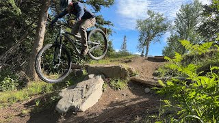
This black diamond flow trail gets bigger as you go. Starting with the airable rock roll at the top to the sendable bridge at Goal Posts and continuing down to the technical finishing section at the bottom – Eh-Line naturally pulls you through a progressively larger rhythm of tables and doubles. Trust the flow No need to pedal or brake if you find the right rhythm and trust the trail. Not only is this a nod to the venerable Whistler headline trail A-Line, but to the two Canadians on this project – Gravity Logic’s Design Consultant Tom Prochazka (Tom Pro) and STA Project Lead Cody Gauer. Tom Pro is Gravity Logic’s Godfather of trail construction and responsible for world famous runs like A-Line, Dirt Merchant, and Crank it Up. A master of design and with a natural eye for flow, Tom’s design elements can be felt throughout the new trail network.

Tags
BermsDropsJumps
Local Trail Association
Traditionally Indigenous Territory

Recent Activity on Trail

Past Week
  • 19 rides
  • 9 miles average
6 Months
  • 263 rides
  • 10 miles avg distance
All
  • 1,558 rides
  • Last: Sep 28, 2026
c1c2c3c4
January
February
March
April
May
June
July
August
September
October
November
December
update trails status or condition

Eh-Line Trail Reports

Status:
on May 31, 2026
Avg: 4.68 (13 votes)
Your vote: 0

view (11,303)
close
      Directions to ehline trailhead (61.144130, -149.721100)

      Photos

      30 more »
      mtb
      71 |
      Sep 6, 2024 @ 1:41am
      Sep 6, 2024
      mtb
      85 |
      Sep 6, 2024 @ 1:41am
      Sep 6, 2024
      mtb
      107 |
      Aug 26, 2024 @ 8:05am
      Aug 26, 2024
      mtb
      103 |
      Aug 26, 2024 @ 8:05am
      Aug 26, 2024

      Videos

      12 more »
      Eh-Line ambience- Just the trail!
      mtb
      2:54 | 236 | Aug 18, 2025 , Anchorage
      Eh-Line
      mtb
      4:39 | 301 | May 31, 2025 , Anchorage
      Fatbike down Eh-line
      mtb
      6:12 | 200 | Feb 10, 2025 , Anchorage
      Alaska: Living The Wild Life - An MTB Road Trip
      mtb
      18:13 | 211 | Feb 10, 2025 , Anchorage

      Trail Lists

      Routes with this trail

      6 miles • 796 ft • 18 • Loop •
      Nice quick Hillside route that maximizes descent for your climb. There's still the long climb up Queen Bee...
      ★ 5.0 • 5 miles • 761 ft • 4 • Loop • Race •
      2021 Hillside Hustler #1 Race Course Up Spencer Loop Backwards Left down Trench Trail Right on Gasline...
      5 miles • 951 ft • 1 • Loop • Race •
      2020 Hillside Mangler XC Course Starting at the Base of Hilltop Ski Area Climb up the Hilltop Cat Track...
      5.0 ★★★★★
      13 Ratings
      5 ★ 100%
      4 ★
      3 ★
      2 ★
      1 ★

      2 Reviews & Comments

      Rebecca1712 Rebecca1712
      Not a black line either, would rate it as a blue, but it’s fun
      mexicanbobcat
      Trail is wet and slippery! Try not to drag your back tire through the lower steep sections.

      We hope you've been enjoying Trailforks!

      Create a FREE account to view all trail reviews and much more.

      Frequently Asked Questions

      ▼ Where is Eh-Line located?
      Eh-Line is located in Hillside Park, Anchorage, Alaska, United States. It is part of the Hillside Park trail network. The trailhead is located at coordinates 61.14413, -149.7211.
      ▼ How hard is Eh-Line?
      Eh-Line is rated as Black Diamond difficulty. The average grade is 8.1%.
      ▼ What is the elevation gain for Eh-Line?
      The trail has 302 ft of elevation descent. The elevation ranges from 510 ft to 812 ft.
      ▼ How long is Eh-Line?
      Eh-Line is 3,734 ft long. The trail type is singletrack.
      ▼ Are dogs allowed on Eh-Line?
      Yes, dogs are allowed on Eh-Line. Please keep dogs on a leash where required and clean up after them.
      ▼ When is the best time of year to ride Eh-Line?
      Based on activity log data, the most popular months to ride Eh-Line are:
      • June (184 activities)
      • August (167 activities)
      • July (137 activities)
      Check the reports page for current trail conditions.
      ▼ How do I access Eh-Line? Where is the closest parking trailhead?
      The closest parking and trailhead locations to Eh-Line are: View all parking locations in the area.
      ▼ How long does it take to ride Eh-Line?
      Based on recorded activities, it takes an average of 5 minutes to ride Eh-Line. The trail is 3,734 ft long. Actual times will vary based on fitness level, conditions, and pace. View recent activity logs for more details.
      ▼ How busy is Eh-Line?
      Eh-Line is a very popular trail. There have been 10,116 recorded activities on this trail. The trail has received 11,303 check-ins. View recent activity on this trail.

      Hit the Trail

      Open in App

      Get this trail on your phone instantly.

      open trail in app

      Download Trail

      Save to wishlist, Garmin & download.
      save the trail

      Find Related Routes

      Find routes and users activities that include this trail.
      find routes for this trail

      You must enter a description before submitting.