

more stats
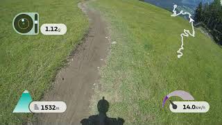
3.1 miles
Distance
109 ft
Climb
-1,274 ft
Descent
00:15:03
Avg time
-1,165 ft
Altitude change
4,488 ft
Altitude min
5,663 ft
Altitude max
5,653 ft
Altitude start
4,488 ft
Altitude end
-7.1%
Grade
-39.7%
Grade max
14.8%
Grade min
2,559 ft
Distance climb
2 miles
Distance down
1,535 ft
Distance flat
00:15:03
Avg time

Eiskar Trail Details

  • Activities
    • Mountain Bike
    • E-Bike
  • Riding Area
  • Ref Number
    #100
  • Difficulty Rating
  • Voted Difficulty
    Green (1 vote)
  • Local Popularity
    90 in Mountain Biking [+]
    • 90 in E-Biking
  • Global Ranking
    #47498 in Mountain Biking [+]
    • #751 in E-Biking
  • National Ranking
    #413 in Mountain Biking · Austria [+]
    • #6 in E-Biking
  • Trail Type
    Singletrack
  • Bike Type
    DH, AM, XC
  • Physical Rating
    Moderate
  • Trail Visibility
    Always easy to follow
  • Season
    May-October
  • Family Friendly
    Yes
  • eBike Allowed
    Yes up to Class 1

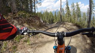
Direkt an der Bergstation Preunegg Jet beginnt der
Eiskar Trail, der sich auch für Einsteiger bestens eignet.
Die Strecke ist frei von Hindernissen und Stufen und
lädt mit dem flowigen Verlauf dazu ein, die Bremsen
offen zu lassen. Nach 300 m auf einem Forstweg, folgt
mit dem Schnepfenwald Trail die Fortsetzung der
blauen Abfahrt.

Tags
Family friendly

Recent Activity on Trail

Past Week
  • 0 rides
  •  
6 Months
  • 63 rides
  • 31 miles avg distance
All
  • 158 rides
  • Last: Oct 30, 2026
c1c2c3c4
January
February
March
April
May
June
July
August
September
October
November
December
Status:
on Aug 24, 2026
Ideal
Avg: 4.09 (15 votes)
Your vote: 0

view (1,618)
close
      Directions to eiskar-trail trailhead (47.360140, 13.596480)

      Photos

      12 more »
      mtb
      115 |
      Aug 29, 2025 @ 11:08pm
      Aug 29, 2025
      mtb
      186 |
      Jul 21, 2020 @ 11:10pm
      Jul 21, 2020
      mtb
      154 |
      Jul 21, 2020 @ 11:10pm
      Jul 21, 2020
      mtb
      154 |
      Jul 21, 2020 @ 11:10pm
      Jul 21, 2020

      Videos

      2 more »
      Reiteralm | Eiskar Trail - Schnepfenwald Trail...
      mtb
      21:01 | 765 | Aug 27, 2020 , My City
      Eiskar Trail
      mtb
      5:59 | 1473 | Aug 20, 2019 , My City
      4.2 ★★★★★
      15 Ratings
      5 ★ 53%
      4 ★ 20%
      3 ★ 20%
      2 ★
      1 ★ 7%

      5 Reviews & Comments

      allowthegoddamnprotonmail
      Great trail to ride with beginners. It's not exposed and so isn't dry, easy for beginners and it's not super boring if you're experienced. I'd take people here rather than Planai any day.
      ktm-boy-69 ktm-boy-69
      Geleck, da sind ja a paar ziemlich "wilde" Kurven verbaut. Wellen zum Abziehen genau vor dem 180° Anlieger sind auch eher suboptimal. Teilweise sehr flach, für Anfänger zum Durchrollen aber voll okay (sind heute auch Leute mit dem Baumarktradl hinunter gefahren). Auf den Flow muss man aber lange warten – wirklich toll ist eigentlich nur der Abschnitt wo der Hochalm-Trail in den Trail hereinzweigt bis zum Trailende hinunter. Der ist wirklich gut gelungen! Die ganzen Abschnitte davor sind eher ein wenig mühsam ...

      We hope you've been enjoying Trailforks!

      Create a FREE account to view all trail reviews and much more.

      • By chiara0 & contributors
      • #183835 - 2,767 views

      Frequently Asked Questions

      ▼ Where is Eiskar Trail located?
      Eiskar Trail is located in Schladming-Dachstein, Austria. It is part of the Schladming-Dachstein trail network. The trailhead is located at coordinates 47.36014, 13.59648.
      ▼ How hard is Eiskar Trail?
      Eiskar Trail is rated as Blue difficulty. The physical rating is Moderate. The average grade is 7.1%.
      ▼ What is the elevation gain for Eiskar Trail?
      Eiskar Trail has 109 ft of elevation gain. The trail has 1,274 ft of elevation descent. The elevation ranges from 4,488 ft to 5,663 ft.
      ▼ How long is Eiskar Trail?
      Eiskar Trail is 3.1 miles long. The trail type is singletrack.
      ▼ Are dogs allowed on Eiskar Trail?
      There is no information about dogs being allowed on Eiskar Trail. Check with local trail managers or the trail page for the latest access rules.
      ▼ When is the best time of year to ride Eiskar Trail?
      Eiskar Trail is best visited during: May-October.
      ▼ How do I access Eiskar Trail? Where is the closest parking trailhead?
      The closest parking and trailhead locations to Eiskar Trail are: View all parking locations in the area.
      ▼ How long does it take to ride Eiskar Trail?
      Based on recorded activities, it takes an average of 15 minutes to ride Eiskar Trail. The trail is 3.1 miles long. Actual times will vary based on fitness level, conditions, and pace. View recent activity logs for more details.
      ▼ How busy is Eiskar Trail?
      Eiskar Trail is a very popular trail. There have been 655 recorded activities on this trail. The trail has received 1,618 check-ins. View recent activity on this trail.

      Hit the Trail

      Open in App

      Get this trail on your phone instantly.

      open trail in app

      Download Trail

      Save to wishlist, Garmin & download.
      save the trail

      Find Related Routes

      Find routes and users activities that include this trail.
      find routes for this trail

      You must enter a description before submitting.

