


Open in App
Get this trail on your phone instantly.

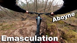
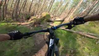
Trail has been re opened by someone, it has slightly changed in the top section and a bit of a new line in the middle part. and a new ending which goes right instead off going into the old tip. but it is good to have it opened but it defo isn't a red now more black
Cycle up water tank track and head up over Birsemore hill, slight push up.
This trail is unsanctioned.
| c1 | c2 | c3 | c4 |
|---|---|---|---|
January | February | March | April |
May | June | July | August |
September | October | November | December |

Service Road Atlas is a free to use, community-driven service for viewing and creating reports on the numerous back-country service roads around B.C. and Alberta.
Save the current map location and zoom level as your default home location whenever this page is loaded.
SaveWe hope you've been enjoying Trailforks!
Create a FREE account to view trail comments and much more.
You must enter a description before submitting.

