
more stats
2.2 miles
Distance
120 ft
Climb
-749 ft
Descent
00:25:10
Avg time
-631 ft
Altitude change
741 ft
Altitude min
1,387 ft
Altitude max
1,372 ft
Altitude start
741 ft
Altitude end
-5.3%
Grade
-57%
Grade max
34.9%
Grade min
1,923 ft
Distance climb
2 miles
Distance down
1,145 ft
Distance flat
00:25:10
Avg time

Empedrat Details

  • Activities
    • Mountain Bike
    • E-Bike
    • Hike
    • Trail Running
  • Riding Area
    Cap de Creus
    Figueres
  • Difficulty Rating
  • Local Popularity
    85 in Mountain Biking [+]
    • 90 in E-Biking
    • 65 in Trail Running
    • 75 in Hiking
  • Global Ranking
    #119907 in Mountain Biking [+]
    • #2924 in E-Biking
    • #114670 in Trail Running
    • #123769 in Hiking
  • National Ranking
    #9,810 in Mountain Biking · Spain [+]
    • #1,170 in E-Biking
    • #10,188 in Trail Running
    • #8,650 in Hiking
  • Hiking SAC Scale
    T1 Hiking
  • Trail Type
    Singletrack
  • Bike Type
    AM, XC
  • Direction
    Downhill Primary
    Popular Direction Shown
  • Climb Difficulty
    Black Diamond
  • Physical Rating
    Moderate
  • Trail Visibility
    Always easy to follow
  • Dogs Allowed
    Yes
  • eBike Allowed
    Yes up to Class 1
  • TTFs on Trail
    Drop, Rock Face, Rock Garden

CAT: Part alta, moltes lloses de pedra, cal navegar be. Un parell de drops de pujada. Part mija, pedra mes solta, i mes rapida. Part inferior terra. Pendent moderat. Molt recomanable.

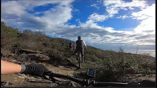
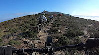
ENG:Very tight singletrack with a very mellow gradient but plenty of rocks, thus you have to focus all the way down.

Tags
DropsRock gardensRock slabs

Recent Activity on Trail

Past Week
  • 0 rides
  •  
6 Months
  • 7 rides
  • 23 miles avg distance
All
  • 41 rides
  • Last: Oct 29, 2026
c1c2c3c4
January
February
March
April
May
June
July
August
September
October
November
December
update trails status or condition

Empedrat Trail Reports

Status:
on Aug 30, 2026
Ideal
Avg: 3.74 (12 votes)
Your vote: 0

view (222)
close
      Directions to empedrat trailhead (42.274360, 3.229150)

      Photos

      21 more »
      mtb
      45 |
      May 15, 2025 @ 4:36am
      May 15, 2025
      mtb
      51 |
      May 15, 2025 @ 4:36am
      May 15, 2025
      mtb
      40 |
      May 15, 2025 @ 4:36am
      May 15, 2025
      mtb
      40 |
      May 15, 2025 @ 4:36am
      May 15, 2025

      Videos

      3 more »
      Empedrat Full
      mtb
      15:41 | 380 | Nov 18, 2023 , Figueres
      Cami vell del Peni
      mtb
      14:10 | 174 | Mar 7, 2022 , Figueres
      Empedrat + cruilla (full)
      ebike
      19:58 | 297 | Apr 15, 2023 , Figueres
      3.7 ★★★★★
      12 Ratings
      5 ★ 17%
      4 ★ 50%
      3 ★ 25%
      2 ★
      1 ★ 8%

      7 Reviews & Comments

      canovi7 canovi7
      va a gustos, jo el trobo excelent, vistarrakes, pedrotes, flow, airet! què més es pot demanar a la vida?
      Simbosu
      I acknowledge what the rider before mentioned. First part is up and down, more technical and difficult to "ride with flow". I please take care of the many pieces of broken glasses in the upper section., see my pictures. These are a lot and spreaded over 100m. Also there are often stones Exactly in the middle located, which are not naturally being there.

      Thanks for the nice trail, keeping the trails in shape!
      mastamars
      First half of trail has some technical climbs and descents which are more red than blue in my opinion. Second part is more flowing.

      We hope you've been enjoying Trailforks!

      Create a FREE account to view all trail reviews and much more.

      • By Wolf34TF Pro TFSPAIN & contributors
      • #347861 - 1,227 views

      Frequently Asked Questions

      ▼ Where is Empedrat located?
      Empedrat is located in Cap de Creus, Figueres, Spain. It is part of the Cap de Creus trail network. The trailhead is located at coordinates 42.27436, 3.22915.
      ▼ How hard is Empedrat?
      Empedrat is rated as Blue difficulty. The physical rating is Moderate. The average grade is 5.3%. The climb difficulty is rated Black Diamond.
      ▼ What is the elevation gain for Empedrat?
      Empedrat has 120 ft of elevation gain. The trail has 749 ft of elevation descent. The elevation ranges from 741 ft to 1,387 ft.
      ▼ Is Empedrat a point to point trail?
      Empedrat is not a point to point trail. The direction is Downhill Primary. The trail type is singletrack.
      ▼ How long is Empedrat?
      Empedrat is 2.2 miles long. The trail type is singletrack.
      ▼ Are dogs allowed on Empedrat?
      Yes, dogs are allowed on Empedrat. Please keep dogs on a leash where required and clean up after them.
      ▼ When is the best time of year to ride Empedrat?
      Based on activity log data, the most popular months to ride Empedrat are:
      • December (6 activities)
      • August (5 activities)
      • April (4 activities)
      Check the reports page for current trail conditions.
      ▼ How do I access Empedrat? Where is the closest parking trailhead?
      The closest parking and trailhead locations to Empedrat are: View all parking locations in the area.
      ▼ How long does it take to ride Empedrat?
      Based on recorded activities, it takes an average of 25 minutes to ride Empedrat. The trail is 2.2 miles long. Actual times will vary based on fitness level, conditions, and pace. View recent activity logs for more details.
      ▼ How busy is Empedrat?
      Empedrat is a very popular trail. There have been 226 recorded activities on this trail. The trail has received 222 check-ins. View recent activity on this trail.

      Hit the Trail

      Open in App

      Get this trail on your phone instantly.

      open trail in app

      Download Trail

      Save to wishlist, Garmin & download.
      save the trail

      Find Related Routes

      Find routes and users activities that include this trail.
      find routes for this trail

      You must enter a description before submitting.

