more stats
3,328 ft
Distance
3 ft
Climb
-309 ft
Descent
00:04:30
Avg time
-306 ft
Altitude change
188 ft
Altitude min
494 ft
Altitude max
494 ft
Altitude start
188 ft
Altitude end
-29.844%
Grade max
4.079%
Grade min
56 ft
Distance climb
3,197 ft
Distance down
75 ft
Distance flat
00:04:30
Avg time

EP Details

  • Activities
    • Mountain Bike
    • E-Bike
    • Hike
    • Trail Running
  • Riding Area
    Wild Park
    Brighton
  • Difficulty Rating
  • Local Popularity
    15 in Mountain Biking [+]
    • 5 in E-Biking
    • 5 in Trail Running
    • 5 in Hiking
  • Global Ranking
    #143710 in Mountain Biking [+]
    • #104661 in E-Biking
    • #134226 in Trail Running
    • #127698 in Hiking
  • Trail Type
    Singletrack
  • Bike Type
    DH
  • Direction
    Downhill Primary
  • Physical Rating
    Hard
  • Dogs Allowed
    Yes
  • eBike Allowed
    Yes up to Class 1
  • Land Owner
    Brighton and Hove City Council

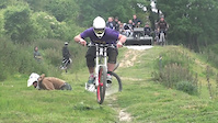
A long flat-out singletrack descent, watch out for dog walkers. Finish by hucking the stair sets like its 1999.

This trail is unsanctioned.

Recent Activity on Trail

Past Week
  • 0 rides
  •  
6 Months
  • 2 rides
  • 8 miles avg distance
All
  • 6 rides
  • Last: Apr 29, 2026
c1c2c3c4
January
February
March
April
May
June
July
August
September
October
November
December
update trails status or condition

EP Trail Reports

statusdatedescription
Apr 1, 2021 @ 1:08am
Apr 1, 2021
Apr 5, 2020 @ 12:29am
Apr 5, 2020
Mar 23, 2019 @ 7:24am
Mar 23, 2019
Mar 23, 2019 @ 7:24am
Mar 23, 2019
Mar 18, 2017 @ 1:23pm
Mar 18, 2017
Nice and simple trail, other than a couple of roots here and there no technical skills required
more »
Status:
on Apr 1, 2021
Dry
Avg: 3.99 (2 votes)
Your vote: 0

view (48)
close
3D
Trail Conditions
  • Unknown
  • Snow Groomed
  • Snow Packed
  • Snow Covered
  • Snow Cover Partial
  • Freeze/thaw Cycle
  • Icy
  • Prevalent Mud
  • Wet
  • Variable
  • Ideal
  • Dry
  • Very Dry
Trail Flow (Ridden Direction)
Trailforks scans users ridelogs to determine the most popular direction each trail is ridden. A good flowing trail network will have most trails flowing in a single direction according to their intension.
The colour categories are based on what percentage of riders are riding a trail in its intended direction.
  • > 96%
  • > 90%
  • > 80%
  • > 70%
  • > 50%
  • < 50%
  • bi-directional trail
  • no data
Trail Last Ridden
Trailforks scans ridelogs to determine the last time a trail was ridden.
  • < 2 days
  • < 1 week
  • < 2 weeks
  • < 1 month
  • < 6 months
  • > 6 months
Trail Ridden Direction
The intended direction a trail should be ridden.
  • Downhill Only
  • Downhill Primary
  • Both Directions
  • Uphill Primary
  • Uphill Only
  • One Direction
Contribute Details
Colors indicate trail is missing specified detail.
  • Description
  • Photos
  • Description & Photos
  • Videos
Trail Popularity ?
Trailforks scans ridelogs to determine which trails are ridden the most in the last 9 months. Trails are compared with nearby trails in the same city region with a possible 25 colour shades. Think of this as a heatmap, more rides = more kinetic energy = warmer colors.
  • most popular
  • popular
  • less popular
  • not popular
ATV/ORV/OHV Filter
Max Vehicle Width
inches
US Cell Coverage
Legend
cell carrier legend

Radar Time
Activity Recordings
Trailforks uses anonymized public activity data. ?
Activity Recordings
Trailforks uses anonymized public activity data. ?
Personal Heatmap
Activity Types
all / none
Options
2
Date range month
Winter Trails
Warning A routing network for winter maps does not exist. Selecting trails using the winter trails layer has been disabled.
Missing Trails
Most Popular
Least Popular
Trails are colored based on popularity. The more popular a trail is, the more red. Less popular trails trend towards green.
Jump Magnitude Heatmap
Heatmap of where riders jump on trails. Zoom in to see individual jumps, click circles to view jump details.
BC Backroad Status

Service Road Atlas is a free to use, community-driven service for viewing and creating reports on the numerous back-country service roads around B.C. and Alberta.

map legend
Slope Aspect
Direction the slope faces
Flat N NE E SE S SW W NW
Trails Deemphasized
Trails are shown in grey.
disable
Only show trails with no bike usage.
Enable
Suggested Layers
Based on selected activity type

    Save the current map location and zoom level as your default home location whenever this page is loaded.

    Save
        Directions to ep trailhead (50.856444, -0.120552)

        Photos

        No photos have been added for EP yet, add a photo.

        Videos

        8 more »
        Fight or Flight Ep 3 - Nice guys finish last...
        3:40 | 1128 | May 30, 2011 , Brighton
        STB Racing ep.2 - Gravity Project
        3:00 | 414 | Jul 1, 2012 , Brighton
        STB Racing Ep 3 - No sponsors, no spikes, no...
        4:44 | 344 | Jul 9, 2012 , Brighton
        STB Racing ep.1 - Enduro
        0:31 | 233 | Jun 23, 2012 , Brighton

        1 Review & Comments


        We hope you've been enjoying Trailforks!

        Create a FREE account to view trail comments and much more.

        • #24859 - 2,711 views

        Frequently Asked Questions About EP

        Where is EP located?
        EP is located in Wild Park, Brighton, United Kingdom. It is part of the Wild Park trail network. The trailhead is located at coordinates 50.85644, -0.12055.
        How hard is EP?
        EP is rated as Green difficulty. The physical rating is Hard.
        What is the elevation gain for EP?
        EP has 3 ft of elevation gain. The trail has 309 ft of elevation descent. The elevation ranges from 188 ft to 494 ft.
        Is EP a point to point trail?
        EP is not a point to point trail. The direction is Downhill Primary. The trail type is singletrack.

        Hit the Trail

        Open in App

        Get this trail on your phone instantly.
        open trail in app

        Download Trail

        Save to wishlist, Garmin & download.
        save the trail

        Find Related Routes

        Find routes and users activities that include this trail.
        find routes for this trail

        You must enter a description before submitting.