more stats
3,793 ft
Distance
3 ft
Climb
-680 ft
Descent
00:07:34
Avg time
-677 ft
Altitude change
2,503 ft
Altitude min
3,180 ft
Altitude max
3,180 ft
Altitude start
2,503 ft
Altitude end
-17.8%
Grade
-87.4%
Grade max
4.1%
Grade min
194 ft
Distance climb
3,520 ft
Distance down
00:07:34
Avg time

Espierlo Details

  • Activities
    • Mountain Bike
    • E-Bike
    • Hike
    • Trail Running
  • Riding Area
  • Ref Number
    1
  • Difficulty Rating
  • Voted Difficulty
    Red (2 votes)
  • Local Popularity
    90 in Mountain Biking [+]
    • 70 in E-Biking
    • 85 in Trail Running
    • 5 in Hiking
  • Global Ranking
    #69590 in Mountain Biking [+]
    • #108758 in E-Biking
    • #112377 in Trail Running
    • #290307 in Hiking
  • National Ranking
    #4,805 in Mountain Biking · Spain [+]
    • #24,315 in E-Biking
    • #10,030 in Trail Running
    • #28,661 in Hiking
  • Hiking SAC Scale
    T2 Mountain Hiking
  • Trail Type
    Singletrack
  • Bike Type
    AM, XC, Fat
  • Direction
    Downhill Primary
    Popular Direction Shown
  • Climb Difficulty
    Black Diamond
  • Physical Rating
    Moderate
  • Trail Visibility
    Always easy to follow
  • Dogs Allowed
    Yes
  • eBike Allowed
    Yes up to Class 1
  • TTFs on Trail
    Rock Face
  • Ride in Rain
    Yes
  • Year Opened
    2010

Estamos ante un descenso singular, no hay nada parecido en los alredadores. El camino va trazando curvas de herradura no muy cerradas y el terreno es gravilla. La diversión esta asegurada. La mejor opción para salir en dia lluvioso o previsión de barro aqui no hay.

Tags
Rock slabs

Trail Supporters

Local Trail Association

Recent Activity on Trail

Past Week
  • 1 rides
  • 17 miles average
6 Months
  • 4 rides
  • 16 miles avg distance
All
  • 40 rides
  • Last: Oct 28, 2026
c1c2c3c4
January
February
March
April
May
June
July
August
September
October
November
December
update trails status or condition

Espierlo Trail Reports

statusdatedescription
Sep 17, 2025 @ 5:47pm (Europe/Andorra)
Sep 17, 2025
Jan 3, 2025 @ 3:49am
Jan 3, 2025
reporter
repaso con azada maza y serrucho
Nov 1, 2024 @ 1:29pm
Nov 1, 2024
Al verla azul pensaba q seria fluida y sencilla, pero me ha sorprendido. Bonita bajada pedregosa con alguna curva tecnica y algun paso. Recomendable.
Oct 5, 2024 @ 2:37pm
Oct 5, 2024
Sep 28, 2024 @ 2:14pm
Sep 28, 2024
Bajada de flow pedrolero muy guapa
more »
Status:
on Sep 17, 2025
Dry
Avg: 4.25 (10 votes)
Your vote: 0

view (241)
close
      Directions to espierlo trailhead (42.440330, 0.036320)

      Photos

      10 more »
      mtb
      49 |
      Sep 28, 2024 @ 2:22pm
      Sep 28, 2024
      mtb
      60 |
      May 20, 2023 @ 5:33pm
      May 20, 2023
      mtb
      65 |
      May 12, 2023 @ 11:34am
      May 12, 2023
      mtb
      69 |
      May 12, 2023 @ 1:27am
      May 12, 2023

      Videos

      2 more »
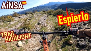
      youtuber AINSA Trail Highlight: Espierlo FULL / Rocks,...
      mtb
      7:59 | 513 | Jun 17, 2022 , Ainsa

      Routes with this trail

      ★ 5.0 • 12 miles • 2,943 ft • 9 • Loop •
      Ruta Extrem muy cañera. Para gozarla tanto subiendo como bajando. Se incorporan sendas poco o nada...
      ★ 4.5 • 15 miles • 3,379 ft • 6 • Loop •
      TIEMPO: 3h. - 3h. 30' h BALIZADA: Sólo GPS. CON BARRO: Nada recomendable Ruta recomendada para Trail...
      ★ 5.0 • 14 miles • 2,775 ft • 5 • Loop •
      DESCRIPCIÓN La sierra Ferrera es un filón de senderos. Te proponemos una ruta de unas 3 horas ampliable...
      4.4 ★★★★★
      10 Ratings
      5 ★ 60%
      4 ★ 30%
      3 ★
      2 ★ 10%
      1 ★

      1 Review & Comments

      theflipside
      This trail is more difficult than other blue trails in the area. Harder than Cerro Coasta in my opinion. A mixture of very grippy bedrock and loose gravel/rocks. Little soil and excellent after rain. The lower part has more soil and has a few washed out parts. Cool trail for good riders.

      We hope you've been enjoying Trailforks!

      Create a FREE account to view all trail reviews and much more.

      • By boltranger & contributors
      • #94443 - 1,537 views

      Frequently Asked Questions

      ▼ Where is Espierlo located?
      Espierlo is located in Zona Zero Centro, Ainsa, Spain. It is part of the Zona Zero Centro trail network. The trailhead is located at coordinates 42.44033, 0.03632.
      ▼ How hard is Espierlo?
      Espierlo is rated as Blue difficulty. The physical rating is Moderate. The average grade is 17.8%. The climb difficulty is rated Black Diamond.
      ▼ What is the elevation gain for Espierlo?
      Espierlo has 3 ft of elevation gain. The trail has 680 ft of elevation descent. The elevation ranges from 2,503 ft to 3,180 ft.
      ▼ Is Espierlo a point to point trail?
      Espierlo is not a point to point trail. The direction is Downhill Primary. The trail type is singletrack.
      ▼ How long is Espierlo?
      Espierlo is 3,793 ft long. The trail type is singletrack.
      ▼ Are dogs allowed on Espierlo?
      Yes, dogs are allowed on Espierlo. Please keep dogs on a leash where required and clean up after them.
      ▼ When is the best time of year to ride Espierlo?
      Based on activity log data, the most popular months to ride Espierlo are:
      • May (3 activities)
      • October (3 activities)
      • March (2 activities)
      Check the reports page for current trail conditions.
      ▼ How do I access Espierlo? Where is the closest parking trailhead?
      The closest parking and trailhead locations to Espierlo are: View all parking locations in the area.
      ▼ How long does it take to ride Espierlo?
      Based on recorded activities, it takes an average of 8 minutes to ride Espierlo. The trail is 3,793 ft long. Actual times will vary based on fitness level, conditions, and pace. View recent activity logs for more details.
      ▼ How busy is Espierlo?
      Espierlo is a very popular trail. There have been 258 recorded activities on this trail. The trail has received 241 check-ins. View recent activity on this trail.

      Hit the Trail

      Open in App

      Get this trail on your phone instantly.

      open trail in app

      Download Trail

      Save to wishlist, Garmin & download.
      save the trail

      Find Related Routes

      Find routes and users activities that include this trail.
      find routes for this trail

      You must enter a description before submitting.