
more stats
2,664 ft
Distance
12 ft
Climb
-225 ft
Descent
00:05:35
Avg time
-214 ft
Altitude change
1,689 ft
Altitude min
1,903 ft
Altitude max
1,903 ft
Altitude start
1,690 ft
Altitude end
-8%
Grade
-26.6%
Grade max
6.7%
Grade min
246 ft
Distance climb
2,126 ft
Distance down
262 ft
Distance flat
00:05:35
Avg time

Evenflow Details

  • Activities
    • Mountain Bike
    • E-Bike
    • Winter Fat Bike
  • Riding Area
    Quesnel Bike Park
    Quesnel, British Columbia
  • Difficulty Rating
  • Local Popularity
    90 in Mountain Biking [+]
    • 80 in E-Biking
    • 5 in Winter Fat Biking
  • Global Ranking
    #51639 in Mountain Biking [+]
    • #20688 in E-Biking
  • Trail Type
    Machine Groomed
  • Bike Type
    DH, AM, XC, DJ, Fat
  • Direction
    Downhill Only
  • Physical Rating
    Easy
  • Trail Visibility
    Always easy to follow
  • Season
    Apr - Nov
  • Family Friendly
    Yes
  • eBike Allowed
    Yes up to Class 1
  • TTFs on Trail
    Berm, Bridge, Jump, Ladder Bridge, Other
  • Land Owner

Machine built flow trail. Designated biking trail by the town of Quesnel. Biking only. Easily found; signs mark trail head.

Access Info

Trail starts near the top of the old Bryce road. If biking up, park at the Quesnel & Districts Arts & Recreation Centre. The bike park (dirt jumps) are located on the Northside. Follow the trail South, until you hit a paved walking path (Bryce Rd) and follow the path for about 1km, until you are parallel with the highway and almost at the top. There will be a sign marking the trail head on your left. The trail can also be accessed from the top. Drive North on the highway (coming from Wal-Mart) and turn left on Dragon Hill Road (at AG Foods). Follow Dragon Hill road, west, until you can't go any further (couple hundred meters) and the parking lot is on your left.

Local Trail Association

Recent Activity on Trail

Past Week
  • 0 rides
  •  
6 Months
  • 11 rides
  • 9 miles avg distance
All
  • 78 rides
  • Last: Sep 16, 2026
c1c2c3c4
January
February
March
April
May
June
July
August
September
October
November
December
update trails status or condition

Evenflow Trail Reports

statusdatedescription
Apr 13, 2026 @ 6:44pm (America/Vancouver)
Apr 13, 2026
reporter Open - Early Season Conditions
Mar 23, 2026 @ 9:23am (America/Vancouver)
Mar 23, 2026
reporter Closed during spring melt - Please respect the closure until the Bike Park dries out
Jun 18, 2025 @ 12:15pm
Jun 18, 2025
Apr 7, 2025 @ 8:07pm
Apr 7, 2025
reporter Early Season conditions - ride with caution
Apr 6, 2025 @ 11:44am
Apr 6, 2025
reporter Open early season conditions
more »
Status:
on Apr 13, 2026
Ideal
Avg: 4.17 (5 votes)
Your vote: 0

view (905)
close
      Directions to evenflow-28555 trailhead (52.982870, -122.459630)

      Photos

      15 more »
      mtb
      69 |
      Jun 18, 2025 @ 9:21pm
      Jun 18, 2025
      mtb
      150 |
      Jun 3, 2025 @ 9:19am
      Jun 3, 2025
      mtb
      82 |
      Nov 1, 2023 @ 1:36pm
      Nov 1, 2023
      mtb
      70 |
      Nov 1, 2023 @ 1:35pm
      Nov 1, 2023

      Videos

      4 more »
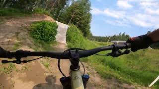
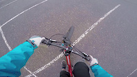
      Even flow at the Quesnel bike park
      mtb
      569 | Jun 30, 2023 , Quesnel
      mtb
      0:12 | 126 | Aug 2, 2022 , Quesnel
      mtb
      0:12 | 67 | Aug 2, 2022 , Quesnel
      Quesnel Flow Trail
      mtb
      2:58 | 605 | Jun 15, 2015 , Quesnel

      Routes with this trail

      10 miles 735 ft 6
      Ride all over town. From Downtown and back the long way.
      5.0 2 miles 328 ft 2 Race
      Combined time Downhill race on Sunday August 23. 1. Around the Bend 2. Even Flow Minimum 1 attempt at each...
      2 miles 205 ft 6 Race
      2025 Lhtako Dene Mountain Bike Festival - Downhill Stage 1. Around the Bend Stage 2. Even Flow
      4.4
      5 Ratings
      5 80%
      4
      3
      2 20%
      1

      3 Reviews & Comments

      sixohfourx sixohfourx
      Really fun trail, if you’re familiar with crank it up in Whistler, it’s somewhat similar.
      DigX
      Trail is really good post re build. Even though it doesn’t have a single giant jump like the other trail it makes up for it by having very fun interesting jumps that keeps you on your toes. Every jump is trail speed except for one table close to the bottom after a shark fin that if you’re going fast you can easily overshoot to flat. It’s amazing with they did to this trail super fun.
      Taykoe Taykoe
      Amazing trail if you wanna go for a quick ride down a pretty flowly trail. The path to get up is nice since it uses the paved pathway that was already there. But i feel like next summer it should be a little reworked due to the multiple spots where rain collects which has made me slide off into the bushes alot of times.

      We hope you've been enjoying Trailforks!

      Create a FREE account to view all trail reviews and much more.

      • By LinzerTF Pro GRCC & contributors
      • #28555 - 2,594 views

      Frequently Asked Questions

      Where is Evenflow located?
      Evenflow is located in Quesnel Bike Park, Quesnel, British Columbia, Canada. It is part of the Quesnel Bike Park trail network. The trailhead is located at coordinates 52.98287, -122.45963.
      How hard is Evenflow?
      Evenflow is rated as Blue difficulty. The physical rating is Easy. The average grade is 8%.
      What is the elevation gain for Evenflow?
      Evenflow has 12 ft of elevation gain. The trail has 225 ft of elevation descent. The elevation ranges from 1,689 ft to 1,903 ft.
      Is Evenflow a point to point trail?
      Yes, Evenflow is a point to point trail. The direction is Downhill Only. The trail type is machine groomed.
      How long is Evenflow?
      Evenflow is 2,664 ft long. The trail type is machine groomed.
      Are dogs allowed on Evenflow?
      There is no information about dogs being allowed on Evenflow. Check with local trail managers or the trail page for the latest access rules.
      When is the best time of year to ride Evenflow?
      Evenflow is best visited during: Apr - Nov.
      How do I access Evenflow? Where is the closest parking trailhead?
      The closest parking and trailhead locations to Evenflow are: View all parking locations in the area.
      How long does it take to ride Evenflow?
      Based on recorded activities, it takes an average of 9 minutes to ride Evenflow. The trail is 2,664 ft long. Actual times will vary based on fitness level, conditions, and pace. View recent activity logs for more details.
      How busy is Evenflow?
      Evenflow is a very popular trail. There have been 557 recorded activities on this trail. The trail has received 905 check-ins. View recent activity on this trail.

      Hit the Trail

      Open in App

      Get this trail on your phone instantly.

      open trail in app

      Download Trail

      Save to wishlist, Garmin & download.
      save the trail

      Find Related Routes

      Find routes and users activities that include this trail.
      find routes for this trail

      You must enter a description before submitting.