


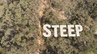
more stats
1.5 miles
Distance
3 ft
Climb
-573 ft
Descent
00:10:35
Avg time
-570 ft
Altitude change
1,261 ft
Altitude min
1,832 ft
Altitude max
1,831 ft
Altitude start
1,260 ft
Altitude end
-7.3%
Grade
-37.9%
Grade max
2.4%
Grade min
243 ft
Distance climb
1 mile
Distance down
354 ft
Distance flat
00:10:35
Avg time

F.A.M.E. Details

  • Activities
    • Mountain Bike
    • E-Bike
  • Riding Area
  • AKA
    Fox Steep
  • Difficulty Rating
  • Voted Difficulty
    Double Black Diamond (1 vote)
  • Local Popularity
    50 in Mountain Biking [+]
    • 45 in E-Biking
  • Global Ranking
    #91503 in Mountain Biking [+]
    • #63877 in E-Biking
  • National Ranking
    #4,382 in Mountain Biking · Australia [+]
    • #4,299 in E-Biking
  • Trail Type
    Singletrack
  • Bike Type
    DH
  • Direction
    Downhill Only
    Popular Direction Shown
  • Dogs Allowed
    Yes
  • eBike Allowed
  • TTFs on Trail
    Drop, Rock Garden
  • Ride in Rain
    Yes
  • Land Owner
    Forestry SA

Very rocky descent

Tags
DropsRock gardensRocky

Trail Supporters

Bike Park

Traditionally Indigenous Territory

Recent Activity on Trail

Past Week
  • 0 rides
  •  
6 Months
  • 3 rides
  • 12 miles avg distance
All
  • 66 rides
  • Last: Oct 2, 2026
c1c2c3c4
January
February
March
April
May
June
July
August
September
October
November
December
update trails status or condition

F.A.M.E. Trail Reports

statusdatedescription
Sep 30, 2026 @ 11:49am (Australia/Adelaide)
Sep 29, 2026
tree down after the top techy section
Dec 20, 2025 @ 10:11pm (Australia/Adelaide)
Dec 20, 2025
Super fun trail, but quite overgrown with prikly bushes like others have mentioned. There's also a small tree down crossing the trail towards the...
Oct 30, 2024 @ 4:55pm
Oct 30, 2024
The top is rideable but the bottom is overgrown with a spiky bush
Sep 3, 2024 @ 10:03pm
Sep 3, 2024
reporter Tree down
Sep 1, 2023 @ 4:58pm
Sep 1, 2023
trees down, giant ruts, leaf litter everywhere in second half, can't even tell where trail is going
more »
Status:
on Sep 30, 2026
Dry
Avg: 4.14 (9 votes)
Your vote: 0

view (906)
close
      Directions to f-a-m-e trailhead (-34.891000, 138.834230)

      Photos

      1 more »
      report
      mtb
      5 |
      Oct 22, 2026 @ 6:37pm
      Oct 22, 2026
      report
      mtb
      91 |
      Nov 17, 2024 @ 3:56pm
      Nov 17, 2024

      Videos

      4 more »
      Fame - A to Z of Adelaide Downhill tracks
      mtb
      5:45 | 185 | Jul 25, 2026 , Adelaide
      Fox Creek - F.A.M.E. (Gnarly)
      mtb
      5:43 | 1739 | Nov 10, 2019 , Adelaide
      Inside line race 1 Steep
      mtb
      4:32 | 542 | May 20, 2019 , Adelaide
      Steep race run 2019
      mtb
      3:46 | 535 | May 20, 2019 , Adelaide

      Trail Lists

      4.0 ★★★★★
      9 Ratings
      5 ★ 33%
      4 ★ 44%
      3 ★ 11%
      2 ★ 11%
      1 ★

      4 Reviews & Comments

      Skippyshredda246 Skippyshredda246
      Awesome chunky tech at the top but the lower half definitely needs a big trim. Trees and branches are poking out all over the track but it would be awesome if that got cleared out
      Skippyshredda246 Skippyshredda246
      Good trail but needs a pretty good rebuild, has to many prickle bushes on the trail aswell as a extremely overgrown section with the trail hard to see.
      SQUIDY-1000
      Fun tech trail with a few drops, and lots of challenging ruts. Definitely one of my favourite trails here. Also definitely a black, with a few optional double black features.

      We hope you've been enjoying Trailforks!

      Create a FREE account to view all trail reviews and much more.

      • By toddTF Pro Trailforks & contributors
      • #16014 - 4,235 views

      Frequently Asked Questions

      ▼ Where is F.A.M.E. located?
      F.A.M.E. is located in Fox Creek Bike Park, Adelaide, Australia. It is part of the Fox Creek Bike Park trail network. The trailhead is located at coordinates -34.891, 138.83423.
      ▼ How hard is F.A.M.E.?
      F.A.M.E. is rated as Black Diamond difficulty. The average grade is 7.3%.
      ▼ What is the elevation gain for F.A.M.E.?
      F.A.M.E. has 3 ft of elevation gain. The trail has 573 ft of elevation descent. The elevation ranges from 1,261 ft to 1,832 ft.
      ▼ Is F.A.M.E. a point to point trail?
      Yes, F.A.M.E. is a point to point trail. The direction is Downhill Only. The trail type is singletrack.
      ▼ How long is F.A.M.E.?
      F.A.M.E. is 1.5 miles long. The trail type is singletrack.
      ▼ Are dogs allowed on F.A.M.E.?
      Yes, dogs are allowed on F.A.M.E.. Please keep dogs on a leash where required and clean up after them.
      ▼ How do I access F.A.M.E.? Where is the closest parking trailhead?
      The closest parking and trailhead locations to F.A.M.E. are: View all parking locations in the area.
      ▼ How long does it take to ride F.A.M.E.?
      Based on recorded activities, it takes an average of 11 minutes to ride F.A.M.E.. The trail is 1.5 miles long. Actual times will vary based on fitness level, conditions, and pace. View recent activity logs for more details.
      ▼ How busy is F.A.M.E.?
      F.A.M.E. is a moderately popular trail. There have been 896 recorded activities on this trail. The trail has received 906 check-ins. View recent activity on this trail.

      Hit the Trail

      Open in App

      Get this trail on your phone instantly.

      open trail in app

      Download Trail

      Save to wishlist, Garmin & download.
      save the trail

      Find Related Routes

      Find routes and users activities that include this trail.
      find routes for this trail

      You must enter a description before submitting.