
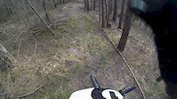
more stats
2,044 ft
Distance
-203 ft
Descent
00:02:42
Avg time
-203 ft
Altitude change
1,486 ft
Altitude min
1,689 ft
Altitude max
1,689 ft
Altitude start
1,486 ft
Altitude end
-9.9%
Grade
-43.6%
Grade max
-0.8%
Grade min
2,044 ft
Distance down
00:02:42
Avg time

Fany trail Details

  • Activities
    • Mountain Bike
    • E-Bike
    • Winter Fat Bike
    • Hike
    • Trail Running
  • Riding Area
    Slovenska Lupca
    Banská Bystrica
  • Difficulty Rating
  • Local Popularity
    80 in Mountain Biking heatmap [+]
    • 75 in E-Biking
    • 5 in Trail Running
    • 90 in Hiking
    • 5 in Winter Fat Biking
  • Global Ranking
    #190136 in Mountain Biking [+]
    • #27815 in E-Biking
    • #405419 in Trail Running
    • #113244 in Hiking
    • #21348 in Winter Fat Biking
  • National Ranking
    #1,048 in Mountain Biking · Slovakia [+]
    • #144 in E-Biking
    • #1,198 in Trail Running
    • #558 in Hiking
    • #63 in Winter Fat Biking
  • Trail Type
    Singletrack
  • Bike Type
    DH, AM, XC, DJ, Fat
  • Direction
    Downhill Only
    Popular Direction Shown
  • Climb Difficulty
    Green
  • Physical Rating
    Easy
  • Trail Visibility
    Sometimes hard to follow
  • Dogs Allowed
    Yes
  • eBike Allowed
    Yes up to Class 1
  • TTFs on Trail
    Berm, Drop

Ľahký trail, obsahujúci niekoľko pasáží, ktoré si užije aj skúsenejší jazdec. Pozostáva z 3 sekcií, oddelených križovatkami s cestami. Prvá pasáž príliš neklesá a miestami na nej treba aj zapedálovať (aj keď sa tu nachádza len jedna krátka a plytká stúpavá pasáž). Po prvom krížení s cestou začína skutočná zábava. Druhá a rovnako aj tretia časť majú flow charakter, ale sú zábavné. prírodné vlny, válovy a krátky, ale pekný strmáčik, to všetko na tejto trati nájdete.

An easy trail, including several sections which are enjoyable by experienced riders as well. It comprises of 3 different parts divided by intersections with roads. The first section doesn't descend much and is rather peddaly (altough there is only one short uphill section and it's definitely not a steep one). After crossing the road for the first time, the real fun begins. The second as well as the third section is flowy, but entertaining. Natural waves, U-shaped holes and a short, but beautiful steep section, all of this can be found here.

This trail is unsanctioned.

Tags
BermsDropsFaint trailFlowy

Recent Activity on Trail

Past Week
  • 0 rides
  •  
6 Months
  • 2 rides
  • 16 miles avg distance
All
  • 18 rides
  • Last: Sep 28, 2026
c1c2c3c4
January
February
March
April
May
June
July
August
September
October
November
December
update trails status or condition

Fany trail Trail Reports

no reports have been added for Fany trail yet, add a trail report.
Trail reports are used to indicate a trails current condition and inform builders and other users about any issues on a trail.
Status:
no votes yet
Your vote: 0

view (88)
close
      Directions to fany-trail trailhead (48.782690, 19.274670)

      Photos

      3 more »
      mtb
      97 |
      Mar 20, 2021 @ 8:57am
      Mar 20, 2021
      mtb
      89 |
      Mar 20, 2021 @ 8:56am
      Mar 20, 2021
      mtb
      123 |
      Mar 21, 2020 @ 2:51pm
      Mar 21, 2020

      Videos

      1 more »
      Karanténa
      mtb
      2:13 | 121 | Mar 26, 2020 , Banská Bystrica

      1 Review & Comments

      FilipVYrnKX
      Zábavný trail, k idealnosti chýba ešte tých posledných 40 metrov v debre kde by sa svahy valova dali využiť ešte na nejake vlnky alebo U čka.

      We hope you've been enjoying Trailforks!

      Create a FREE account to view all trail reviews and much more.

      • #265572 - 759 views

      Frequently Asked Questions

      ▼ Where is Fany trail located?
      Fany trail is located in Slovenska Lupca, Banská Bystrica, Slovakia. It is part of the Slovenska Lupca trail network. The trailhead is located at coordinates 48.78269, 19.27467.
      ▼ How hard is Fany trail?
      Fany trail is rated as Blue difficulty. The physical rating is Easy. The average grade is 9.9%. The climb difficulty is rated Green.
      ▼ What is the elevation gain for Fany trail?
      The trail has 203 ft of elevation descent. The elevation ranges from 1,486 ft to 1,689 ft.
      ▼ Is Fany trail a point to point trail?
      Yes, Fany trail is a point to point trail. The direction is Downhill Only. The trail type is singletrack.
      ▼ How long is Fany trail?
      Fany trail is 2,044 ft long. The trail type is singletrack.
      ▼ Are dogs allowed on Fany trail?
      Yes, dogs are allowed on Fany trail. Please keep dogs on a leash where required and clean up after them.
      ▼ When is the best time of year to ride Fany trail?
      Based on activity log data, the most popular months to ride Fany trail are:
      • March (6 activities)
      • April (3 activities)
      • September (3 activities)
      Check the reports page for current trail conditions.
      ▼ How do I access Fany trail? Where is the closest parking trailhead?
      The closest parking and trailhead locations to Fany trail are: View all parking locations in the area.
      ▼ How long does it take to ride Fany trail?
      Based on recorded activities, it takes an average of 3 minutes to ride Fany trail. The trail is 2,044 ft long. Actual times will vary based on fitness level, conditions, and pace. View recent activity logs for more details.
      ▼ How busy is Fany trail?
      Fany trail is a very popular trail. There have been 86 recorded activities on this trail. The trail has received 88 check-ins. View recent activity on this trail.

      Hit the Trail

      Open in App

      Get this trail on your phone instantly.

      open trail in app

      Download Trail

      Save to wishlist, Garmin & download.
      save the trail

      Find Related Routes

      Find routes and users activities that include this trail.
      find routes for this trail

      You must enter a description before submitting.

